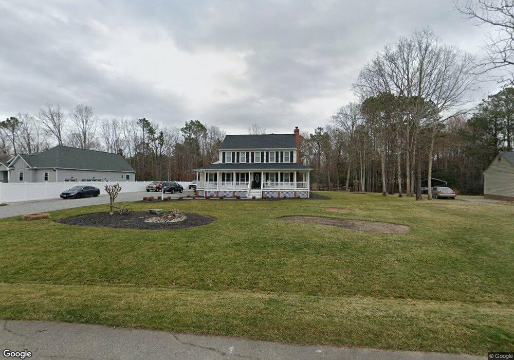
11031 Long Branch Dr Chesterfield, VA 23832
South Chesterfield County NeighborhoodEstimated Value: $396,000 - $409,753
3
Beds
3
Baths
1,802
Sq Ft
$223/Sq Ft
Est. Value
About This Home
This home is located at 11031 Long Branch Dr, Chesterfield, VA 23832 and is currently estimated at $402,438, approximately $223 per square foot. 11031 Long Branch Dr is a home located in Chesterfield County with nearby schools including Spring Run Elementary School, Bailey Bridge Middle School, and Manchester High.
Ownership History
Date
Name
Owned For
Owner Type
Purchase Details
Closed on
Dec 12, 2019
Sold by
Lucie Cathy W
Bought by
Lucie Brent A and Lucie Cathy W
Current Estimated Value
Purchase Details
Closed on
Jul 27, 2005
Sold by
Sylvester Robin L
Bought by
Worch Cathy
Home Financials for this Owner
Home Financials are based on the most recent Mortgage that was taken out on this home.
Original Mortgage
$172,400
Outstanding Balance
$90,622
Interest Rate
5.67%
Mortgage Type
New Conventional
Estimated Equity
$311,816
Create a Home Valuation Report for This Property
The Home Valuation Report is an in-depth analysis detailing your home's value as well as a comparison with similar homes in the area
Home Values in the Area
Average Home Value in this Area
Purchase History
| Date | Buyer | Sale Price | Title Company |
|---|---|---|---|
| Lucie Brent A | -- | None Available | |
| Worch Cathy | $215,500 | -- |
Source: Public Records
Mortgage History
| Date | Status | Borrower | Loan Amount |
|---|---|---|---|
| Open | Worch Cathy | $172,400 |
Source: Public Records
Tax History Compared to Growth
Tax History
| Year | Tax Paid | Tax Assessment Tax Assessment Total Assessment is a certain percentage of the fair market value that is determined by local assessors to be the total taxable value of land and additions on the property. | Land | Improvement |
|---|---|---|---|---|
| 2025 | $3,257 | $363,200 | $73,000 | $290,200 |
| 2024 | $3,257 | $348,000 | $70,000 | $278,000 |
| 2023 | $2,992 | $328,800 | $70,000 | $258,800 |
| 2022 | $2,799 | $304,200 | $57,000 | $247,200 |
| 2021 | $2,742 | $281,700 | $55,000 | $226,700 |
| 2020 | $2,366 | $264,500 | $53,000 | $211,500 |
| 2019 | $2,278 | $239,800 | $51,000 | $188,800 |
| 2018 | $2,169 | $227,400 | $49,000 | $178,400 |
| 2017 | $2,127 | $216,400 | $48,000 | $168,400 |
| 2016 | $1,940 | $202,100 | $48,000 | $154,100 |
| 2015 | $1,898 | $195,100 | $48,000 | $147,100 |
| 2014 | $1,861 | $191,200 | $48,000 | $143,200 |
Source: Public Records
Map
Nearby Homes
- 12605 Long Branch Ct
- 11100 Qualla Rd
- 10702 Eaglenest Dr
- 10376 Qualla Rd
- 10377 Qualla Rd
- 10370 Qualla Rd
- 10371 Qualla Rd
- 10344 Qualla Rd
- 10345 Qualla Rd
- 10338 Qualla Rd
- 10313 Qualla Rd
- 10307 Qualla Rd
- 10306 Lifford Ln
- 12912 Carters Hill Place
- 13001 Carters Garden Dr
- 9933 Third Branch Dr
- 10104 Manordale Rd
- 10110 N Donegal Rd
- 10200 Cloverfield Cir
- 13619 Brandy Oaks Rd
- 11021 Long Branch Dr
- 11041 Long Branch Dr
- 11051 Long Branch Dr
- 12603 Long Branch Ct
- 11001 Long Branch Dr
- 11002 Golden Nugget Ct
- 11050 Long Branch Dr
- 11020 Long Branch Dr
- 11006 Golden Nugget Ct
- 11060 Long Branch Dr
- 11008 Golden Nugget Ct
- 11061 Long Branch Dr
- 12620 Crooked Creek Dr
- 12601 Long Branch Ct
- 11000 Golden Nugget Ct
- 11010 Long Branch Dr
- 11070 Long Branch Dr
- 11001 Golden Nugget Ct
- 11010 Golden Nugget Ct
- 12604 Long Branch Ct