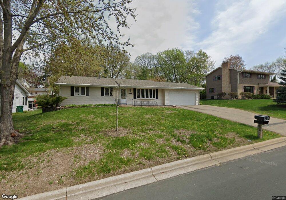
11033 27th Ave S Burnsville, MN 55337
Estimated Value: $352,111 - $414,000
3
Beds
2
Baths
1,820
Sq Ft
$207/Sq Ft
Est. Value
About This Home
This home is located at 11033 27th Ave S, Burnsville, MN 55337 and is currently estimated at $377,528, approximately $207 per square foot. 11033 27th Ave S is a home located in Dakota County with nearby schools including Burnsville High School, Gateway STEM Academy, and Sunrise International Montessori School.
Ownership History
Date
Name
Owned For
Owner Type
Purchase Details
Closed on
Mar 5, 2021
Sold by
Sai Rebecca Mae
Bought by
Sai Nestor Asman
Current Estimated Value
Purchase Details
Closed on
Feb 28, 2019
Sold by
Smith Stephanie A and Smith Kaleb B
Bought by
Sai Nestor and Sai Rebecca
Home Financials for this Owner
Home Financials are based on the most recent Mortgage that was taken out on this home.
Original Mortgage
$261,250
Outstanding Balance
$229,683
Interest Rate
4.4%
Mortgage Type
New Conventional
Estimated Equity
$147,845
Purchase Details
Closed on
Jul 6, 2017
Sold by
Melin Ronald W and Melin Martha E
Bought by
Smith Kaleb B and Smith Stephanie A
Home Financials for this Owner
Home Financials are based on the most recent Mortgage that was taken out on this home.
Original Mortgage
$214,370
Interest Rate
3.89%
Mortgage Type
Unknown
Create a Home Valuation Report for This Property
The Home Valuation Report is an in-depth analysis detailing your home's value as well as a comparison with similar homes in the area
Home Values in the Area
Average Home Value in this Area
Purchase History
| Date | Buyer | Sale Price | Title Company |
|---|---|---|---|
| Sai Nestor Asman | -- | None Available | |
| Sai Nestor | $275,000 | Executive Title | |
| Smith Kaleb B | $221,000 | Executive Title | |
| Melin Martha E | -- | Edina Realty Title Inc |
Source: Public Records
Mortgage History
| Date | Status | Borrower | Loan Amount |
|---|---|---|---|
| Open | Sai Nestor | $261,250 | |
| Previous Owner | Smith Kaleb B | $214,370 | |
| Previous Owner | Melin Martha E | $214,370 |
Source: Public Records
Tax History Compared to Growth
Tax History
| Year | Tax Paid | Tax Assessment Tax Assessment Total Assessment is a certain percentage of the fair market value that is determined by local assessors to be the total taxable value of land and additions on the property. | Land | Improvement |
|---|---|---|---|---|
| 2024 | $3,000 | $293,800 | $87,500 | $206,300 |
| 2023 | $3,000 | $293,500 | $87,600 | $205,900 |
| 2022 | $2,518 | $289,500 | $87,400 | $202,100 |
| 2021 | $2,488 | $246,200 | $76,000 | $170,200 |
| 2020 | $2,500 | $232,100 | $69,300 | $162,800 |
| 2019 | $2,361 | $225,300 | $66,000 | $159,300 |
| 2018 | $2,344 | $205,000 | $62,900 | $142,100 |
| 2017 | $2,171 | $198,100 | $59,900 | $138,200 |
| 2016 | $2,239 | $183,100 | $57,100 | $126,000 |
| 2015 | $2,071 | $160,377 | $49,007 | $111,370 |
| 2014 | -- | $154,491 | $47,779 | $106,712 |
| 2013 | -- | $138,577 | $42,784 | $95,793 |
Source: Public Records
Map
Nearby Homes
- 11036 27th Ave S
- 11017 27th Ave S
- 10934 Southview Dr
- 11115 Carver Ct
- 2329 Explorer Ct
- 3108 Foxpoint Cir
- 11459 Galtier Dr
- 2001 Woods Ln
- 3113 Chandler Ct
- 4165 Old Sibley Hwy
- 11311 W River Hills Dr
- 3017 Mcleod St
- 4413 Slater Rd
- 4427 Cinnamon Ridge Cir
- 4425 Cinnamon Ridge Cir
- 1601 Raleigh Dr
- 2177 Cool Stream Cir
- 4463 Cinnamon Ridge Cir
- 11902 River Hills Cir
- 4370 Nicols Rd
- 11029 27th Ave S
- 11037 27th Ave S
- 2704 River Hills Dr
- 11013 London Dr
- 11025 27th Ave S
- 11040 27th Ave S
- 2610 River Hills Dr
- 11032 27th Ave S
- 11021 27th Ave S
- 11009 London Dr
- 11028 27th Ave S
- 11016 London Dr
- 11012 London Dr
- 11008 London Dr
- 11005 London Dr
- 2701 27th Place
- 11024 27th Ave S
- 11017 11017 27th-Avenue-s
- 10932 Ridgewood Ct
- 2703 27th Place