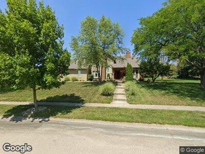
11036 Wilmington Ct Fort Wayne, IN 46814
Southwest Fort Wayne NeighborhoodEstimated Value: $388,717 - $476,000
4
Beds
3
Baths
4,178
Sq Ft
$105/Sq Ft
Est. Value
About This Home
This home is located at 11036 Wilmington Ct, Fort Wayne, IN 46814 and is currently estimated at $437,679, approximately $104 per square foot. 11036 Wilmington Ct is a home located in Allen County with nearby schools including Aboite Elementary School, Summit Middle School, and Homestead Senior High School.
Ownership History
Date
Name
Owned For
Owner Type
Purchase Details
Closed on
May 7, 2010
Sold by
Howe Robert K
Bought by
Howe Robert K and Howe Rebecca S
Current Estimated Value
Home Financials for this Owner
Home Financials are based on the most recent Mortgage that was taken out on this home.
Original Mortgage
$215,033
Interest Rate
4.75%
Mortgage Type
FHA
Create a Home Valuation Report for This Property
The Home Valuation Report is an in-depth analysis detailing your home's value as well as a comparison with similar homes in the area
Home Values in the Area
Average Home Value in this Area
Purchase History
| Date | Buyer | Sale Price | Title Company |
|---|---|---|---|
| Howe Robert K | -- | None Available | |
| Howe Robert K | -- | Meridian Title |
Source: Public Records
Mortgage History
| Date | Status | Borrower | Loan Amount |
|---|---|---|---|
| Open | Howe Robert Kenneth | $100,000 | |
| Open | Howe Robert K | $170,000 | |
| Closed | Howe Robert K | $17,000 | |
| Closed | Howe Robert K | $194,000 | |
| Closed | Howe Robert K | $215,033 | |
| Previous Owner | Fodor Janis P | $73,800 |
Source: Public Records
Tax History Compared to Growth
Tax History
| Year | Tax Paid | Tax Assessment Tax Assessment Total Assessment is a certain percentage of the fair market value that is determined by local assessors to be the total taxable value of land and additions on the property. | Land | Improvement |
|---|---|---|---|---|
| 2024 | $3,654 | $359,000 | $67,600 | $291,400 |
| 2023 | $3,654 | $340,300 | $42,300 | $298,000 |
| 2022 | $3,249 | $300,400 | $42,300 | $258,100 |
| 2021 | $2,898 | $276,100 | $42,300 | $233,800 |
| 2020 | $2,836 | $269,400 | $42,300 | $227,100 |
| 2019 | $2,701 | $256,000 | $42,300 | $213,700 |
| 2018 | $2,474 | $234,300 | $42,300 | $192,000 |
| 2017 | $2,318 | $219,000 | $42,300 | $176,700 |
| 2016 | $2,305 | $216,700 | $42,300 | $174,400 |
| 2014 | $2,302 | $217,900 | $43,700 | $174,200 |
| 2013 | $2,212 | $208,500 | $43,700 | $164,800 |
Source: Public Records
Map
Nearby Homes
- 5620 Homestead Rd
- 5220 Spartan Dr
- 6215 Shady Creek Ct
- 5805 Hemingway Run
- 11710 Tweedsmuir Run
- 6211 Salford Ct
- 6026 Hemingway Run
- 5002 Buffalo Ct
- 4904 Live Oak Ct
- 4807 Oak Mast Trail
- 6322 Eagle Nest Ct
- 6719 Dell Loch Way
- 5814 Balfour Cir
- 10621 Unita Dr
- 10909 Bittersweet Dells Ln
- 6811 Bittersweet Dells Ct
- 10530 Uncas Trail
- 4435 Aboite Lake Dr
- 10425 Lake Tahoe Dr
- 10328 Unita Dr
- 11036 Wilmington Ct
- 11026 Wilmington Ct
- 5315 Hopkinton Dr
- 5332 Hopkinton Dr
- 11031 Wilmington Ct
- 5416 Hopkinton Dr
- 5328 Hopkinton Dr
- 5316 Hopkinton Dr
- 11027 Wrentham Ln
- 11020 Wilmington Ct
- 11023 Wilmington Ct
- 5422 Hopkinton Dr
- 11019 Wrentham Ln
- 5207 Hopkinton Dr
- 5218 Hopkinton Dr
- 11024 Acton Ct
- 11005 Wrentham Ln
- 11017 Wilmington Ct
- 11012 Wilmington Ct
- 5430 Hopkinton Dr