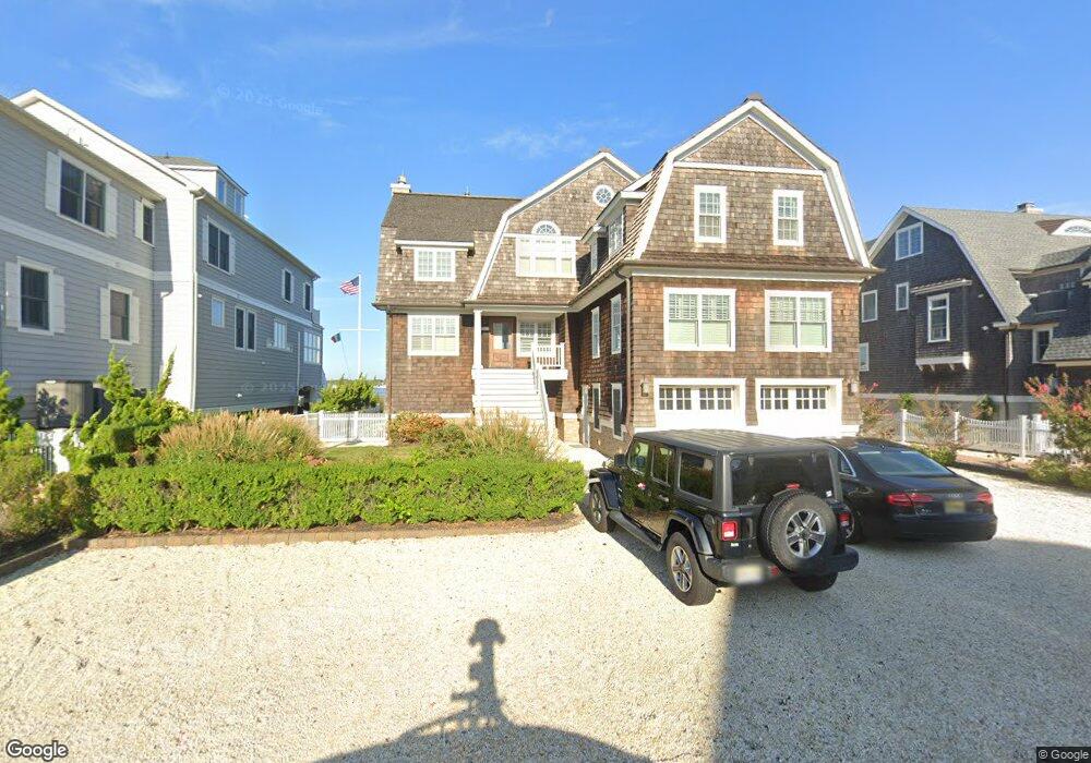
1104 Barnegat Ln Mantoloking, NJ 08738
Estimated Value: $3,974,000 - $6,271,000
6
Beds
5
Baths
3,816
Sq Ft
$1,354/Sq Ft
Est. Value
About This Home
This home is located at 1104 Barnegat Ln, Mantoloking, NJ 08738 and is currently estimated at $5,168,123, approximately $1,354 per square foot. 1104 Barnegat Ln is a home located in Ocean County with nearby schools including G Harold Antrim Elementary School, Point Pleasant Beach High School, and St. Peter School.
Ownership History
Date
Name
Owned For
Owner Type
Purchase Details
Closed on
Dec 2, 2010
Sold by
Mercatanti Debra Young
Bought by
Savas Paul and Savas Mary Beth
Current Estimated Value
Purchase Details
Closed on
Jun 27, 2002
Sold by
Voss Beverly Ann
Bought by
Mercatanti Debra
Home Financials for this Owner
Home Financials are based on the most recent Mortgage that was taken out on this home.
Original Mortgage
$1,202,500
Interest Rate
6.73%
Create a Home Valuation Report for This Property
The Home Valuation Report is an in-depth analysis detailing your home's value as well as a comparison with similar homes in the area
Home Values in the Area
Average Home Value in this Area
Purchase History
| Date | Buyer | Sale Price | Title Company |
|---|---|---|---|
| Savas Paul | $3,425,000 | -- | |
| Mercatanti Debra | $1,850,000 | -- |
Source: Public Records
Mortgage History
| Date | Status | Borrower | Loan Amount |
|---|---|---|---|
| Previous Owner | Mercatanti Debra | $1,202,500 |
Source: Public Records
Tax History Compared to Growth
Tax History
| Year | Tax Paid | Tax Assessment Tax Assessment Total Assessment is a certain percentage of the fair market value that is determined by local assessors to be the total taxable value of land and additions on the property. | Land | Improvement |
|---|---|---|---|---|
| 2025 | $25,586 | $2,982,100 | $1,553,800 | $1,428,300 |
| 2024 | $24,334 | $2,982,100 | $1,553,800 | $1,428,300 |
| 2023 | $20,875 | $2,982,100 | $1,553,800 | $1,428,300 |
| 2022 | $20,875 | $2,982,100 | $1,553,800 | $1,428,300 |
| 2021 | $20,958 | $2,982,100 | $1,553,800 | $1,428,300 |
| 2020 | $21,233 | $2,982,100 | $1,553,800 | $1,428,300 |
| 2019 | $20,934 | $2,982,100 | $1,553,800 | $1,428,300 |
| 2018 | $18,568 | $2,683,300 | $1,553,800 | $1,129,500 |
| 2017 | $18,322 | $2,628,700 | $1,553,800 | $1,074,900 |
| 2016 | $18,243 | $2,628,700 | $1,553,800 | $1,074,900 |
| 2015 | $17,954 | $2,628,700 | $1,553,800 | $1,074,900 |
| 2014 | $16,482 | $2,628,700 | $1,553,800 | $1,074,900 |
Source: Public Records
Map
Nearby Homes
- 1097 Barnegat Ln
- 1201 Ocean Ave
- 1207 Ocean Ave
- 1063 Ocean Ave
- 1318 Ocean Ave
- 1027 Ocean Ave
- 982 Barnegat Ln
- 978 East Ave
- 954 Barnegat Ln
- 1519 Runyon Ln
- 940 Barnegat Ln
- 920 East Ave
- 122 Squan Beach Dr
- 233 Curtis Point Dr
- 767 East Ave
- 776 South Dr
- 150 Sunset Ln
- 750 East Ave
- 53 Driftwood Dr
- 275 Curtis Point Dr
- 1106 Barnegat Ln
- 1102 Barnegat Ln
- 1100 Barnegat Ln
- 1108 Barnegat Ln
- 1105 Barnegat Ln
- 1107 Barnegat Ln
- 1103 Barnegat Ln
- 1108 Ocean Ave
- 1098 Barnegat Ln
- 1101 Barnegat Ln
- 1116 Ocean Ave
- 1110 Barnegat Ln
- 1110 Ocean Ave
- 1112 Barnegat Ln
- 1096 Barnegat Ln
- 1111 Barnegat Ln
- 1095 Barnegat Ln
- 1105 Ocean Ave
- 1109 Ocean Ave
- 1112 Ocean Ave