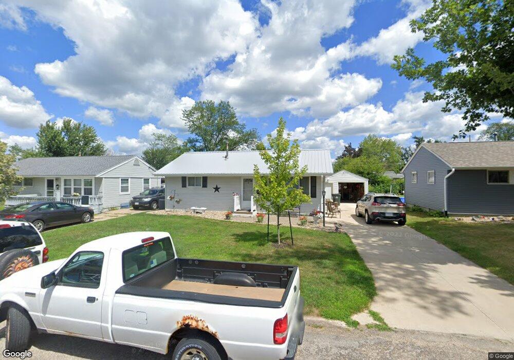
1104 Harold Dr SE Cedar Rapids, IA 52403
Estimated Value: $167,000 - $186,000
3
Beds
1
Bath
864
Sq Ft
$203/Sq Ft
Est. Value
About This Home
This home is located at 1104 Harold Dr SE, Cedar Rapids, IA 52403 and is currently estimated at $175,172, approximately $202 per square foot. 1104 Harold Dr SE is a home located in Linn County with nearby schools including Summit Elementary School, Erskine Elementary School, and McKinley STEAM Academy.
Ownership History
Date
Name
Owned For
Owner Type
Purchase Details
Closed on
Oct 19, 2022
Sold by
Newlen William F
Bought by
Newlen William F and Kepler Linda S
Current Estimated Value
Purchase Details
Closed on
Jun 6, 2007
Sold by
Prewitt William D and Prewitt Jennifer J
Bought by
Newlen William F
Home Financials for this Owner
Home Financials are based on the most recent Mortgage that was taken out on this home.
Original Mortgage
$109,155
Interest Rate
6.21%
Mortgage Type
Purchase Money Mortgage
Purchase Details
Closed on
Jul 27, 2004
Sold by
Gast Jeffrey Allan and Gast Heidi L
Bought by
Prewitt William D and Prewitt Jennifer J
Home Financials for this Owner
Home Financials are based on the most recent Mortgage that was taken out on this home.
Original Mortgage
$80,750
Interest Rate
5%
Mortgage Type
Unknown
Create a Home Valuation Report for This Property
The Home Valuation Report is an in-depth analysis detailing your home's value as well as a comparison with similar homes in the area
Home Values in the Area
Average Home Value in this Area
Purchase History
| Date | Buyer | Sale Price | Title Company |
|---|---|---|---|
| Newlen William F | -- | -- | |
| Newlen William F | $114,500 | None Available | |
| Prewitt William D | $94,500 | -- |
Source: Public Records
Mortgage History
| Date | Status | Borrower | Loan Amount |
|---|---|---|---|
| Previous Owner | Newlen William F | $109,155 | |
| Previous Owner | Prewitt William D | $80,750 | |
| Closed | Prewitt William D | $14,102 |
Source: Public Records
Tax History Compared to Growth
Tax History
| Year | Tax Paid | Tax Assessment Tax Assessment Total Assessment is a certain percentage of the fair market value that is determined by local assessors to be the total taxable value of land and additions on the property. | Land | Improvement |
|---|---|---|---|---|
| 2025 | $2,314 | $163,700 | $31,900 | $131,800 |
| 2024 | $2,584 | $160,500 | $31,900 | $128,600 |
| 2023 | $2,584 | $148,200 | $29,000 | $119,200 |
| 2022 | $2,426 | $131,400 | $26,100 | $105,300 |
| 2021 | $2,428 | $126,100 | $26,100 | $100,000 |
| 2020 | $2,428 | $118,600 | $20,300 | $98,300 |
| 2019 | $2,262 | $113,500 | $20,300 | $93,200 |
| 2018 | $2,090 | $113,500 | $20,300 | $93,200 |
| 2017 | $1,986 | $99,700 | $20,300 | $79,400 |
| 2016 | $2,083 | $98,000 | $20,300 | $77,700 |
| 2015 | $2,109 | $99,113 | $20,300 | $78,813 |
| 2014 | $1,924 | $99,113 | $20,300 | $78,813 |
| 2013 | $1,738 | $99,113 | $20,300 | $78,813 |
Source: Public Records
Map
Nearby Homes
- 1111 Brockman Dr SE
- 1013 36th St SE
- 1241 38th St SE
- 3630 Mt Vernon Rd SE Unit 6
- 1401 Harold Dr SE
- 1331 34th St SE
- 707 40th St SE
- 3600 Bel Air Dr SE
- 654 34th St SE
- TBD 42nd St SE
- 651 34th St SE
- 3510 Pioneer Ave SE
- 1310 42nd St SE
- 1310 42nd St SE Unit LotWP001
- 3223 Mound Ave SE
- 3535 Pioneer Ave SE
- 2227 Kestrel Dr SE
- 2403 Kestrel Dr SE
- 2416 Kestrel Dr SE
- 2226 Kestrel Dr SE
- 1100 Harold Dr SE
- 1108 Harold Dr SE
- 1022 Harold Dr SE
- 1112 Harold Dr SE
- 1103 Brockman Dr SE
- 1107 Brockman Dr SE
- 1101 Brockman Dr SE
- 1019 Brockman Dr SE
- 1118 Harold Dr SE
- 1018 Harold Dr SE
- 1103 Harold Dr SE
- 1107 Harold Dr SE
- 1101 Harold Dr SE
- 1117 Brockman Dr SE
- 1111 Harold Dr SE
- 1021 Harold Dr SE
- 1015 Brockman Dr SE
- 1124 Harold Dr SE
- 1010 Harold Dr SE
- 1117 Harold Dr SE