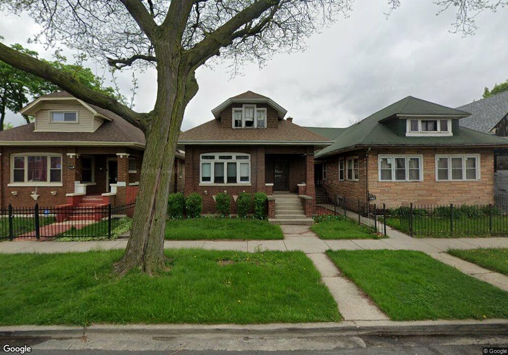
1104 N Menard Ave Chicago, IL 60651
Austin NeighborhoodEstimated Value: $257,000 - $357,000
3
Beds
1
Bath
1,250
Sq Ft
$238/Sq Ft
Est. Value
About This Home
This home is located at 1104 N Menard Ave, Chicago, IL 60651 and is currently estimated at $297,790, approximately $238 per square foot. 1104 N Menard Ave is a home located in Cook County with nearby schools including St Angela Elementary School, The Field School, and Christ Lutheran School.
Ownership History
Date
Name
Owned For
Owner Type
Purchase Details
Closed on
Dec 20, 2007
Sold by
Tatum Maxine
Bought by
Chicago Title Land Trust Co and Trust #3737
Current Estimated Value
Purchase Details
Closed on
Oct 10, 2006
Sold by
Amalgamated Bank Of Chicago
Bought by
Tatum Maxine
Home Financials for this Owner
Home Financials are based on the most recent Mortgage that was taken out on this home.
Original Mortgage
$141,000
Interest Rate
6.45%
Mortgage Type
Unknown
Purchase Details
Closed on
Sep 1, 1999
Sold by
Amalgamated Bank Of Chicago
Bought by
Tatum Maxine
Home Financials for this Owner
Home Financials are based on the most recent Mortgage that was taken out on this home.
Original Mortgage
$12,530
Interest Rate
7.9%
Create a Home Valuation Report for This Property
The Home Valuation Report is an in-depth analysis detailing your home's value as well as a comparison with similar homes in the area
Home Values in the Area
Average Home Value in this Area
Purchase History
| Date | Buyer | Sale Price | Title Company |
|---|---|---|---|
| Chicago Title Land Trust Co | -- | Chicago Title Land Trust Co | |
| Tatum Maxine | -- | Lakeshore Title Agency | |
| Tatum Maxine | -- | -- |
Source: Public Records
Mortgage History
| Date | Status | Borrower | Loan Amount |
|---|---|---|---|
| Previous Owner | Tatum Maxine | $141,000 | |
| Previous Owner | Tatum Maxine | $12,530 |
Source: Public Records
Tax History Compared to Growth
Tax History
| Year | Tax Paid | Tax Assessment Tax Assessment Total Assessment is a certain percentage of the fair market value that is determined by local assessors to be the total taxable value of land and additions on the property. | Land | Improvement |
|---|---|---|---|---|
| 2024 | $2,750 | $21,000 | $4,880 | $16,120 |
| 2023 | $2,641 | $19,000 | $3,864 | $15,136 |
| 2022 | $2,641 | $19,000 | $3,864 | $15,136 |
| 2021 | $1,195 | $18,999 | $3,863 | $15,136 |
| 2020 | $1,630 | $13,523 | $3,456 | $10,067 |
| 2019 | $3,019 | $15,026 | $3,456 | $11,570 |
| 2018 | $2,968 | $15,026 | $3,456 | $11,570 |
| 2017 | $1,670 | $13,833 | $3,050 | $10,783 |
| 2016 | $1,913 | $13,833 | $3,050 | $10,783 |
| 2015 | $1,711 | $13,833 | $3,050 | $10,783 |
| 2014 | $1,623 | $13,152 | $2,846 | $10,306 |
| 2013 | $1,914 | $13,152 | $2,846 | $10,306 |
Source: Public Records
Map
Nearby Homes
- 1118 N Monitor Ave
- 1108 N Massasoit Ave
- 1133 N Massasoit Ave
- 1122 N Mason Ave
- 5807 W Walton St
- 1132 N Parkside Ave
- 1032 N Austin Blvd Unit 2N
- 7211 W Division St Unit C2
- 5828 W Iowa St
- 5636 W Augusta Blvd
- 1051 N Parkside Ave
- 5636 W Division St
- 1318 N Menard Ave
- 910 N Humphrey Ave
- 1308 N Waller Ave
- 5962 W Iowa St
- 802 N Taylor Ave
- 840 N Massasoit Ave
- 914 N Austin Blvd Unit A5
- 1338 N Massasoit Ave
- 1106 N Menard Ave
- 1100 N Menard Ave
- 1110 N Menard Ave
- 1114 N Menard Ave
- 1056 N Menard Ave
- 1105 N Monitor Ave
- 1118 N Menard Ave
- 1107 N Monitor Ave
- 1101 N Monitor Ave
- 1111 N Monitor Ave
- 1054 N Menard Ave
- 1115 N Monitor Ave
- 1115 N Monitor Ave
- 1122 N Menard Ave
- 1117 N Monitor Ave
- 1105 N Menard Ave
- 1101 N Menard Ave
- 1057 N Monitor Ave
- 1050 N Menard Ave Unit 2
- 1050 N Menard Ave Unit 3