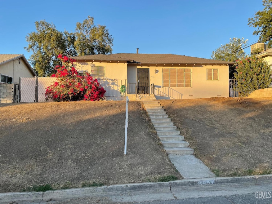
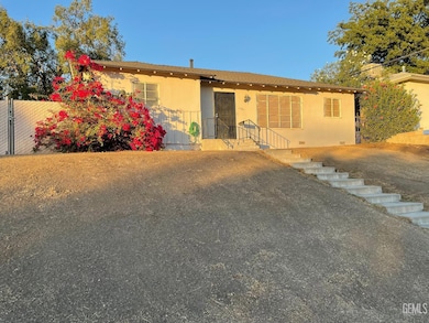
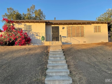
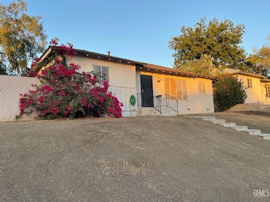
1104 W Point Dr Bakersfield, CA 93305
College Heights NeighborhoodEstimated payment $1,730/month
About This Home
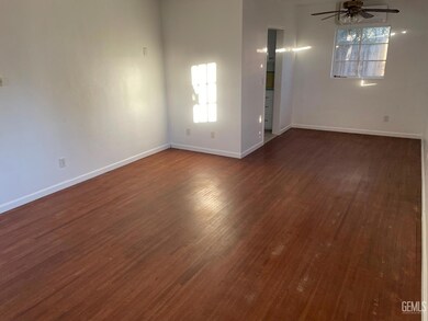
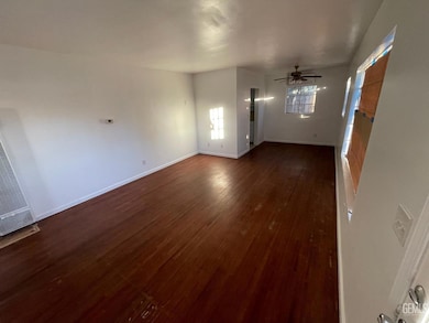
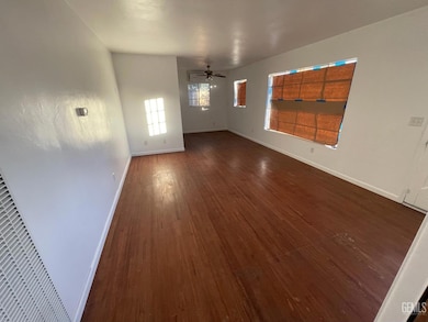
College Heights classic home! Walking distance to Bakersfield College. Great North East Bakersfield location close to the college, parks, schools and shopping. Galley style kitchen with large living room. All bedrooms feature beautiful hardwood flooring in a smart family friendly floor plan. Two car garage and spacious back yard with covered patio perfect for entertaining.
Home Details
Home Type
- Single Family
Est. Annual Taxes
- $2,068
Year Built
- Built in 1954
Lot Details
- 6,534 Sq Ft Lot
- Zoning described as R1
Parking
- 2 Car Garage
Interior Spaces
- 1,300 Sq Ft Home
- 1-Story Property
- Heated Floors
Bedrooms and Bathrooms
- 3 Bedrooms
- 1.5 Bathrooms
Schools
- Noble Elementary School
- Washington Middle School
- Highland School
Listing and Financial Details
- Assessor Parcel Number 02119114
Map
Home Values in the Area
Average Home Value in this Area
Tax History
| Year | Tax Paid | Tax Assessment Tax Assessment Total Assessment is a certain percentage of the fair market value that is determined by local assessors to be the total taxable value of land and additions on the property. | Land | Improvement |
|---|---|---|---|---|
| 2025 | $2,068 | $102,265 | $17,383 | $84,882 |
| 2024 | $2,068 | $100,261 | $17,043 | $83,218 |
| 2023 | $1,842 | $98,296 | $16,709 | $81,587 |
| 2022 | $1,790 | $96,370 | $16,382 | $79,988 |
| 2021 | $1,688 | $94,481 | $16,061 | $78,420 |
| 2020 | $1,653 | $93,513 | $15,897 | $77,616 |
| 2019 | $1,621 | $93,513 | $15,897 | $77,616 |
| 2018 | $1,502 | $89,884 | $15,281 | $74,603 |
| 2017 | $1,490 | $88,123 | $14,982 | $73,141 |
| 2016 | $1,384 | $86,396 | $14,689 | $71,707 |
| 2015 | $1,371 | $85,099 | $14,469 | $70,630 |
| 2014 | $1,326 | $83,433 | $14,186 | $69,247 |
Property History
| Date | Event | Price | List to Sale | Price per Sq Ft |
|---|---|---|---|---|
| 10/30/2025 10/30/25 | Pending | -- | -- | -- |
| 10/09/2025 10/09/25 | For Sale | $295,000 | -- | $227 / Sq Ft |
Purchase History
| Date | Type | Sale Price | Title Company |
|---|---|---|---|
| Grant Deed | -- | None Listed On Document | |
| Quit Claim Deed | -- | None Available | |
| Interfamily Deed Transfer | -- | -- |
Source: Bakersfield Association of REALTORS® / GEMLS
MLS Number: 202511520
APN: 021-191-14-00-7
Disclaimer: Certain information contained herein is derived from information provided by parties other than Homes.com. All information provided is deemed reliable, but is not guaranteed to be accurate and should be independently verified.
![]() Information is deemed reliable but not guaranteed.
Information is deemed reliable but not guaranteed.
Copyright Golden Empire MLS, Inc. 2025.
- 1105 Vanderbilt Dr
- 1105 Acacia Ave
- 1208 W Point Dr
- 3300 Bucknell St
- 1013 Oxford Ct
- 3007 Bucknell St
- 1416 Duke Dr
- 3105 Haley St
- 920 Stanford Ct
- 923 University Ave
- 909 Oberlin Ct
- 1513 University Ave
- 1605 Duke Dr
- 1312 Shattuck Ave
- 1017 Radcliffe Ave
- 0 Acacia Ave
- 925 Radcliffe Ave
- 2904 Cornell St
- 2804 Haley St
- 2312 River Blvd
