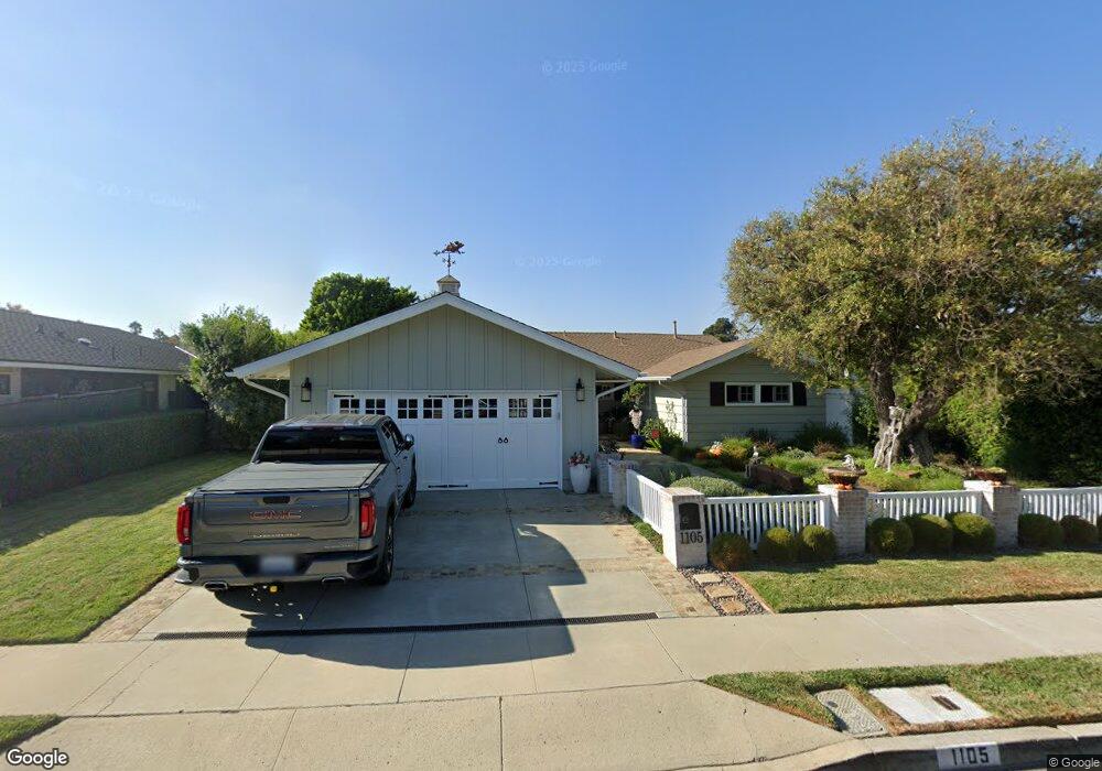
1105 Devon Ln Newport Beach, CA 92660
Mariners NeighborhoodEstimated Value: $2,835,000 - $3,560,000
3
Beds
2
Baths
1,840
Sq Ft
$1,758/Sq Ft
Est. Value
About This Home
This home is located at 1105 Devon Ln, Newport Beach, CA 92660 and is currently estimated at $3,234,199, approximately $1,757 per square foot. 1105 Devon Ln is a home located in Orange County with nearby schools including Mariners Elementary School, Horace Ensign Intermediate School, and Newport Harbor High School.
Ownership History
Date
Name
Owned For
Owner Type
Purchase Details
Closed on
Apr 3, 2019
Sold by
Bratz Cheryl A
Bought by
Bratz Thomas Michael and Bratz Ann Bratz
Current Estimated Value
Purchase Details
Closed on
May 10, 2002
Sold by
Savage David Thomas and Savage Kelly Ann
Bought by
Bratz Cheryl A
Home Financials for this Owner
Home Financials are based on the most recent Mortgage that was taken out on this home.
Original Mortgage
$642,400
Outstanding Balance
$250,939
Interest Rate
5.87%
Estimated Equity
$2,983,260
Purchase Details
Closed on
Oct 5, 2001
Sold by
Savage Dave and Savage Kelly
Bought by
Savage David Thomas and Savage Kelly Ann
Home Financials for this Owner
Home Financials are based on the most recent Mortgage that was taken out on this home.
Original Mortgage
$90,000
Interest Rate
6.91%
Mortgage Type
Stand Alone Second
Purchase Details
Closed on
Oct 6, 1999
Sold by
Dave Savage and Dave Kelly
Bought by
Savage David Thomas and Savage Kelly Ann
Purchase Details
Closed on
Jan 21, 1998
Sold by
Knight Richard and Knight Sheila
Bought by
Savage Dave and Savage Kelly
Home Financials for this Owner
Home Financials are based on the most recent Mortgage that was taken out on this home.
Original Mortgage
$408,000
Interest Rate
6.99%
Purchase Details
Closed on
Apr 22, 1997
Sold by
Knight Richard and Knight Sheila
Bought by
Knight Richard and Knight Sheila
Home Financials for this Owner
Home Financials are based on the most recent Mortgage that was taken out on this home.
Original Mortgage
$388,000
Interest Rate
8%
Purchase Details
Closed on
Mar 10, 1997
Sold by
Blanchard Roger H
Bought by
Knight Richard and Knight Sheila
Home Financials for this Owner
Home Financials are based on the most recent Mortgage that was taken out on this home.
Original Mortgage
$388,000
Interest Rate
8%
Purchase Details
Closed on
Dec 21, 1995
Sold by
Stewart Michael G and Stewart Kimberly J
Bought by
Blanchard Roger H
Create a Home Valuation Report for This Property
The Home Valuation Report is an in-depth analysis detailing your home's value as well as a comparison with similar homes in the area
Home Values in the Area
Average Home Value in this Area
Purchase History
| Date | Buyer | Sale Price | Title Company |
|---|---|---|---|
| Bratz Thomas Michael | -- | None Available | |
| Bratz Cheryl A | -- | None Available | |
| Bratz Cheryl A | $803,000 | Stewart Title | |
| Savage David Thomas | -- | -- | |
| Savage Dave | -- | Lawyers Title Company | |
| Savage David Thomas | -- | -- | |
| Savage Dave | $510,000 | Fidelity National Title Ins | |
| Knight Richard | -- | Stewart Title | |
| Knight Richard | $485,000 | Stewart Title | |
| Blanchard Roger H | $479,000 | Stewart Title |
Source: Public Records
Mortgage History
| Date | Status | Borrower | Loan Amount |
|---|---|---|---|
| Open | Bratz Cheryl A | $642,400 | |
| Previous Owner | Savage Dave | $90,000 | |
| Previous Owner | Savage Dave | $408,000 | |
| Previous Owner | Knight Richard | $388,000 | |
| Closed | Savage Dave | $51,000 |
Source: Public Records
Tax History
| Year | Tax Paid | Tax Assessment Tax Assessment Total Assessment is a certain percentage of the fair market value that is determined by local assessors to be the total taxable value of land and additions on the property. | Land | Improvement |
|---|---|---|---|---|
| 2025 | $12,958 | $1,225,106 | $1,052,250 | $172,856 |
| 2024 | $12,958 | $1,201,085 | $1,031,618 | $169,467 |
| 2023 | $12,651 | $1,177,535 | $1,011,390 | $166,145 |
| 2022 | $12,437 | $1,154,447 | $991,559 | $162,888 |
| 2021 | $12,071 | $1,119,719 | $972,117 | $147,602 |
| 2020 | $11,707 | $1,084,692 | $962,149 | $122,543 |
| 2019 | $11,467 | $1,063,424 | $943,283 | $120,141 |
| 2018 | $11,238 | $1,042,573 | $924,787 | $117,786 |
| 2017 | $11,039 | $1,022,131 | $906,654 | $115,477 |
| 2016 | $10,791 | $1,002,090 | $888,877 | $113,213 |
| 2015 | $10,688 | $987,038 | $875,525 | $111,513 |
| 2014 | $10,435 | $967,704 | $858,375 | $109,329 |
Source: Public Records
Map
Nearby Homes
- 1312 Dover Dr
- 1232 Blue Gum Ln
- 1136 Highland Dr
- 47 Cape Andover
- 1518 Anita Ln
- 2127 Cresta Dr
- 1173 Winslow Ln
- 1430 Lincoln Ln
- 1100 Polaris Dr
- 1423 Mariners Dr
- 1700 Highland Dr
- 1423 Santiago Dr
- 1801 Beryl Ln
- 1412 Santiago Dr
- 42 Saratoga Unit 42
- 469 Lenwood Cir
- 25 Saratoga
- 702 Saint James Place
- 94 Yorktown
- 11 Saratoga
Your Personal Tour Guide
Ask me questions while you tour the home.