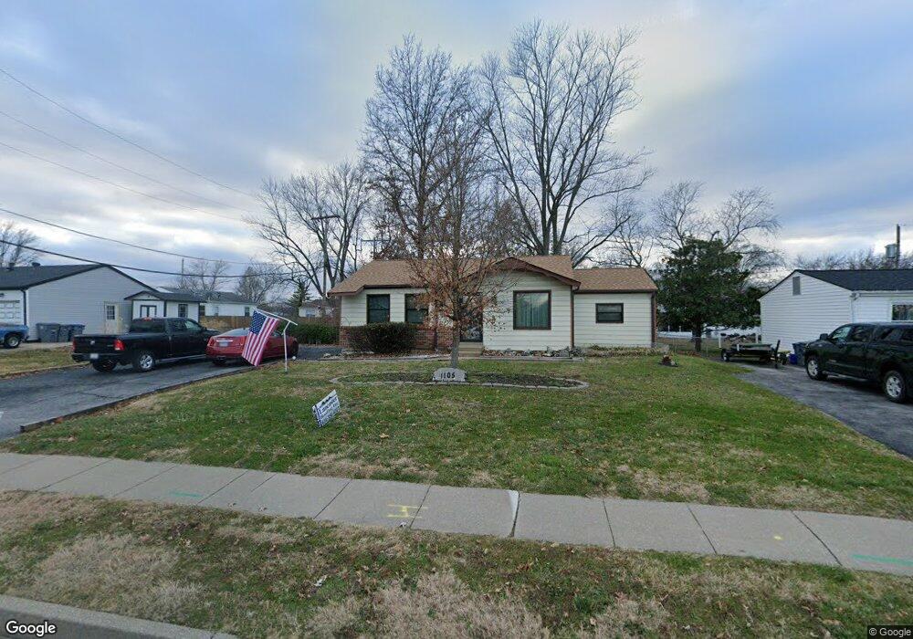
1105 N Main St O Fallon, MO 63366
Estimated Value: $257,834 - $288,000
3
Beds
2
Baths
1,279
Sq Ft
$214/Sq Ft
Est. Value
About This Home
This home is located at 1105 N Main St, O Fallon, MO 63366 and is currently estimated at $273,459, approximately $213 per square foot. 1105 N Main St is a home located in St. Charles County with nearby schools including Westhoff Elementary School, Fort Zumwalt North Middle School, and Fort Zumwalt North High School.
Ownership History
Date
Name
Owned For
Owner Type
Purchase Details
Closed on
Oct 5, 2021
Sold by
Oneal John C and Oneal Mary E
Bought by
Oneal John C and Oneal Mary E
Current Estimated Value
Purchase Details
Closed on
Aug 30, 2006
Sold by
Franz Steven M and Franz Michelle Y
Bought by
Schmidt Brett and Schmidt Jill
Home Financials for this Owner
Home Financials are based on the most recent Mortgage that was taken out on this home.
Original Mortgage
$211,500
Outstanding Balance
$127,359
Interest Rate
6.72%
Mortgage Type
Purchase Money Mortgage
Estimated Equity
$146,100
Create a Home Valuation Report for This Property
The Home Valuation Report is an in-depth analysis detailing your home's value as well as a comparison with similar homes in the area
Home Values in the Area
Average Home Value in this Area
Purchase History
| Date | Buyer | Sale Price | Title Company |
|---|---|---|---|
| Oneal John C | -- | None Available | |
| Schmidt Brett | -- | Emmons Title |
Source: Public Records
Mortgage History
| Date | Status | Borrower | Loan Amount |
|---|---|---|---|
| Open | Schmidt Brett | $211,500 |
Source: Public Records
Tax History
| Year | Tax Paid | Tax Assessment Tax Assessment Total Assessment is a certain percentage of the fair market value that is determined by local assessors to be the total taxable value of land and additions on the property. | Land | Improvement |
|---|---|---|---|---|
| 2025 | $2,623 | $41,479 | -- | -- |
| 2023 | $2,624 | $39,443 | $0 | $0 |
| 2022 | $2,158 | $30,093 | $0 | $0 |
| 2021 | $2,160 | $30,093 | $0 | $0 |
| 2020 | $2,063 | $27,901 | $0 | $0 |
| 2019 | $2,068 | $27,901 | $0 | $0 |
| 2018 | $1,864 | $23,981 | $0 | $0 |
| 2017 | $1,831 | $23,981 | $0 | $0 |
| 2016 | $1,696 | $22,118 | $0 | $0 |
| 2015 | $1,577 | $22,118 | $0 | $0 |
| 2014 | $1,738 | $23,987 | $0 | $0 |
Source: Public Records
Map
Nearby Homes
- 1215 Cypress Dr
- 201 Allen Dr
- 201 Old Schaeffer Ln
- 31 Piepers Glen Ct
- 409 Saint Joseph Ave
- 231 England Dr
- 218 Centerfield Dr
- 203 Saint Margaret Ln
- 632 Homerun Dr Unit 33N
- 730 Homerun Dr Unit 76N
- 17 Homefield Gardens Dr
- 19 Homefield Gardens Dr Unit 27N
- 21 Homefield Gardens Dr Unit 28N
- 122 Courtfield Dr
- 140 Park Ridge Dr
- 805 Saint Joseph Ave
- 214 Maryland Dr Unit 26B
- 205 E Elm St
- 1612 Homefield Meadows Dr
- 0 Tom Ginnever Ave
- 1109 N Main St
- 1103 N Main St
- 105 Bittersweet Dr
- 1104 Cypress Dr
- 214220 N Main St
- 11331137 N Main St
- 603609 N Main St
- 1106 Cypress Dr
- 1113 N Main St
- 17 Bittersweet Lots Dr
- 1108 Cypress Dr
- 1102 Cypress Dr
- 1117 N Main St
- 127 Bittersweet Dr
- 0 Bitter Sweet Dr Unit 10017333
- 0 Bittersweet Unit 10041013
- 0 Bittersweet Unit 12049051
- 0TBLT Bittersweet Dr
- 1107 Cypress Dr
- 1109 Central Pkwy
Your Personal Tour Guide
Ask me questions while you tour the home.