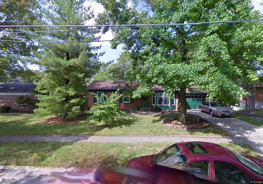
11051 Corona Rd Cincinnati, OH 45240
Estimated Value: $201,000 - $261,000
3
Beds
2
Baths
1,510
Sq Ft
$147/Sq Ft
Est. Value
About This Home
This home is located at 11051 Corona Rd, Cincinnati, OH 45240 and is currently estimated at $222,592, approximately $147 per square foot. 11051 Corona Rd is a home located in Hamilton County with nearby schools including Calvary Academy- The, John Paul II Catholic School, and St Gabriel Consolidated School.
Ownership History
Date
Name
Owned For
Owner Type
Purchase Details
Closed on
May 9, 2003
Sold by
Henson Bynum E and Henson Darcy L
Bought by
Snyder Lynn and Andrews Christina
Current Estimated Value
Home Financials for this Owner
Home Financials are based on the most recent Mortgage that was taken out on this home.
Original Mortgage
$121,985
Outstanding Balance
$51,585
Interest Rate
5.9%
Mortgage Type
FHA
Estimated Equity
$171,007
Purchase Details
Closed on
May 29, 1998
Sold by
Woehrmyer Douglas R and Woehrmyer Cynthia L
Bought by
Henson Bynum E and Henson Darcy L
Home Financials for this Owner
Home Financials are based on the most recent Mortgage that was taken out on this home.
Original Mortgage
$89,200
Interest Rate
7.27%
Purchase Details
Closed on
Dec 30, 1993
Sold by
Ahuja Roshan Bob and Ahuja Michelle
Bought by
Woehrmyer Douglas R and Woehrmer Cynthia L
Create a Home Valuation Report for This Property
The Home Valuation Report is an in-depth analysis detailing your home's value as well as a comparison with similar homes in the area
Home Values in the Area
Average Home Value in this Area
Purchase History
| Date | Buyer | Sale Price | Title Company |
|---|---|---|---|
| Snyder Lynn | $123,900 | -- | |
| Henson Bynum E | $94,900 | -- | |
| Woehrmyer Douglas R | -- | -- |
Source: Public Records
Mortgage History
| Date | Status | Borrower | Loan Amount |
|---|---|---|---|
| Open | Snyder Lynn | $121,985 | |
| Closed | Henson Bynum E | $89,200 |
Source: Public Records
Tax History
| Year | Tax Paid | Tax Assessment Tax Assessment Total Assessment is a certain percentage of the fair market value that is determined by local assessors to be the total taxable value of land and additions on the property. | Land | Improvement |
|---|---|---|---|---|
| 2025 | $2,935 | $49,883 | $10,679 | $39,204 |
| 2024 | $2,857 | $49,883 | $10,679 | $39,204 |
| 2023 | $3,145 | $49,883 | $10,679 | $39,204 |
| 2022 | $2,744 | $35,770 | $9,499 | $26,271 |
| 2021 | $2,680 | $35,770 | $9,499 | $26,271 |
| 2020 | $2,714 | $35,770 | $9,499 | $26,271 |
| 2019 | $2,576 | $29,810 | $7,917 | $21,893 |
| 2018 | $2,582 | $29,810 | $7,917 | $21,893 |
| 2017 | $2,484 | $29,810 | $7,917 | $21,893 |
| 2016 | $2,395 | $28,158 | $8,348 | $19,810 |
| 2015 | $2,222 | $28,158 | $8,348 | $19,810 |
| 2014 | $2,051 | $28,158 | $8,348 | $19,810 |
| 2013 | $2,114 | $29,638 | $8,785 | $20,853 |
Source: Public Records
Map
Nearby Homes
- 16 Japonica Dr
- 602 Brightview Place Unit 34
- 612 Brightview Place Unit 30
- 614 Brightview Place Unit 29
- 626 Brightview Place Unit 24
- 622 Brightview Place Unit 26
- 620 Brightview Place Unit 27
- 624 Brightview Place Unit 25
- 1 Jennings Rd
- 38 Handel Ln
- 564 Waycross Rd
- 37 Hayden Dr
- 920 Waycross Rd
- 34 Gambier Cir
- 1013 Ligorio Ave
- 1105 Inner Circle Dr
- 11481 Fremantle Dr
- 31 Flanders Ln
- 483 Vista Glen Dr
- 440 W Sharon Rd
- 11061 Corona Rd
- 11039 Corona Rd
- 10942 Carnegie Dr
- 11029 Corona Rd
- 10950 Carnegie Dr
- 10934 Carnegie Dr
- 799 Converse Dr
- 11038 Corona Rd
- 10958 Carnegie Dr
- 10926 Carnegie Dr
- 11017 Corona Ridge
- 11017 Corona Rd
- 11026 Corona Rd
- 11078 Corona Rd
- 11083 Corona Rd
- 791 Converse Dr
- 10918 Carnegie Dr
- 10964 Carnegie Dr
- 11016 Corona Rd
- 11088 Corona Rd
Your Personal Tour Guide
Ask me questions while you tour the home.