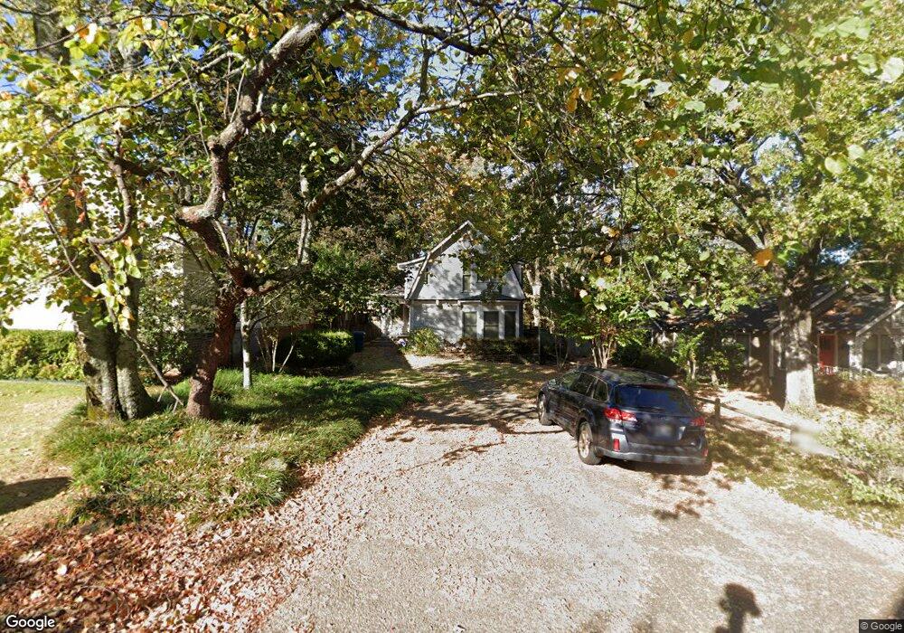
1106 Beechwood St Little Rock, AR 72205
Hillcrest NeighborhoodEstimated Value: $286,510 - $390,000
--
Bed
2
Baths
1,684
Sq Ft
$199/Sq Ft
Est. Value
About This Home
This home is located at 1106 Beechwood St, Little Rock, AR 72205 and is currently estimated at $334,878, approximately $198 per square foot. 1106 Beechwood St is a home located in Pulaski County with nearby schools including Pulaski Heights Elementary School, Pulaski Heights Middle School, and Central High School.
Ownership History
Date
Name
Owned For
Owner Type
Purchase Details
Closed on
Jun 7, 2013
Sold by
Snook Roy G
Bought by
Nas Properties Llc
Current Estimated Value
Purchase Details
Closed on
Apr 2, 2004
Sold by
Newland John and Newland Christy E
Bought by
Snook Roy G
Home Financials for this Owner
Home Financials are based on the most recent Mortgage that was taken out on this home.
Original Mortgage
$136,470
Interest Rate
4%
Mortgage Type
Purchase Money Mortgage
Create a Home Valuation Report for This Property
The Home Valuation Report is an in-depth analysis detailing your home's value as well as a comparison with similar homes in the area
Home Values in the Area
Average Home Value in this Area
Purchase History
| Date | Buyer | Sale Price | Title Company |
|---|---|---|---|
| Nas Properties Llc | -- | None Available | |
| Snook Roy G | $185,000 | Stewart Title Of Arkansas |
Source: Public Records
Mortgage History
| Date | Status | Borrower | Loan Amount |
|---|---|---|---|
| Previous Owner | Snook Roy G | $136,470 |
Source: Public Records
Tax History Compared to Growth
Tax History
| Year | Tax Paid | Tax Assessment Tax Assessment Total Assessment is a certain percentage of the fair market value that is determined by local assessors to be the total taxable value of land and additions on the property. | Land | Improvement |
|---|---|---|---|---|
| 2025 | $3,520 | $53,016 | $30,000 | $23,016 |
| 2024 | $3,017 | $53,016 | $30,000 | $23,016 |
| 2023 | $3,017 | $53,016 | $30,000 | $23,016 |
| 2022 | $2,766 | $53,016 | $30,000 | $23,016 |
| 2021 | $2,532 | $35,920 | $24,500 | $11,420 |
| 2020 | $2,514 | $35,920 | $24,500 | $11,420 |
| 2019 | $2,514 | $35,920 | $24,500 | $11,420 |
| 2018 | $2,514 | $35,920 | $24,500 | $11,420 |
| 2017 | $2,514 | $35,920 | $24,500 | $11,420 |
| 2016 | $2,699 | $38,550 | $15,000 | $23,550 |
| 2015 | $2,702 | $38,550 | $15,000 | $23,550 |
| 2014 | $2,702 | $0 | $0 | $0 |
Source: Public Records
Map
Nearby Homes
- 1100 N Palm St
- 1109 N Spruce St
- 416 N Spruce St
- 314 N Walnut St
- 4907 N Lookout St
- 5015 E Crestwood Dr
- 4009 Kenyon Dr
- 4523 Woodlawn Dr
- 5009 N Lookout Dr
- 501 N Palm St
- 5024 Crestwood Dr
- 5116 Edgewood Rd
- 5120 F St
- 1109 N Tyler St
- 3901 Cedar Hill #23 Rd
- 4001 Cedar Hill Rd
- 5223 G St
- 3901 Cedar Hill Rd
- 326 Ash St
- 4817 Kavanaugh Blvd
- 4600 Kenyon Dr
- 1112 Beechwood St
- 1020 Beechwood St
- 4620 Kenyon Dr
- 4524 Kenyon Dr
- 1018 Beechwood St
- 4621 Kenyon Dr Unit 2
- 4621 Kenyon Dr
- 4520 Kenyon Dr
- 1021 Beechwood St
- 4613 N Lookout St
- 1016 Beechwood St
- 1109 N Palm St
- 4611 N Lookout St
- 4624 Kenyon Dr
- 4615 N Lookout St
- N Lookout Rd
- 4615 N Lookout Rd
- 4609 N Lookout St
- 1025 N Palm St