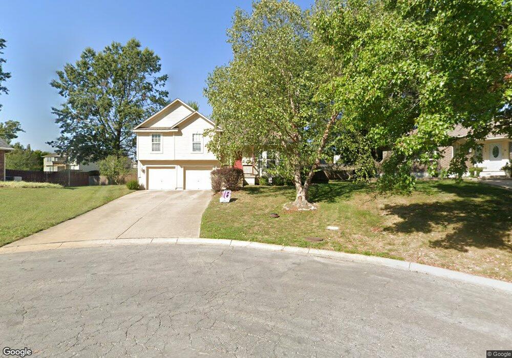
1106 Brookside Ct Raymore, MO 64083
Estimated Value: $313,000 - $340,000
4
Beds
3
Baths
1,491
Sq Ft
$220/Sq Ft
Est. Value
About This Home
This home is located at 1106 Brookside Ct, Raymore, MO 64083 and is currently estimated at $328,243, approximately $220 per square foot. 1106 Brookside Ct is a home located in Cass County with nearby schools including Eagle Glen Intermediate School, Raymore-Peculiar East Middle School, and Raymore-Peculiar Senior High School.
Ownership History
Date
Name
Owned For
Owner Type
Purchase Details
Closed on
Jan 22, 2007
Sold by
Accredited Home Lenders
Bought by
Deutsche Bank National Trust Co
Current Estimated Value
Home Financials for this Owner
Home Financials are based on the most recent Mortgage that was taken out on this home.
Original Mortgage
$163,455
Outstanding Balance
$97,401
Interest Rate
6.25%
Mortgage Type
New Conventional
Estimated Equity
$230,842
Purchase Details
Closed on
Oct 20, 2006
Sold by
Carter Dennis N and Carter Rene
Bought by
Aames Home Loan
Create a Home Valuation Report for This Property
The Home Valuation Report is an in-depth analysis detailing your home's value as well as a comparison with similar homes in the area
Home Values in the Area
Average Home Value in this Area
Purchase History
| Date | Buyer | Sale Price | Title Company |
|---|---|---|---|
| Deutsche Bank National Trust Co | -- | -- | |
| Aames Home Loan | -- | -- |
Source: Public Records
Mortgage History
| Date | Status | Borrower | Loan Amount |
|---|---|---|---|
| Open | Deutsche Bank National Trust Co | $163,455 |
Source: Public Records
Tax History
| Year | Tax Paid | Tax Assessment Tax Assessment Total Assessment is a certain percentage of the fair market value that is determined by local assessors to be the total taxable value of land and additions on the property. | Land | Improvement |
|---|---|---|---|---|
| 2025 | $2,795 | $38,870 | $4,260 | $34,610 |
| 2024 | $2,795 | $34,340 | $3,880 | $30,460 |
| 2023 | $2,791 | $34,340 | $3,880 | $30,460 |
| 2022 | $2,529 | $30,910 | $3,880 | $27,030 |
| 2021 | $2,529 | $30,910 | $3,880 | $27,030 |
| 2020 | $2,500 | $30,010 | $3,880 | $26,130 |
| 2019 | $2,413 | $30,010 | $3,880 | $26,130 |
| 2018 | $2,222 | $26,680 | $3,100 | $23,580 |
| 2017 | $2,027 | $26,680 | $3,100 | $23,580 |
| 2016 | $2,027 | $25,260 | $3,100 | $22,160 |
| 2015 | $2,028 | $25,260 | $3,100 | $22,160 |
| 2014 | $2,029 | $25,260 | $3,100 | $22,160 |
| 2013 | -- | $25,260 | $3,100 | $22,160 |
Source: Public Records
Map
Nearby Homes
- 1105 Brookside Place
- 1003 Silver Lake Dr
- 110 S Westglen Dr
- 112 S Westglen Dr
- 205 Johnston Pkwy
- 108 Rainbow Cir
- 701 Hampstead Dr
- 809 Stratford Dr
- 1601 Stasi Ave
- 411 Eagle Glen Dr
- 1108 Yokley Dr
- 215 Scott Dr
- 615 N Conway St
- 0 Scott Dr
- 1412 W Stone Blvd
- 503 N Jenkins Blvd
- 212 S Huntsman Blvd
- 901 W Lucy Webb Rd
- 1323 W Johns Blvd
- 1010 Wiltshire Blvd
- 1104 Brookside Ct
- 1105 Brookside Ct
- 111 N Eastglen Dr
- 113 N Eastglen Dr
- 115 N Eastglen Dr
- 107 N Eastglen Dr
- 1103 Brookside Ct
- 1107 W Glendale Dr
- 1020 Brookside Dr
- 1102 Brookside Ct
- 1105 W Glendale Dr
- 117 N Eastglen Dr
- 1103 W Glendale Dr
- 1101 Brookside Ct
- 1104 Johnston Dr
- 1101 W Glendale Dr
- 1102 Johnston Dr
- 1201 Belinder Dr
- 201 N Eastglen Dr
- 100 N Silver Top Ln