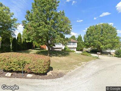
1106 Jacobs Cir Scottdale, PA 15683
East Huntingdon Township NeighborhoodEstimated Value: $81,326 - $287,000
--
Bed
--
Bath
988
Sq Ft
$182/Sq Ft
Est. Value
About This Home
This home is located at 1106 Jacobs Cir, Scottdale, PA 15683 and is currently estimated at $179,832, approximately $182 per square foot. 1106 Jacobs Cir is a home with nearby schools including Southmoreland Elementary School, Southmoreland Primary Center, and Southmoreland Senior High School.
Ownership History
Date
Name
Owned For
Owner Type
Purchase Details
Closed on
Jul 14, 2006
Sold by
Hall Travia Y Dorsey and Hall Derrick
Bought by
Naper Ronald F and Naper Barbara A
Current Estimated Value
Home Financials for this Owner
Home Financials are based on the most recent Mortgage that was taken out on this home.
Original Mortgage
$80,000
Interest Rate
6.71%
Mortgage Type
Purchase Money Mortgage
Create a Home Valuation Report for This Property
The Home Valuation Report is an in-depth analysis detailing your home's value as well as a comparison with similar homes in the area
Home Values in the Area
Average Home Value in this Area
Purchase History
| Date | Buyer | Sale Price | Title Company |
|---|---|---|---|
| Naper Ronald F | $103,000 | None Available |
Source: Public Records
Mortgage History
| Date | Status | Borrower | Loan Amount |
|---|---|---|---|
| Open | Naper Ronald F | $72,000 | |
| Closed | Naper Ronald F | $80,000 |
Source: Public Records
Tax History Compared to Growth
Tax History
| Year | Tax Paid | Tax Assessment Tax Assessment Total Assessment is a certain percentage of the fair market value that is determined by local assessors to be the total taxable value of land and additions on the property. | Land | Improvement |
|---|---|---|---|---|
| 2025 | $2,953 | $23,170 | $7,770 | $15,400 |
| 2024 | $2,927 | $23,170 | $7,770 | $15,400 |
| 2023 | $2,657 | $23,170 | $7,770 | $15,400 |
| 2022 | $2,541 | $23,170 | $7,770 | $15,400 |
| 2021 | $2,474 | $23,170 | $7,770 | $15,400 |
| 2020 | $2,434 | $23,170 | $7,770 | $15,400 |
| 2019 | $2,341 | $23,170 | $7,770 | $15,400 |
| 2018 | $2,267 | $23,170 | $7,770 | $15,400 |
| 2017 | $2,267 | $23,170 | $7,770 | $15,400 |
| 2016 | $2,216 | $23,170 | $7,770 | $15,400 |
| 2015 | $2,216 | $23,170 | $7,770 | $15,400 |
| 2014 | $2,185 | $23,170 | $7,770 | $15,400 |
Source: Public Records
Map
Nearby Homes
- 1106 Jacobs Cir
- 1108 Jacobs Cir
- 1110 Jacobs Cir
- 1102 Jacobs Cir
- 1105 Jacob's Cir
- 1109 Jacobs Cir
- 2201 Loucks Rd
- 2103 Loucks Rd
- 103 Loucks Rd
- 2106 Loucks Rd
- 2104 Loucks Rd
- 2203 Loucks Rd
- 2200 Loucks Rd
- 2102 Loucks Rd
- 2098 Loucks Rd
- 2100 Loucks Rd
- 2101 Loucks Rd
- 2202 Loucks Rd
- 1300 Gurley Dr
- 306 Wood St