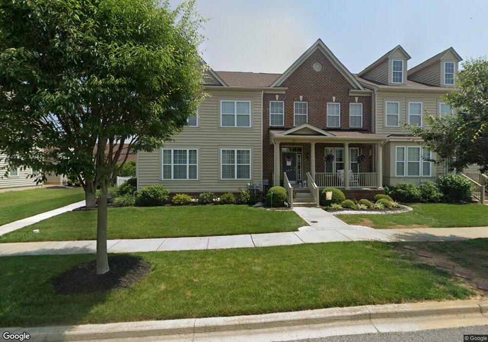
1106 S Olmsted Pkwy Middletown, DE 19709
Estimated Value: $448,305 - $481,000
3
Beds
3
Baths
2,006
Sq Ft
$231/Sq Ft
Est. Value
About This Home
This home is located at 1106 S Olmsted Pkwy, Middletown, DE 19709 and is currently estimated at $463,076, approximately $230 per square foot. 1106 S Olmsted Pkwy is a home located in New Castle County with nearby schools including Cedar Lane Elementary School, Alfred G. Waters Middle School, and Middletown High School.
Ownership History
Date
Name
Owned For
Owner Type
Purchase Details
Closed on
Feb 20, 2019
Sold by
Zyskowski Theodore L and Zyskowski Diane Marie
Bought by
Devany Teresa M and Stickel Dennis M
Current Estimated Value
Home Financials for this Owner
Home Financials are based on the most recent Mortgage that was taken out on this home.
Original Mortgage
$264,600
Outstanding Balance
$232,156
Interest Rate
4.4%
Mortgage Type
New Conventional
Estimated Equity
$230,920
Purchase Details
Closed on
Mar 21, 2014
Sold by
Farm Land Holdings Llc
Bought by
Theodore L Zyskowski Living Trust
Home Financials for this Owner
Home Financials are based on the most recent Mortgage that was taken out on this home.
Original Mortgage
$115,000
Interest Rate
3.37%
Mortgage Type
Adjustable Rate Mortgage/ARM
Create a Home Valuation Report for This Property
The Home Valuation Report is an in-depth analysis detailing your home's value as well as a comparison with similar homes in the area
Home Values in the Area
Average Home Value in this Area
Purchase History
| Date | Buyer | Sale Price | Title Company |
|---|---|---|---|
| Devany Teresa M | -- | None Available | |
| Theodore L Zyskowski Living Trust | $269,420 | None Available |
Source: Public Records
Mortgage History
| Date | Status | Borrower | Loan Amount |
|---|---|---|---|
| Open | Devany Teresa M | $264,600 | |
| Previous Owner | Theodore L Zyskowski Living Trust | $115,000 |
Source: Public Records
Tax History Compared to Growth
Tax History
| Year | Tax Paid | Tax Assessment Tax Assessment Total Assessment is a certain percentage of the fair market value that is determined by local assessors to be the total taxable value of land and additions on the property. | Land | Improvement |
|---|---|---|---|---|
| 2024 | $3,712 | $88,700 | $7,500 | $81,200 |
| 2023 | $3,154 | $88,700 | $7,500 | $81,200 |
| 2022 | $3,177 | $88,700 | $7,500 | $81,200 |
| 2021 | $3,138 | $88,700 | $7,500 | $81,200 |
| 2020 | $0 | $88,700 | $7,500 | $81,200 |
| 2019 | $2,929 | $88,700 | $7,500 | $81,200 |
| 2018 | $92 | $88,700 | $7,500 | $81,200 |
| 2017 | $2,419 | $88,700 | $7,500 | $81,200 |
| 2016 | $2,419 | $88,700 | $7,500 | $81,200 |
| 2015 | $2,353 | $88,700 | $7,500 | $81,200 |
| 2014 | $2,319 | $87,600 | $7,500 | $80,100 |
Source: Public Records
Map
Nearby Homes
- 2241 Winchelsea Pkwy
- 3502 Pipewell Ln
- 3506 Pipewell Ln
- 3104 Pett Level Dr
- 3029 Ivyhouse Ln
- 3108 Pett Level Dr
- 3110 Pett Level Dr
- 1169 S Olmsted Pkwy
- 3134 Pett Level Dr
- 2248 Audubon Trail
- 3112 Pett Level Dr
- 2918 Cordwainers Ln
- 2674 Fairlight Dr
- 1221 N Olmsted Pkwy
- Solano Plan at Venue at Winchelsea 55+ - Winchelsea Singles
- Taylor Plan at Venue at Winchelsea 55+ - Winchelsea Towns
- Mendocino Plan at Venue at Winchelsea 55+ - Winchelsea Singles
- Carson Plan at Venue at Winchelsea 55+ - Winchelsea Singles
- Truman Plan at Venue at Winchelsea 55+ - Winchelsea Towns
- Mendocino Luxe Plan at Venue at Winchelsea 55+ - Winchelsea Singles
- 1106 S Olmsted Pkwy
- 1104 S Olmsted Pkwy
- 1102 S Olmsted Pkwy
- 1102 S Olmsted Pkwy
- 1108 S Olmsted Pkwy
- 1110 S Olmsted Pkwy
- 1110 S Olmsted Pkwy
- 1112 S Olmsted Pkwy
- 1112 S Olmsted Pkwy
- 1807 N Pollock Way
- 1114 S Olmsted Pkwy
- 1114 S Olmsted Pkwy
- 1805 N Pollock Way
- 1803 N Pollock Way
- 1576 E Matisse Dr
- 1809 N Pollock Way
- 1116 S Olmsted Pkwy
- 1811 N Pollock Way
- 1813 N Pollock Way
- 1118 S Olmsted Pkwy