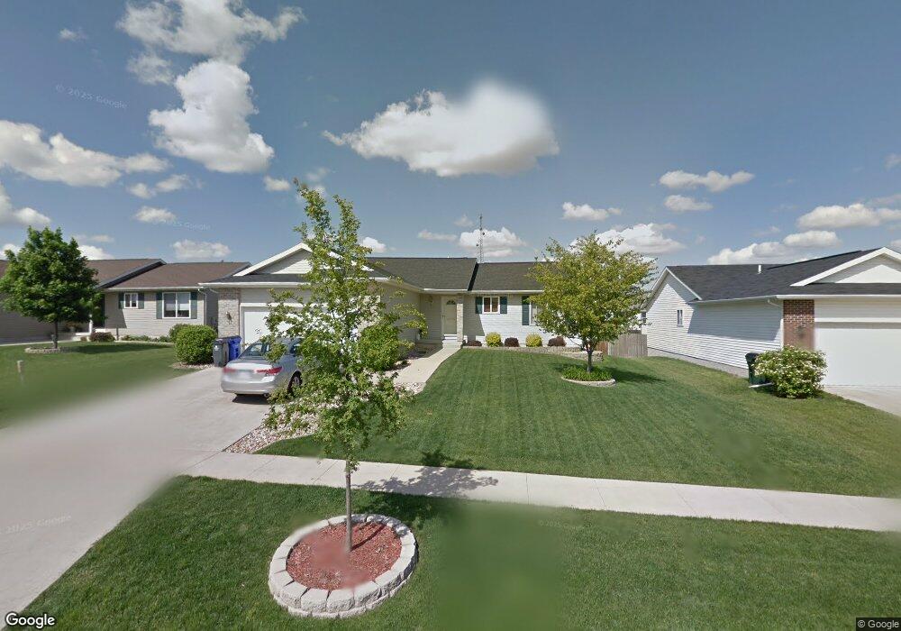
1106 Wolf Dr NW Cedar Rapids, IA 52405
Estimated Value: $288,000 - $331,000
4
Beds
3
Baths
1,400
Sq Ft
$219/Sq Ft
Est. Value
About This Home
This home is located at 1106 Wolf Dr NW, Cedar Rapids, IA 52405 and is currently estimated at $306,746, approximately $219 per square foot. 1106 Wolf Dr NW is a home located in Linn County with nearby schools including Maple Grove Elementary School, Taft Middle School, and John F. Kennedy High School.
Ownership History
Date
Name
Owned For
Owner Type
Purchase Details
Closed on
Aug 16, 2001
Sold by
Kacs Lc
Bought by
Thorstenson Eric and Thorstenson Stacy
Current Estimated Value
Home Financials for this Owner
Home Financials are based on the most recent Mortgage that was taken out on this home.
Original Mortgage
$101,850
Outstanding Balance
$39,615
Interest Rate
7.11%
Estimated Equity
$267,131
Create a Home Valuation Report for This Property
The Home Valuation Report is an in-depth analysis detailing your home's value as well as a comparison with similar homes in the area
Purchase History
| Date | Buyer | Sale Price | Title Company |
|---|---|---|---|
| Thorstenson Eric | $145,500 | -- |
Source: Public Records
Mortgage History
| Date | Status | Borrower | Loan Amount |
|---|---|---|---|
| Open | Thorstenson Eric | $101,850 | |
| Closed | Thorstenson Eric | $43,650 |
Source: Public Records
Tax History
| Year | Tax Paid | Tax Assessment Tax Assessment Total Assessment is a certain percentage of the fair market value that is determined by local assessors to be the total taxable value of land and additions on the property. | Land | Improvement |
|---|---|---|---|---|
| 2025 | $4,368 | $279,300 | $58,000 | $221,300 |
| 2024 | $4,506 | $257,300 | $54,700 | $202,600 |
| 2023 | $4,506 | $257,300 | $54,700 | $202,600 |
| 2022 | $4,210 | $222,500 | $48,100 | $174,400 |
| 2021 | $4,268 | $212,200 | $41,500 | $170,700 |
| 2020 | $4,268 | $202,000 | $41,500 | $160,500 |
| 2019 | $3,766 | $183,200 | $33,200 | $150,000 |
| 2018 | $3,658 | $183,200 | $33,200 | $150,000 |
| 2017 | $3,706 | $178,700 | $33,200 | $145,500 |
| 2016 | $3,767 | $177,200 | $33,200 | $144,000 |
| 2015 | $3,943 | $185,338 | $33,168 | $152,170 |
| 2014 | $3,758 | $185,338 | $33,168 | $152,170 |
| 2013 | $3,674 | $185,338 | $33,168 | $152,170 |
Source: Public Records
Map
Nearby Homes
- 1211 Wolf Dr NW
- 4341 Beecher Ct NW
- 1722 Gardner Dr NW
- 1608 Morris Ave NW
- 4524 E Ave NW
- 602 Olive Dr NW
- 1209 39th Street Rd NW
- 408 Jacolyn Dr NW
- 410 Wiley Blvd NW
- 332 Bezdek Dr NW
- 3802 Richland Dr NW
- 448 Day St NW
- 281 Jacolyn Dr NW
- 332 Carter St NW
- 408 Day St NW
- 456 Mayberry Dr NW
- 3407 H Ave NW
- 327* Edgewood Rd NW
- 3503 East Ave NW
- 236 Jacolyn Dr NW
- 1112 Wolf Dr NW
- 1100 Wolf Dr NW
- 1113 Koudsi Blvd NW
- 1118 Wolf Dr NW
- 1028 Wolf Dr NW
- 1119 Koudsi Blvd NW
- 1107 Koudsi Blvd NW
- 1109 Wolf Dr NW
- 1101 Koudsi Blvd NW
- 1125 Koudsi Blvd NW
- 1103 Wolf Dr NW
- 1115 Wolf Dr NW
- 1124 Wolf Dr NW
- 1022 Wolf Dr NW
- 1025 Wolf Dr NW
- 1121 Wolf Dr NW
- 1203 Koudsi Blvd NW
- 1029 Koudsi Blvd NW
- 1019 Wolf Dr NW
- 1202 Wolf Dr NW
Your Personal Tour Guide
Ask me questions while you tour the home.