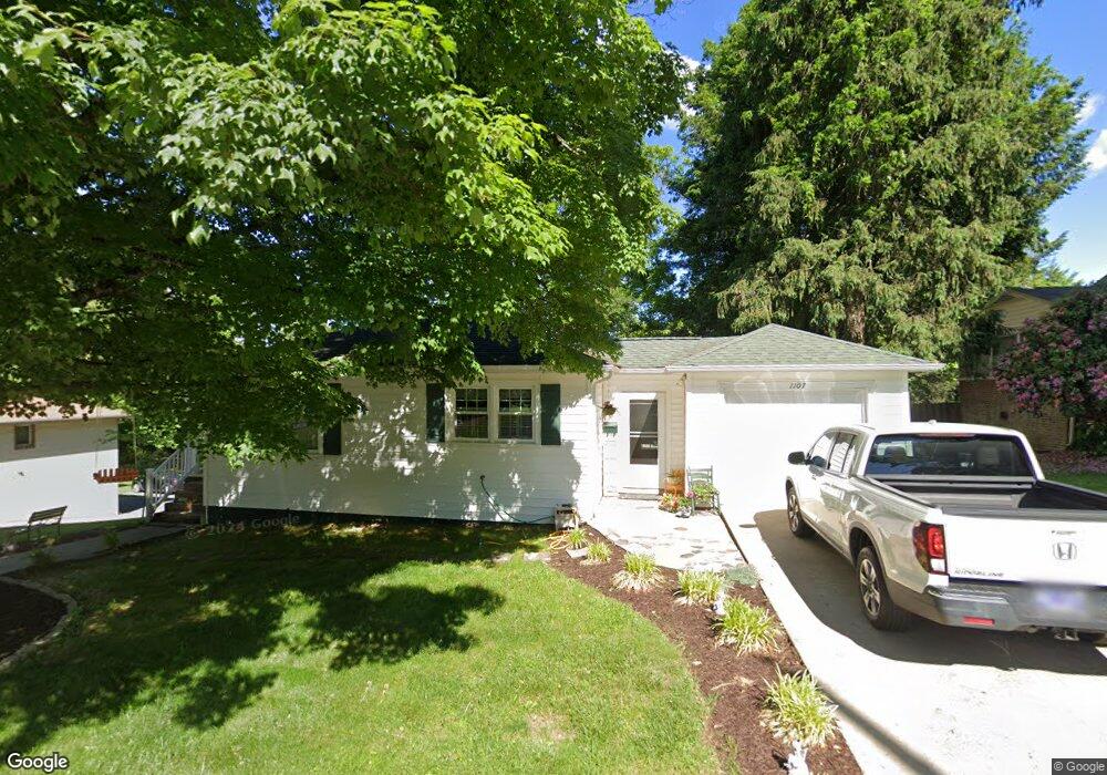
1107 7th Ave Bristol, TN 37620
Estimated Value: $171,000 - $226,000
2
Beds
1
Bath
1,236
Sq Ft
$164/Sq Ft
Est. Value
About This Home
This home is located at 1107 7th Ave, Bristol, TN 37620 and is currently estimated at $202,216, approximately $163 per square foot. 1107 7th Ave is a home located in Sullivan County with nearby schools including Anderson Elementary School, Vance Middle School, and Tennessee High School.
Ownership History
Date
Name
Owned For
Owner Type
Purchase Details
Closed on
Mar 3, 2004
Sold by
Jeffrey Davenport and Jeffrey Melissa
Bought by
Debora Smelser
Current Estimated Value
Home Financials for this Owner
Home Financials are based on the most recent Mortgage that was taken out on this home.
Original Mortgage
$66,500
Outstanding Balance
$31,101
Interest Rate
5.68%
Estimated Equity
$171,115
Purchase Details
Closed on
Jul 30, 1999
Sold by
Ann Mullins Catherine
Bought by
Davenport Jeffrey L
Home Financials for this Owner
Home Financials are based on the most recent Mortgage that was taken out on this home.
Original Mortgage
$66,774
Interest Rate
7.7%
Purchase Details
Closed on
Feb 1, 1994
Sold by
Walter Fain
Bought by
Catherine Mullins
Create a Home Valuation Report for This Property
The Home Valuation Report is an in-depth analysis detailing your home's value as well as a comparison with similar homes in the area
Home Values in the Area
Average Home Value in this Area
Purchase History
| Date | Buyer | Sale Price | Title Company |
|---|---|---|---|
| Debora Smelser | $70,000 | -- | |
| Davenport Jeffrey L | $67,325 | -- | |
| Catherine Mullins | $45,500 | -- |
Source: Public Records
Mortgage History
| Date | Status | Borrower | Loan Amount |
|---|---|---|---|
| Open | Catherine Mullins | $66,500 | |
| Previous Owner | Catherine Mullins | $66,774 |
Source: Public Records
Tax History Compared to Growth
Tax History
| Year | Tax Paid | Tax Assessment Tax Assessment Total Assessment is a certain percentage of the fair market value that is determined by local assessors to be the total taxable value of land and additions on the property. | Land | Improvement |
|---|---|---|---|---|
| 2024 | -- | $24,125 | $4,700 | $19,425 |
| 2023 | $1,060 | $24,125 | $4,700 | $19,425 |
| 2022 | $1,060 | $24,125 | $4,700 | $19,425 |
| 2021 | $1,060 | $24,125 | $4,700 | $19,425 |
| 2020 | $1,051 | $24,125 | $4,700 | $19,425 |
| 2019 | $1,051 | $22,200 | $4,700 | $17,500 |
| 2018 | $1,046 | $22,200 | $4,700 | $17,500 |
| 2017 | $1,046 | $22,200 | $4,700 | $17,500 |
| 2016 | $1,072 | $22,200 | $4,700 | $17,500 |
| 2014 | -- | $22,208 | $0 | $0 |
Source: Public Records
Map
Nearby Homes
- 1224 7th Ave
- 801 Holston Ave
- 577 English St Unit B3
- 577 English St
- 1108 Glen St
- 1106 W Cedar St
- 602 9th St
- 909 Wilson Ave
- 103 Skyline Dr
- 309 Knob Hill Dr
- 310 Knob Hill Dr
- 1019 College Ave
- 522 Alabama St
- 1617 Tremont Ave
- 1020 Hill St
- 736 4th St
- 359 Vance Dr
- 948 Anderson St
- 116 Eastside Dr
- 115 Eastside Dr