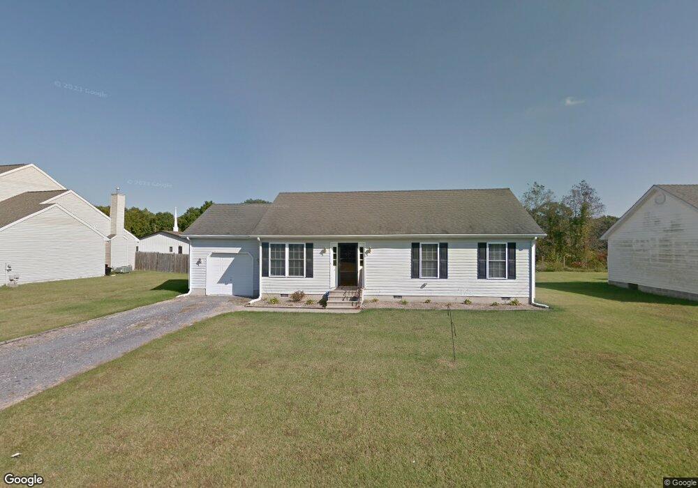
1108 High St Cambridge, MD 21613
Estimated Value: $212,767 - $227,000
--
Bed
2
Baths
1,176
Sq Ft
$187/Sq Ft
Est. Value
About This Home
This home is located at 1108 High St, Cambridge, MD 21613 and is currently estimated at $220,442, approximately $187 per square foot. 1108 High St is a home located in Dorchester County with nearby schools including Choptank Elementary School, Mace's Lane Middle School, and Cambridge-South Dorchester High School.
Ownership History
Date
Name
Owned For
Owner Type
Purchase Details
Closed on
Oct 11, 2005
Sold by
Hill William H B
Bought by
Robinson Mcdonald and Robinson Mary
Current Estimated Value
Home Financials for this Owner
Home Financials are based on the most recent Mortgage that was taken out on this home.
Original Mortgage
$34,200
Interest Rate
5.78%
Mortgage Type
Stand Alone Second
Purchase Details
Closed on
Sep 30, 2005
Sold by
Hill William H B
Bought by
Robinson Mcdonald and Robinson Mary
Home Financials for this Owner
Home Financials are based on the most recent Mortgage that was taken out on this home.
Original Mortgage
$34,200
Interest Rate
5.78%
Mortgage Type
Stand Alone Second
Purchase Details
Closed on
Apr 29, 2003
Sold by
Bayly Crossing Llc
Bought by
Hill William H B and Nicole Patrice
Create a Home Valuation Report for This Property
The Home Valuation Report is an in-depth analysis detailing your home's value as well as a comparison with similar homes in the area
Home Values in the Area
Average Home Value in this Area
Purchase History
| Date | Buyer | Sale Price | Title Company |
|---|---|---|---|
| Robinson Mcdonald | $171,000 | -- | |
| Robinson Mcdonald | $171,000 | -- | |
| Hill William H B | $119,000 | -- |
Source: Public Records
Mortgage History
| Date | Status | Borrower | Loan Amount |
|---|---|---|---|
| Closed | Robinson Mcdonald | $34,200 | |
| Open | Robinson Mcdonald | $136,800 | |
| Closed | Robinson Mcdonald | $136,800 | |
| Closed | Hill William H B | -- |
Source: Public Records
Tax History Compared to Growth
Tax History
| Year | Tax Paid | Tax Assessment Tax Assessment Total Assessment is a certain percentage of the fair market value that is determined by local assessors to be the total taxable value of land and additions on the property. | Land | Improvement |
|---|---|---|---|---|
| 2025 | $2,890 | $167,400 | $16,700 | $150,700 |
| 2024 | $2,565 | $153,100 | $0 | $0 |
| 2023 | $2,565 | $138,800 | $0 | $0 |
| 2022 | $5,538 | $124,500 | $16,700 | $107,800 |
| 2021 | $2,986 | $122,733 | $0 | $0 |
| 2020 | $2,281 | $120,967 | $0 | $0 |
| 2019 | $2,273 | $119,200 | $16,700 | $102,500 |
| 2018 | $2,213 | $119,200 | $16,700 | $102,500 |
| 2017 | $2,209 | $119,200 | $0 | $0 |
| 2016 | -- | $120,200 | $0 | $0 |
| 2015 | -- | $120,200 | $0 | $0 |
| 2014 | -- | $120,200 | $0 | $0 |
Source: Public Records
Map
Nearby Homes
- 1117 High St
- 0 E S Rainbow Ave
- 0 Bradley Ave
- 824 McBrides Ave
- 1304 Rainbow Ave
- 701 Goldsborough Ave
- 1008 Phillips St
- 825 Ames Ct
- 819 MacEs Ln
- 802 Allen St
- 810 Washington St
- 909 Pine St
- 0 W S Center St
- 807 Pine St
- 800 Center St
- 638 Douglas St
- 506 Robbins St
- 636 Douglas St
- 610 Washington St
- BTW 800-802 Center St