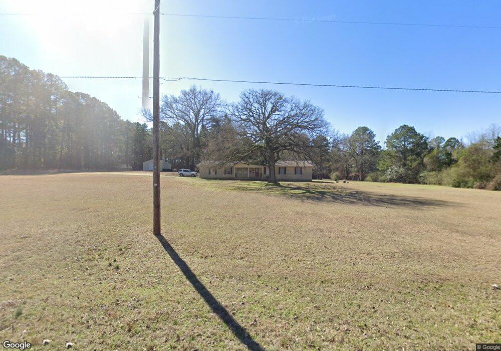
11083 Upper State Line Rd Vivian, LA 71082
Estimated Value: $188,000 - $271,620
2
Beds
2
Baths
2,801
Sq Ft
$83/Sq Ft
Est. Value
About This Home
This home is located at 11083 Upper State Line Rd, Vivian, LA 71082 and is currently estimated at $233,655, approximately $83 per square foot. 11083 Upper State Line Rd is a home located in Caddo Parish with nearby schools including Judson Fundamental Elementary School, Fairfield Magnet School, and Herndon Magnet School.
Ownership History
Date
Name
Owned For
Owner Type
Purchase Details
Closed on
Mar 25, 2011
Sold by
Banks Ricky Wayne
Bought by
Roberts Angle Johnnie Norman and Roberts Angle Deborah Ann
Current Estimated Value
Home Financials for this Owner
Home Financials are based on the most recent Mortgage that was taken out on this home.
Original Mortgage
$125,000
Outstanding Balance
$1,970
Interest Rate
5.04%
Mortgage Type
Unknown
Estimated Equity
$231,685
Purchase Details
Closed on
Sep 10, 2010
Sold by
Banks Toni Lynette
Bought by
Banks Ricky Wayne
Create a Home Valuation Report for This Property
The Home Valuation Report is an in-depth analysis detailing your home's value as well as a comparison with similar homes in the area
Home Values in the Area
Average Home Value in this Area
Purchase History
| Date | Buyer | Sale Price | Title Company |
|---|---|---|---|
| Roberts Angle Johnnie Norman | $165,000 | None Available | |
| Banks Ricky Wayne | -- | None Available |
Source: Public Records
Mortgage History
| Date | Status | Borrower | Loan Amount |
|---|---|---|---|
| Open | Roberts Angle Johnnie Norman | $125,000 |
Source: Public Records
Tax History
| Year | Tax Paid | Tax Assessment Tax Assessment Total Assessment is a certain percentage of the fair market value that is determined by local assessors to be the total taxable value of land and additions on the property. | Land | Improvement |
|---|---|---|---|---|
| 2025 | $2,730 | $17,376 | $424 | $16,952 |
| 2024 | $2,717 | $17,376 | $424 | $16,952 |
| 2023 | $2,531 | $15,849 | $409 | $15,440 |
| 2022 | $2,531 | $15,849 | $409 | $15,440 |
| 2021 | $2,532 | $15,849 | $409 | $15,440 |
| 2020 | $2,521 | $15,849 | $409 | $15,440 |
| 2019 | $2,520 | $16,015 | $408 | $15,607 |
| 2018 | $1,375 | $16,015 | $408 | $15,607 |
| 2017 | $1,245 | $7,680 | $436 | $7,244 |
| 2015 | $265 | $8,740 | $430 | $8,310 |
| 2014 | $266 | $8,740 | $430 | $8,310 |
| 2013 | -- | $8,740 | $430 | $8,310 |
Source: Public Records
Map
Nearby Homes
- Lot 14 Peaceful Pines Ln
- Lot 4 Peaceful Pines Ln
- Lot 2 Peaceful Pines Ln
- Lot 6 Peaceful Pines Ln
- Lot 5 Peaceful Pines Ln
- Lot 12 Peaceful Pines Ln
- 10739 Monterey School Rd
- 10744 Monterey School Rd
- 2040 Marion County Road 3509
- 0 Boyter Ln
- 307 Gilbert Dr
- 101 N Walnut St
- 612 S Cypress St
- 1005 S Cypress St
- 0 Camp Vivian St
- 62011 Rebel Heights Rd
- 325 E Oklahoma Ave
- 1 E Mary Ann St
- 0 E Mary Ann St
- 1701 N Pine St
- 11083 Upper State Line Rd
- 11107 Upper State Line Rd
- 11078 Upper State Line Rd
- 11043 Upper State Line Rd
- 11104 Upper State Line Rd
- 11123 Upper State Line Rd
- 11110 Upper State Line Rd
- 11030 Upper State Line Rd
- 11029 Upper State Line Rd
- 11168 Upper State Line Rd
- 11168 Upper State Line Rd
- 11190 Upper State Line Rd
- 11188 Upper State Line Rd
- 11207 Upper State Line Rd
- 11090 Upper State Line Rd
- 10955 Upper State Line Rd
- 11245 Upper State Line Rd
- 11046 Upper State Line Rd
- 739 County Road 4448
- 14395 Cass County Rd
Your Personal Tour Guide
Ask me questions while you tour the home.