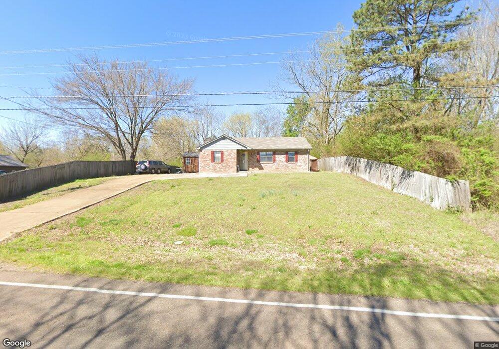
11085 Highway 76 S Somerville, TN 38068
Estimated Value: $119,000 - $225,000
3
Beds
2
Baths
1,145
Sq Ft
$146/Sq Ft
Est. Value
About This Home
This home is located at 11085 Highway 76 S, Somerville, TN 38068 and is currently estimated at $167,115, approximately $145 per square foot. 11085 Highway 76 S is a home located in Fayette County with nearby schools including Buckley-Carpenter Elementary School, East Junior High School, and Fayette Ware Comprehensive High School.
Ownership History
Date
Name
Owned For
Owner Type
Purchase Details
Closed on
Mar 25, 2022
Sold by
Malone Lashunda V
Bought by
Vaja Bipin and Patel Vaishali
Current Estimated Value
Purchase Details
Closed on
May 5, 2010
Sold by
R W Properties
Bought by
Malone Lashunda
Home Financials for this Owner
Home Financials are based on the most recent Mortgage that was taken out on this home.
Original Mortgage
$92,000
Interest Rate
5.15%
Purchase Details
Closed on
Jul 31, 1995
Bought by
Tapplin James and Tapplin Linda
Purchase Details
Closed on
Sep 22, 1993
Bought by
Williams Remus
Purchase Details
Closed on
May 14, 1984
Bought by
Fogelman Willie Lou
Create a Home Valuation Report for This Property
The Home Valuation Report is an in-depth analysis detailing your home's value as well as a comparison with similar homes in the area
Home Values in the Area
Average Home Value in this Area
Purchase History
| Date | Buyer | Sale Price | Title Company |
|---|---|---|---|
| Vaja Bipin | $50,000 | Minor Johnston Douglas Pllc | |
| Malone Lashunda | $87,500 | -- | |
| Malone Lashunda V | $87,500 | -- | |
| Tapplin James | $55,000 | -- | |
| Williams Remus | $8,000 | -- | |
| Fogelman Willie Lou | -- | -- |
Source: Public Records
Mortgage History
| Date | Status | Borrower | Loan Amount |
|---|---|---|---|
| Previous Owner | Malone Lashunda V | $92,000 |
Source: Public Records
Tax History Compared to Growth
Tax History
| Year | Tax Paid | Tax Assessment Tax Assessment Total Assessment is a certain percentage of the fair market value that is determined by local assessors to be the total taxable value of land and additions on the property. | Land | Improvement |
|---|---|---|---|---|
| 2024 | $250 | $21,150 | $1,950 | $19,200 |
| 2023 | $546 | $21,150 | $0 | $0 |
| 2022 | $398 | $21,150 | $1,950 | $19,200 |
| 2021 | $398 | $21,150 | $1,950 | $19,200 |
| 2020 | $406 | $21,150 | $1,950 | $19,200 |
| 2019 | $406 | $18,575 | $1,950 | $16,625 |
| 2018 | $406 | $18,575 | $1,950 | $16,625 |
| 2017 | $406 | $18,575 | $1,950 | $16,625 |
| 2016 | $402 | $17,350 | $1,950 | $15,400 |
| 2015 | $402 | $17,350 | $1,950 | $15,400 |
| 2014 | $402 | $17,350 | $1,950 | $15,400 |
Source: Public Records
Map
Nearby Homes
- 11 ACRES Lagrange Rd
- 0 Kay Ln
- 0 Clark Rd
- 000 Jernigan Dr
- 12315 S Main St
- 16055 Route 76
- 12370 S Main St
- 801 S Somerville St
- 0 Jernigan Dr
- 0 Jernigan Dr Unit 10138144
- 422 S Hiawatha St
- 307 Church St
- 462 Woodbridge Rd
- 380 Woodbridge Rd
- 155 Nicholas Dr
- 285 Woodbridge Rd
- 306 Old Jernigan Rd
- 105 Nicholas Dr
- 116 W Marginal St
- 55 Cedar Hill Cove
- 11085 Tennessee 76
- 11075 Highway 76 S
- 11055 Highway 76 S
- 11135 Highway 76 S
- 7350 Tennessee 195
- 7350 Highway 195
- 7370 Tennessee 195
- 7290 Highway 195
- 7280 Highway 195
- 19.5 ACRES Lagrange Rd
- 605 Lagrange Rd
- 7365 Highway 195
- 7335 Highway 195
- 7335 Hwy 195 Hwy
- 7335 Tennessee 195
- 7305 Highway 195
- 7415 Highway 195
- 7295 Highway 195
- 7275 Highway 195
- 7255 Highway 195