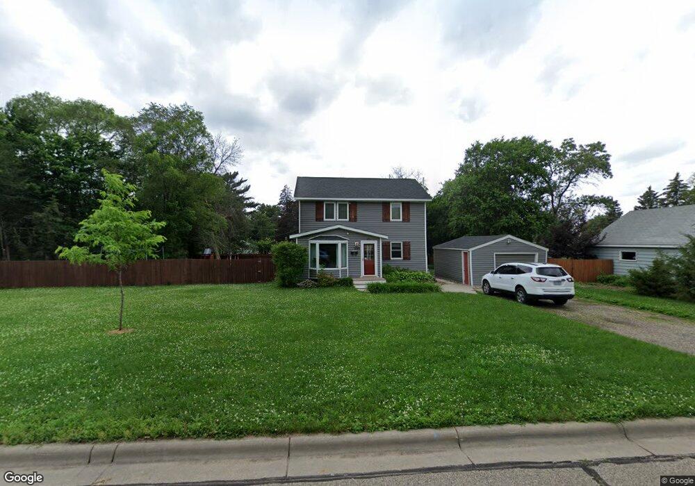
1109 Ashland Ave Saint Paul Park, MN 55071
Estimated Value: $306,000 - $340,000
3
Beds
2
Baths
1,472
Sq Ft
$224/Sq Ft
Est. Value
About This Home
This home is located at 1109 Ashland Ave, Saint Paul Park, MN 55071 and is currently estimated at $329,919, approximately $224 per square foot. 1109 Ashland Ave is a home located in Washington County with nearby schools including Pullman Elementary School, Oltman Middle School, and Park Senior High School.
Ownership History
Date
Name
Owned For
Owner Type
Purchase Details
Closed on
Oct 13, 2019
Sold by
Lise Nathan and Lise Janna
Bought by
Duong Jayson and Duong Kayla S
Current Estimated Value
Home Financials for this Owner
Home Financials are based on the most recent Mortgage that was taken out on this home.
Original Mortgage
$237,616
Outstanding Balance
$209,712
Interest Rate
3.87%
Mortgage Type
FHA
Estimated Equity
$120,207
Purchase Details
Closed on
Apr 18, 2016
Bought by
Janna Nathan
Purchase Details
Closed on
Jun 12, 2015
Sold by
Roberts Ryan
Bought by
Bank Of New York Mellon
Purchase Details
Closed on
Apr 7, 2003
Sold by
Lemere Myrtle M
Bought by
Ryan Robert
Create a Home Valuation Report for This Property
The Home Valuation Report is an in-depth analysis detailing your home's value as well as a comparison with similar homes in the area
Home Values in the Area
Average Home Value in this Area
Purchase History
| Date | Buyer | Sale Price | Title Company |
|---|---|---|---|
| Duong Jayson | $242,000 | Multiple | |
| Janna Nathan | $95,000 | -- | |
| Bank Of New York Mellon | $113,925 | Attorney | |
| Ryan Robert | $154,100 | -- |
Source: Public Records
Mortgage History
| Date | Status | Borrower | Loan Amount |
|---|---|---|---|
| Open | Duong Jayson | $237,616 |
Source: Public Records
Tax History Compared to Growth
Tax History
| Year | Tax Paid | Tax Assessment Tax Assessment Total Assessment is a certain percentage of the fair market value that is determined by local assessors to be the total taxable value of land and additions on the property. | Land | Improvement |
|---|---|---|---|---|
| 2024 | $3,978 | $312,000 | $80,000 | $232,000 |
| 2023 | $3,978 | $304,000 | $75,100 | $228,900 |
| 2022 | $3,252 | $290,000 | $75,100 | $214,900 |
| 2021 | $3,218 | $241,500 | $62,500 | $179,000 |
| 2020 | $3,112 | $242,900 | $72,500 | $170,400 |
| 2019 | $2,258 | $232,600 | $61,000 | $171,600 |
| 2018 | $1,868 | $149,000 | $50,000 | $99,000 |
| 2017 | $2,064 | $122,500 | $50,000 | $72,500 |
| 2016 | $3,338 | $138,600 | $55,000 | $83,600 |
| 2015 | $3,332 | $117,200 | $55,000 | $62,200 |
| 2013 | -- | $71,000 | $32,500 | $38,500 |
Source: Public Records
Map
Nearby Homes
- 1200 Laurel Ave
- 1200 Summit Ave
- 1033 Portland Ave
- 1313 11th Ave
- 816 Holley Ave
- 1121 5th St
- 1227 5th St
- 1601 14th Ave
- 801 Summit Ave
- 1020 Gary Dr
- 730 Pleasant Ave
- 1142 1st St
- 11XX 1st St
- 928 1st St
- 6467 82nd St S
- TBD Broadway Ave
- 10503 Glenbrook Ave S
- 10406 Glenbrook Ave S
- 10502 Glenbrook Ave S
- 10508 Glenbrook Ave S
- 1123 Ashland Ave
- 1101 Ashland Ave
- 1112 Holley Ave
- 1129 Ashland Ave
- 1129 1129 Ashland Ave
- 1124 Holley Ave
- 1100 1100 Holley Ave
- 1100 Holley Ave
- 1108 Ashland Ave
- 1108 1108 Ashland-Avenue-
- 1116 Ashland Ave
- 1100 1100 Ashland Ave
- 1126 1126 Ashland-Avenue-
- 1128 Holley Ave
- 1126 Ashland Ave
- 1139 Ashland Ave
- 1045 Ashland Ave
- 1130 Ashland Ave
- 1136 Holley Ave
- 1040 Holley Ave