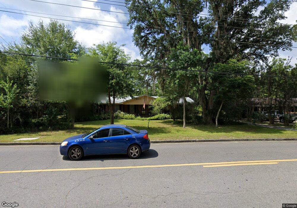
1109 Gornto Rd Valdosta, GA 31602
Estimated Value: $213,921 - $244,000
--
Bed
2
Baths
1,850
Sq Ft
$127/Sq Ft
Est. Value
About This Home
This home is located at 1109 Gornto Rd, Valdosta, GA 31602 and is currently estimated at $235,230, approximately $127 per square foot. 1109 Gornto Rd is a home located in Lowndes County with nearby schools including S.L. Mason Elementary School, Valdosta Middle School, and Valdosta High School.
Ownership History
Date
Name
Owned For
Owner Type
Purchase Details
Closed on
Dec 19, 2001
Sold by
Ely Charles A and Ely Liane M
Bought by
Lynn Coleman J
Current Estimated Value
Purchase Details
Closed on
Aug 4, 1997
Bought by
Ely Charles A and Ely Liane M
Purchase Details
Closed on
Feb 10, 1993
Bought by
Bracewell Arlton R
Purchase Details
Closed on
Jan 17, 1991
Bought by
Wheaton Edward Douglas
Create a Home Valuation Report for This Property
The Home Valuation Report is an in-depth analysis detailing your home's value as well as a comparison with similar homes in the area
Home Values in the Area
Average Home Value in this Area
Purchase History
| Date | Buyer | Sale Price | Title Company |
|---|---|---|---|
| Lynn Coleman J | $95,000 | -- | |
| Ely Charles A | $86,900 | -- | |
| Bracewell Arlton R | $69,500 | -- | |
| Wheaton Edward Douglas | $66,000 | -- |
Source: Public Records
Tax History Compared to Growth
Tax History
| Year | Tax Paid | Tax Assessment Tax Assessment Total Assessment is a certain percentage of the fair market value that is determined by local assessors to be the total taxable value of land and additions on the property. | Land | Improvement |
|---|---|---|---|---|
| 2024 | $1,525 | $60,602 | $13,200 | $47,402 |
| 2023 | $1,525 | $62,374 | $13,200 | $49,174 |
| 2022 | $1,344 | $45,759 | $13,200 | $32,559 |
| 2021 | $1,382 | $45,759 | $13,200 | $32,559 |
| 2020 | $1,412 | $45,759 | $13,200 | $32,559 |
| 2019 | $1,411 | $45,759 | $13,200 | $32,559 |
| 2018 | $1,430 | $45,759 | $13,200 | $32,559 |
| 2017 | $1,439 | $45,759 | $13,200 | $32,559 |
| 2016 | $1,437 | $45,759 | $13,200 | $32,559 |
| 2015 | $1,320 | $45,759 | $13,200 | $32,559 |
| 2014 | $1,342 | $45,759 | $13,200 | $32,559 |
Source: Public Records
Map
Nearby Homes
- 1108 Kimberly Dr
- 1104 Linda Dr
- 908 Maplewood Dr
- 2502B Jerry Jones Dr Unit 1
- 1211 Gornto Rd
- 903 Gornto Rd
- 1212 Dellwood Dr
- 5 Dellwood Cir
- 2325 White Oak Dr
- 2424 Westwood Dr
- 68 Pineridge Dr
- 1 Fox Hollow Cir
- 2211 Jerry Jones Dr
- 2436 Meadowbrook Dr
- 2432 Meadowbrook Dr
- 2208 Dogwood Dr
- 2217 Brighton Place
- 2214 Park Ln
- 1114 Lake Dr
- 2206 White Oak Dr
- 1107 Gornto Rd
- 1111 Gornto Rd
- 1106 Kimberly Dr
- 1110 Kimberly Dr
- 1105 Gornto Rd
- 1113 Gornto Rd
- 1104 Kimberly Dr
- 1112 Kimberly Dr
- 1103 Gornto Rd
- 1109 Kimberly Dr
- 1111 Kimberly Dr
- 1107 Kimberly Dr
- 1102 Kimberly Dr
- 1201 Gornto Rd
- 1113 Kimberly Dr
- 1105 Kimberly Dr
- 1101 Gornto Rd
- 1108 Gornto Rd
- 1115 Kimberly Dr
- 1110 Linda Dr