Estimated Value: $87,000 - $146,000
3
Beds
1
Bath
1,232
Sq Ft
$98/Sq Ft
Est. Value
About This Home
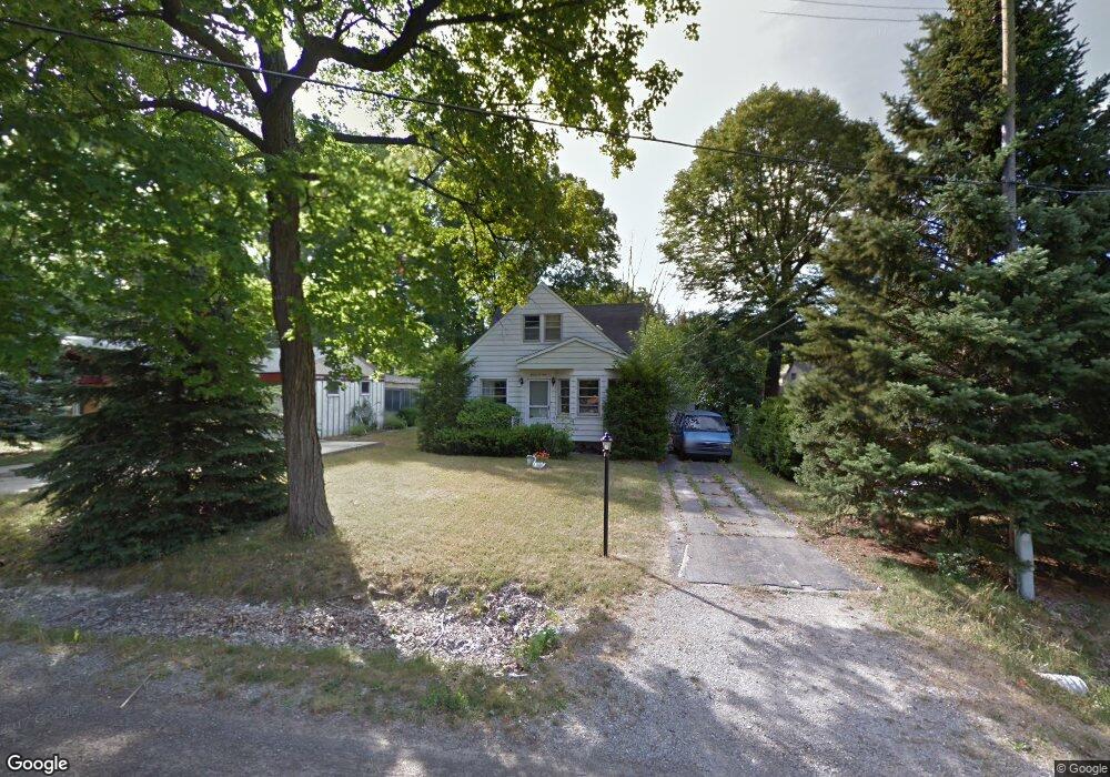
This home is located at 1109 W Decamp St, Flint, MI 48507 and is currently estimated at $121,242, approximately $98 per square foot. 1109 W Decamp St is a home located in Genesee County with nearby schools including Carman-Ainsworth High School and International Academy of Flint (K-12).
Ownership History
Date
Name
Owned For
Owner Type
Purchase Details
Closed on
Aug 21, 2017
Sold by
Riggs Jennifer
Bought by
Gardner Charles
Current Estimated Value
Purchase Details
Closed on
Jan 11, 2012
Sold by
The Genesee County Land Bank Authority
Bought by
Gardner Charles
Purchase Details
Closed on
Dec 21, 2011
Sold by
Genesee County Treasurer
Bought by
Genesee County Land Bank
Purchase Details
Closed on
Aug 11, 2004
Sold by
Martin Jerome B
Bought by
Gardner Joan Martin and Stewart Joan Martin
Purchase Details
Closed on
Jul 22, 2004
Sold by
Martin Dwayne P
Bought by
Gardner Joan Martin and Stewart Joan Martin
Create a Home Valuation Report for This Property
The Home Valuation Report is an in-depth analysis detailing your home's value as well as a comparison with similar homes in the area
Home Values in the Area
Average Home Value in this Area
Purchase History
| Date | Buyer | Sale Price | Title Company |
|---|---|---|---|
| Gardner Charles | -- | None Available | |
| Gardner Charles | $10,000 | None Available | |
| Genesee County Land Bank | -- | None Available | |
| Gardner Joan Martin | -- | -- | |
| Gardner Joan Martin | -- | -- |
Source: Public Records
Mortgage History
| Date | Status | Borrower | Loan Amount |
|---|---|---|---|
| Closed | Gardner Charles | $0 |
Source: Public Records
Tax History Compared to Growth
Tax History
| Year | Tax Paid | Tax Assessment Tax Assessment Total Assessment is a certain percentage of the fair market value that is determined by local assessors to be the total taxable value of land and additions on the property. | Land | Improvement |
|---|---|---|---|---|
| 2025 | $1,639 | $43,100 | $0 | $0 |
| 2024 | $937 | $42,400 | $0 | $0 |
| 2023 | $883 | $39,700 | $0 | $0 |
| 2022 | $521 | $32,800 | $0 | $0 |
| 2021 | $511 | $28,100 | $0 | $0 |
| 2020 | $1,090 | $24,100 | $0 | $0 |
| 2019 | $753 | $21,200 | $0 | $0 |
| 2018 | $1,652 | $20,300 | $0 | $0 |
| 2017 | $1,726 | $20,300 | $0 | $0 |
| 2016 | $1,613 | $18,000 | $0 | $0 |
| 2015 | $1,018 | $18,100 | $0 | $0 |
| 2014 | $728 | $17,400 | $0 | $0 |
| 2012 | -- | $0 | $0 | $0 |
Source: Public Records
Map
Nearby Homes
- 3322 Fenton Rd
- 1039 Markham St
- 1247 Catalina Dr
- 1122 Markham St
- 1210 Pinehurst Ave
- 1314 Pinehurst Ave
- 1031 Ingleside Ave
- 1318 Ingleside Ave
- 4518 Huckleberry Ln
- 1234 Huron St
- 1310 Huron St
- 1015 Alvord Ave
- 4418 Brunswick Ave
- 1826 Greenbrook Ln
- 1151 Wells St
- Lot 57 Walnut Creek Dr
- 1169 Carman St
- 1418 Blueberry Ln
- 1809 Crestbrook Ln
- 1212 Crawford St
- 3383 W Mandeville St
- 3389 W Mandeville St
- 3364 Phillip Ave
- 1112 W Decamp St
- 3352 Phillip Ave
- 3395 W Mandeville St
- 1098 W Decamp St
- 12432 Jacoby Rd Campbell St
- 3368 Phillip Ave
- 1088 W Decamp St
- 3405 W Mandeville St
- 3405 Manderville St
- 1125 Ronald St
- 3384 Phillip Ave
- 1121 Ronald St
- 3353 Phillip Ave
- 3352 Tuxedo Ave
- 3328 Phillip Ave
- 3365 Phillip Ave
- 1076 W Decamp St