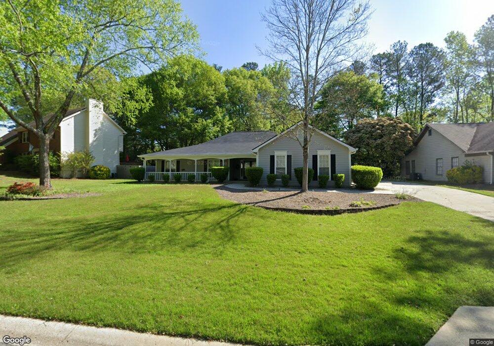
1109 Wynford Commons SW Unit 1 Marietta, GA 30064
West Cobb NeighborhoodEstimated Value: $409,095 - $433,000
3
Beds
3
Baths
1,952
Sq Ft
$215/Sq Ft
Est. Value
About This Home
This home is located at 1109 Wynford Commons SW Unit 1, Marietta, GA 30064 and is currently estimated at $419,274, approximately $214 per square foot. 1109 Wynford Commons SW Unit 1 is a home located in Cobb County with nearby schools including Dowell Elementary School, Lovinggood Middle School, and Hillgrove High School.
Ownership History
Date
Name
Owned For
Owner Type
Purchase Details
Closed on
Aug 1, 2002
Sold by
Nakas Edward V
Bought by
Gragg James D and Gragg Gayle F
Current Estimated Value
Home Financials for this Owner
Home Financials are based on the most recent Mortgage that was taken out on this home.
Original Mortgage
$27,585
Interest Rate
6.53%
Mortgage Type
New Conventional
Purchase Details
Closed on
Dec 5, 1994
Sold by
Rogers James E
Bought by
Nakas Edward V
Home Financials for this Owner
Home Financials are based on the most recent Mortgage that was taken out on this home.
Original Mortgage
$115,154
Interest Rate
8%
Mortgage Type
VA
Create a Home Valuation Report for This Property
The Home Valuation Report is an in-depth analysis detailing your home's value as well as a comparison with similar homes in the area
Home Values in the Area
Average Home Value in this Area
Purchase History
| Date | Buyer | Sale Price | Title Company |
|---|---|---|---|
| Gragg James D | $183,900 | -- | |
| Nakas Edward V | $111,800 | -- |
Source: Public Records
Mortgage History
| Date | Status | Borrower | Loan Amount |
|---|---|---|---|
| Closed | Gragg James D | $27,585 | |
| Previous Owner | Nakas Edward V | $115,154 |
Source: Public Records
Tax History Compared to Growth
Tax History
| Year | Tax Paid | Tax Assessment Tax Assessment Total Assessment is a certain percentage of the fair market value that is determined by local assessors to be the total taxable value of land and additions on the property. | Land | Improvement |
|---|---|---|---|---|
| 2025 | $927 | $162,156 | $34,000 | $128,156 |
| 2024 | $930 | $162,156 | $34,000 | $128,156 |
| 2023 | $676 | $146,132 | $34,000 | $112,132 |
| 2022 | $772 | $109,064 | $26,000 | $83,064 |
| 2021 | $749 | $101,356 | $21,600 | $79,756 |
| 2020 | $734 | $96,408 | $21,600 | $74,808 |
| 2019 | $734 | $96,408 | $21,600 | $74,808 |
| 2018 | $734 | $96,408 | $21,600 | $74,808 |
| 2017 | $603 | $80,080 | $21,600 | $58,480 |
| 2016 | $606 | $80,080 | $21,600 | $58,480 |
| 2015 | $566 | $60,360 | $21,660 | $38,700 |
| 2014 | $579 | $60,360 | $0 | $0 |
Source: Public Records
Map
Nearby Homes
- 1237 Wynford Woods SW
- 1331 Wynford Chase SW Unit 1
- 3033 Addie Pond Way SW
- 1209 Wilkes Way SW Unit 1
- 3072 Addie Pond Way SW
- 1518 Sage Ridge Dr
- 1274 Wynford Colony SW
- 2563 Irwin Lake Overlook Rd SW
- 3003 Lawson Dr
- 2722 Sandy Irwin Ct SW
- 2613 Lakefield Ct
- 1555 Vine Leaf Dr
- 1239 Bonshaw Trail Unit 3
- 1204 Commonwealth Ave SW
- 2403 Bonshaw Ln
- 3028 Hallman Cir SW
- 1227 Bonshaw Trail
- 1765 Dew Place
- 946 Steadman Terrace SW
- 1214 Bonshaw Trail
- 1107 Wynford Commons SW
- 1111 Wynford Commons SW Unit 1
- 1111 Wynford Commons SW
- 1105 Wynford Commons SW
- 1105 Wynford Commons SW
- 1106 Wynford Commons SW
- 1108 Wynford Commons SW
- 1108 Wynford Commons SW Unit 1
- 1110 Wynford Commons SW
- 1106 Wynford Commons SW
- 1301 W Sandtown Rd SW
- 0 Wynford Commons SW Unit 8825896
- 1291 W Sandtown Rd SW
- 1113 Wynford Commons SW
- 1104 Wynford Commons SW Unit 1
- 1112 Wynford Common SW
- 1112 Wynford Commons SW
- 1112 Wynford Commons SW
- 1311 W Sandtown Rd SW Unit 1311
- 1311 W Sandtown Rd SW