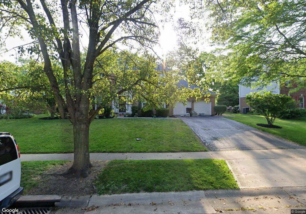
11099 Allenhurst Blvd E Cincinnati, OH 45241
Estimated Value: $454,761 - $725,000
4
Beds
4
Baths
3,106
Sq Ft
$172/Sq Ft
Est. Value
About This Home
This home is located at 11099 Allenhurst Blvd E, Cincinnati, OH 45241 and is currently estimated at $534,940, approximately $172 per square foot. 11099 Allenhurst Blvd E is a home located in Hamilton County with nearby schools including Sharonville Elementary School, Princeton Community Middle School, and Princeton High School.
Ownership History
Date
Name
Owned For
Owner Type
Purchase Details
Closed on
Mar 14, 2022
Sold by
Danziger Michael
Bought by
Ryan Ho and Warman Ashlee
Current Estimated Value
Home Financials for this Owner
Home Financials are based on the most recent Mortgage that was taken out on this home.
Interest Rate
3.85%
Purchase Details
Closed on
Mar 3, 2022
Sold by
Danziger and Lindsey
Bought by
Ho Ryan and Ho Ashlee Warman
Home Financials for this Owner
Home Financials are based on the most recent Mortgage that was taken out on this home.
Interest Rate
3.85%
Purchase Details
Closed on
Sep 22, 2016
Sold by
Chinta Ravi and Chinta Savithri D
Bought by
Danziger Michael and Danziger Lindsey
Home Financials for this Owner
Home Financials are based on the most recent Mortgage that was taken out on this home.
Original Mortgage
$232,050
Interest Rate
3.45%
Mortgage Type
New Conventional
Create a Home Valuation Report for This Property
The Home Valuation Report is an in-depth analysis detailing your home's value as well as a comparison with similar homes in the area
Home Values in the Area
Average Home Value in this Area
Purchase History
| Date | Buyer | Sale Price | Title Company |
|---|---|---|---|
| Ryan Ho | $325,000 | -- | |
| Ho Ryan | $325,000 | None Listed On Document | |
| Danziger Michael | $273,000 | Prodigy Title |
Source: Public Records
Mortgage History
| Date | Status | Borrower | Loan Amount |
|---|---|---|---|
| Closed | Ryan Ho | -- | |
| Open | Ho Ryan | $260,000 | |
| Previous Owner | Danziger Michael | $232,050 |
Source: Public Records
Tax History
| Year | Tax Paid | Tax Assessment Tax Assessment Total Assessment is a certain percentage of the fair market value that is determined by local assessors to be the total taxable value of land and additions on the property. | Land | Improvement |
|---|---|---|---|---|
| 2025 | $5,409 | $113,750 | $19,075 | $94,675 |
| 2024 | $4,616 | $113,750 | $19,075 | $94,675 |
| 2023 | $4,620 | $113,750 | $19,075 | $94,675 |
| 2022 | $5,263 | $104,153 | $18,886 | $85,267 |
| 2021 | $5,117 | $104,153 | $18,886 | $85,267 |
| 2020 | $5,176 | $104,153 | $18,886 | $85,267 |
| 2019 | $5,163 | $95,550 | $17,325 | $78,225 |
| 2018 | $4,842 | $95,550 | $17,325 | $78,225 |
| 2017 | $4,534 | $95,550 | $17,325 | $78,225 |
| 2016 | $4,186 | $87,480 | $16,853 | $70,627 |
| 2015 | $4,227 | $87,480 | $16,853 | $70,627 |
| 2014 | $4,241 | $87,480 | $16,853 | $70,627 |
| 2013 | $3,872 | $81,757 | $15,750 | $66,007 |
Source: Public Records
Map
Nearby Homes
- 4036 Haverstraw Dr
- 4170 Cornell Rd
- 4051 Falling Creek Ct
- 11108 Huntwicke Place
- 4365 Classic Dr
- 4071 E Kemper Rd
- 10514 Thornview Dr
- 4254 Fox Hollow Dr
- 3319 Mcgrew St
- 5024 Lord Alfred Ct
- 3590 Glendale Milford Rd
- 5930 Carpol St
- 3875 Hauck Rd
- 4195 Crystal View Ct
- 10301 Giverny Blvd
- 10561 Plainfield Rd
- 37 Carpenters Run
- 5164 Londonderry Dr
- 4204 Magnolia Aly
- 4270 Parkview Dr
- 11099 Allenhurst Blvd W
- 11093 Allenhurst Blvd W
- 11105 Allenhurst Blvd W
- 11128 Mulligan St
- 11138 Mulligan St
- 11087 Allenhurst Blvd W
- 11122 Mulligan St
- 11111 Allenhurst Blvd W
- 11098 Allenhurst Blvd W
- 11092 Allenhurst Blvd W
- 11144 Mulligan St
- 11116 Mulligan St
- 11104 Allenhurst Blvd W
- 11086 Allenhurst Blvd W
- 11081 Allenhurst Blvd W
- 11152 Mulligan St
- 11117 Allenhurst Blvd W
- 11135 Mulligan St
- 11108 Mulligan St
- 4078 Malaer Dr
Your Personal Tour Guide
Ask me questions while you tour the home.