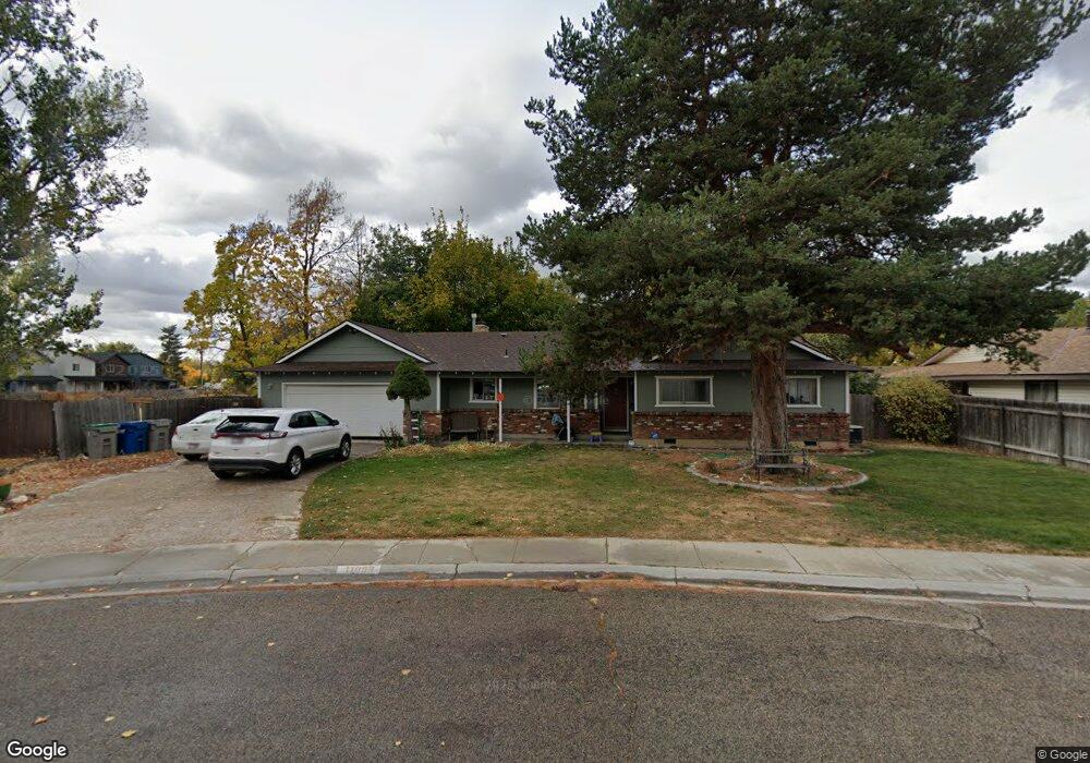
11099 Wampum Dr Boise, ID 83713
West Boise NeighborhoodEstimated Value: $438,000 - $446,554
4
Beds
2
Baths
1,754
Sq Ft
$251/Sq Ft
Est. Value
About This Home
This home is located at 11099 Wampum Dr, Boise, ID 83713 and is currently estimated at $440,889, approximately $251 per square foot. 11099 Wampum Dr is a home located in Ada County with nearby schools including Frontier Elementary School, Lowell Scott Middle School, and Centennial High School.
Ownership History
Date
Name
Owned For
Owner Type
Purchase Details
Closed on
Aug 6, 2009
Sold by
Doster Alexander L
Bought by
Kalange Patrick and Childers Mindy
Current Estimated Value
Home Financials for this Owner
Home Financials are based on the most recent Mortgage that was taken out on this home.
Original Mortgage
$152,192
Outstanding Balance
$100,439
Interest Rate
5.37%
Mortgage Type
FHA
Estimated Equity
$341,609
Purchase Details
Closed on
Nov 1, 1999
Sold by
Frank Steiner M and Frank Terrie A
Bought by
Amore Dominick and Amore Lisa
Home Financials for this Owner
Home Financials are based on the most recent Mortgage that was taken out on this home.
Original Mortgage
$81,350
Interest Rate
11.12%
Mortgage Type
Purchase Money Mortgage
Create a Home Valuation Report for This Property
The Home Valuation Report is an in-depth analysis detailing your home's value as well as a comparison with similar homes in the area
Home Values in the Area
Average Home Value in this Area
Purchase History
| Date | Buyer | Sale Price | Title Company |
|---|---|---|---|
| Kalange Patrick | -- | Stewart Title Emerald O | |
| Amore Dominick | -- | Transnation Title & Escrow I |
Source: Public Records
Mortgage History
| Date | Status | Borrower | Loan Amount |
|---|---|---|---|
| Open | Kalange Patrick | $152,192 | |
| Previous Owner | Amore Dominick | $81,350 | |
| Closed | Amore Dominick | $21,700 |
Source: Public Records
Tax History Compared to Growth
Tax History
| Year | Tax Paid | Tax Assessment Tax Assessment Total Assessment is a certain percentage of the fair market value that is determined by local assessors to be the total taxable value of land and additions on the property. | Land | Improvement |
|---|---|---|---|---|
| 2025 | $1,590 | $388,900 | -- | -- |
| 2024 | $1,673 | $365,500 | -- | -- |
| 2023 | $1,673 | $365,300 | $0 | $0 |
| 2022 | $2,008 | $422,500 | $0 | $0 |
| 2021 | $1,740 | $323,500 | $0 | $0 |
| 2020 | $1,469 | $247,400 | $0 | $0 |
| 2019 | $1,596 | $224,600 | $0 | $0 |
| 2018 | $1,373 | $193,300 | $0 | $0 |
| 2017 | $1,308 | $173,200 | $0 | $0 |
| 2016 | $1,253 | $162,000 | $0 | $0 |
| 2015 | $1,152 | $151,100 | $0 | $0 |
| 2012 | -- | $102,500 | $0 | $0 |
Source: Public Records
Map
Nearby Homes
- 11143 W Ramrod Dr
- 3552 N Covered Wagon Way
- 11000 W Ramrod Dr
- 11175 W Hinsdale St
- 3845 N Shamrock Ave
- 11288 W Race Ct
- 10742 W Ardyce Ln Unit 11
- 10974 W Edna St
- 3958 N Bryson Way
- 11900 W Ramrod Dr
- 10778 W Ripley St
- 3289 N Dove Place
- 11303 W Tahiti St
- 2573 & 2575 N Dusty Ln
- 10319 W Ardyce St
- 11934 W Ardyce St
- 2281 N Shaelyn Ln
- 2299 N Shaelyn Ln
- 2293 N Shaelyn Ln
- 11336 W Poppy St
- 11110 W
- 11103 Wampum Dr
- 11167 W Gunsmoke Place
- 11167 Gunsmoke Place
- 11163 Gunsmoke Place
- 11071 Wampum Dr
- 11050 Wampum Dr
- 11115 W Gunsmoke St
- 11055 Wampum Dr
- 11110 Wampum Dr
- 11143 W Gunsmoke St
- 11171 Gunsmoke Place
- 11061 W Gunsmoke St
- 11033 Wampum Dr
- 11028 Wampum Dr
- 11175 Gunsmoke Place
- 11179 W Gunsmoke St
- 11118 W Ustick Rd
- 3325 Covered Wagon Way
- 11114 W Ustick Rd