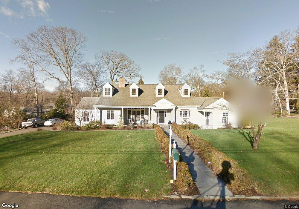
111 Colony Rd Darien, CT 06820
Estimated Value: $1,945,000 - $3,093,000
4
Beds
3
Baths
3,166
Sq Ft
$843/Sq Ft
Est. Value
About This Home
This home is located at 111 Colony Rd, Darien, CT 06820 and is currently estimated at $2,667,465, approximately $842 per square foot. 111 Colony Rd is a home located in Fairfield County with nearby schools including Holmes Elementary School, Middlesex Middle School, and Darien High School.
Ownership History
Date
Name
Owned For
Owner Type
Purchase Details
Closed on
Sep 18, 1998
Sold by
Eisenberg Arthur and Eisenberg Deborah
Bought by
Vegliante Robert A and Vegliante Kelly A
Current Estimated Value
Purchase Details
Closed on
Jun 13, 1991
Sold by
Talbot Constance
Bought by
Eisenberg Arthur and Eisenberg Deborah
Create a Home Valuation Report for This Property
The Home Valuation Report is an in-depth analysis detailing your home's value as well as a comparison with similar homes in the area
Home Values in the Area
Average Home Value in this Area
Purchase History
| Date | Buyer | Sale Price | Title Company |
|---|---|---|---|
| Vegliante Robert A | $700,000 | -- | |
| Eisenberg Arthur | $462,500 | -- |
Source: Public Records
Mortgage History
| Date | Status | Borrower | Loan Amount |
|---|---|---|---|
| Open | Eisenberg Arthur | $545,000 | |
| Closed | Eisenberg Arthur | $530,000 |
Source: Public Records
Tax History
| Year | Tax Paid | Tax Assessment Tax Assessment Total Assessment is a certain percentage of the fair market value that is determined by local assessors to be the total taxable value of land and additions on the property. | Land | Improvement |
|---|---|---|---|---|
| 2025 | $22,188 | $1,433,320 | $934,710 | $498,610 |
| 2024 | $21,055 | $1,433,320 | $934,710 | $498,610 |
| 2023 | $19,000 | $1,078,910 | $623,140 | $455,770 |
| 2022 | $18,590 | $1,078,910 | $623,140 | $455,770 |
| 2021 | $18,169 | $1,078,910 | $623,140 | $455,770 |
| 2020 | $17,651 | $1,078,910 | $623,140 | $455,770 |
| 2019 | $17,770 | $1,078,910 | $623,140 | $455,770 |
| 2018 | $3,299 | $1,157,730 | $683,060 | $474,670 |
| 2017 | $3,086 | $1,157,730 | $683,060 | $474,670 |
| 2016 | $18,257 | $1,157,730 | $683,060 | $474,670 |
| 2015 | $17,771 | $1,157,730 | $683,060 | $474,670 |
| 2014 | $17,378 | $1,157,730 | $683,060 | $474,670 |
Source: Public Records
Map
Nearby Homes
- 166 Hollow Tree Ridge Rd
- 13 Patton Dr
- 76 Deepwood Rd
- 223 Middlesex Rd
- 17 Sunnyside Ave
- 77 Maple St
- 100 Maple Tree Ave Unit 7
- 22 Radio Place Unit 10
- 5 Shields Ln
- 15 Waterbury Ln
- 32 Relihan Rd
- 19 Georgian Ln
- 35 Maple Tree Ave Unit 1
- 3 Salt Box Ln E
- 34 Crescent St Unit 2D
- 151 Courtland Ave Unit 6
- 73 Courtland Ave Unit 163 ( 8)
- 29 Waterbury Ave
- 455 Hope St Unit 4B
- 10 Stony Brook Rd
- 101 Colony Rd
- 110 Colony Rd
- 119 Colony Rd
- 106 Colony Rd
- 114 Colony Rd
- 102 Colony Rd
- 116 Colony Rd
- 207 Hollow Tree Ridge Rd
- 10 Colony Rd
- 209 Hollow Tree Ridge Rd
- 10 Webster Valley Rd
- 126 Colony Rd
- 128 Colony Rd
- 211 Hollow Tree Ridge Rd
- 1 Tyler Dr
- 8 Webster Valley Rd
- 118 Colony Rd
- 132 Colony Rd
- 122 Colony Rd
- 217 Hollow Tree Ridge Rd
Your Personal Tour Guide
Ask me questions while you tour the home.