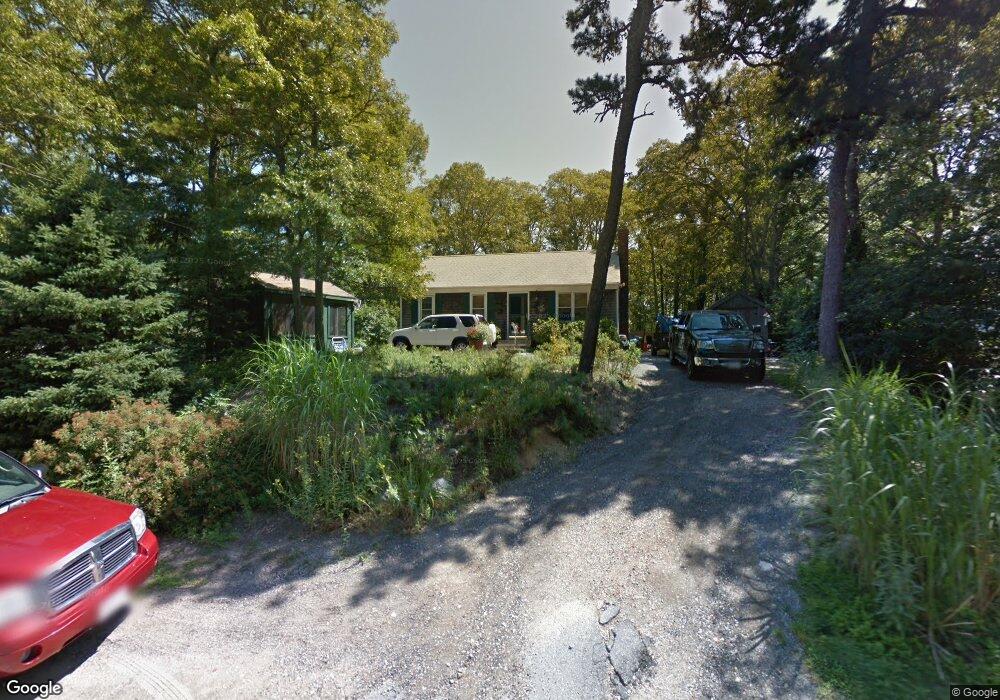
111 Commons Way Brewster, MA 02631
Estimated Value: $570,000 - $858,000
3
Beds
1
Bath
1,100
Sq Ft
$588/Sq Ft
Est. Value
About This Home
This home is located at 111 Commons Way, Brewster, MA 02631 and is currently estimated at $646,970, approximately $588 per square foot. 111 Commons Way is a home located in Barnstable County with nearby schools including Stony Brook Elementary School, Eddy Elementary School, and Nauset Regional Middle School.
Ownership History
Date
Name
Owned For
Owner Type
Purchase Details
Closed on
Oct 13, 2017
Sold by
Stearns Beth and Stearns Dana W
Bought by
Stearns Dana W
Current Estimated Value
Purchase Details
Closed on
Aug 11, 2006
Sold by
Bonanno Suzanne
Bought by
Stearns Beth and Stearns Dana W
Home Financials for this Owner
Home Financials are based on the most recent Mortgage that was taken out on this home.
Original Mortgage
$228,000
Interest Rate
6.8%
Mortgage Type
Purchase Money Mortgage
Purchase Details
Closed on
Mar 13, 2001
Sold by
Squire Linda R
Bought by
Bonanno Suzanne
Home Financials for this Owner
Home Financials are based on the most recent Mortgage that was taken out on this home.
Original Mortgage
$120,400
Interest Rate
7.15%
Mortgage Type
Purchase Money Mortgage
Create a Home Valuation Report for This Property
The Home Valuation Report is an in-depth analysis detailing your home's value as well as a comparison with similar homes in the area
Home Values in the Area
Average Home Value in this Area
Purchase History
| Date | Buyer | Sale Price | Title Company |
|---|---|---|---|
| Stearns Dana W | -- | -- | |
| Stearns Beth | $285,000 | -- | |
| Bonanno Suzanne | $165,000 | -- |
Source: Public Records
Mortgage History
| Date | Status | Borrower | Loan Amount |
|---|---|---|---|
| Previous Owner | Stearns Beth | $228,000 | |
| Previous Owner | Stearns Beth | $57,000 | |
| Previous Owner | Bonanno Suzanne | $160,000 | |
| Previous Owner | Bonanno Suzanne | $120,400 |
Source: Public Records
Tax History Compared to Growth
Tax History
| Year | Tax Paid | Tax Assessment Tax Assessment Total Assessment is a certain percentage of the fair market value that is determined by local assessors to be the total taxable value of land and additions on the property. | Land | Improvement |
|---|---|---|---|---|
| 2025 | $2,983 | $433,600 | $177,500 | $256,100 |
| 2024 | $2,809 | $412,500 | $167,400 | $245,100 |
| 2023 | $2,581 | $369,200 | $149,500 | $219,700 |
| 2022 | $2,687 | $342,300 | $155,600 | $186,700 |
| 2021 | $2,537 | $295,700 | $135,300 | $160,400 |
| 2020 | $2,502 | $290,300 | $135,300 | $155,000 |
| 2019 | $2,398 | $279,500 | $130,100 | $149,400 |
| 2018 | $2,276 | $275,500 | $130,100 | $145,400 |
| 2017 | $2,154 | $256,700 | $130,100 | $126,600 |
| 2016 | $2,137 | $253,500 | $127,600 | $125,900 |
| 2015 | $2,048 | $247,900 | $125,100 | $122,800 |
Source: Public Records
Map
Nearby Homes
- 16 Commons Way
- 0 Commons Way Unit 22504099
- 765 Millstone Rd
- 274 Commons Way
- 96 Eaton Ln Unit 96
- 78 Eaton Ln Unit 78
- 78 Eaton Ln
- 52 Eaton Ln Unit (52)
- 82 Fletcher Ln Unit I
- 100 Fletcher Ln Unit E
- 737 Thousand Oaks Dr
- 60 Fletcher Ln Unit H
- 60 Fletcher Ln Unit C
- 63 Trevor Ln Unit 63
- 958 Long Pond Rd
- 277 Lund Farm Way
- 26 Pinewood Dr
- 398 Lund Farm Way
- 82 Middlecott Ln
- 33 Captain William Arthur Rd
- 101 Commons Way
- 121 Commons Way
- 135 Commons Way
- 91 Commons Way
- 135 Commons Way
- 116 Commons Way
- 106 Commons Way
- 126 Commons Way
- 96 Commons Way
- 195 Magnet Way
- 81 Commons Way
- 141 Commons Way
- 136 Commons Way
- 84 Commons Way
- 422 Thousand Oaks Dr
- 219 Magnet Way
- 148 Commons Way
- 153 Commons Way
- 74 Commons Way
- 71 Commons Way