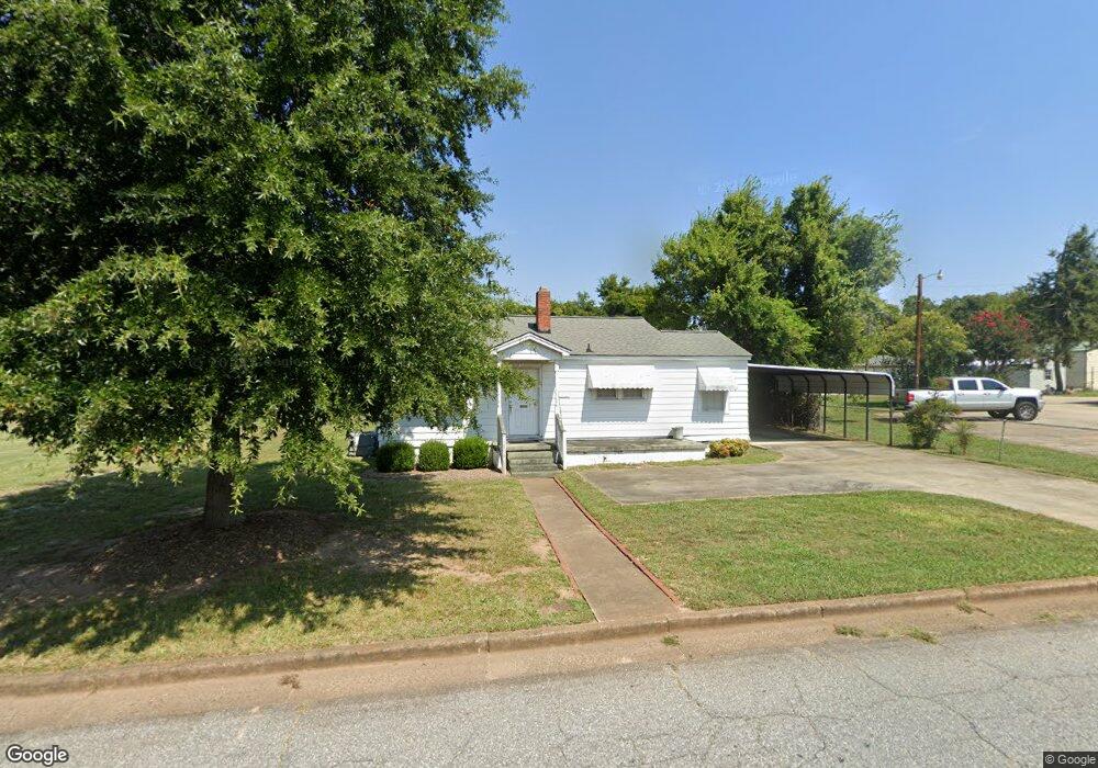
111 E Mauldin St Anderson, SC 29621
Estimated Value: $199,000 - $256,000
2
Beds
--
Bath
1,361
Sq Ft
$163/Sq Ft
Est. Value
About This Home
This home is located at 111 E Mauldin St, Anderson, SC 29621 and is currently estimated at $221,320, approximately $162 per square foot. 111 E Mauldin St is a home with nearby schools including Concord Elementary School, McCants Middle School, and T.L. Hanna High School.
Ownership History
Date
Name
Owned For
Owner Type
Purchase Details
Closed on
Dec 30, 2013
Sold by
111 East Mauldin Llc
Bought by
Anderson Federal Credit Union
Current Estimated Value
Purchase Details
Closed on
Jun 6, 2008
Sold by
Chamblee Jane A
Bought by
111 East Mauldin Llc
Purchase Details
Closed on
Nov 19, 2004
Sold by
Chamblee Jane A
Bought by
Chamblee Jane A
Purchase Details
Closed on
Jul 10, 2002
Sold by
Baker Billy J
Bought by
Chamblee Jane A
Purchase Details
Closed on
Jun 14, 2002
Sold by
Manning Timothy A
Bought by
Leimenstoll Tonya D
Create a Home Valuation Report for This Property
The Home Valuation Report is an in-depth analysis detailing your home's value as well as a comparison with similar homes in the area
Home Values in the Area
Average Home Value in this Area
Purchase History
| Date | Buyer | Sale Price | Title Company |
|---|---|---|---|
| Anderson Federal Credit Union | $117,500 | -- | |
| 111 East Mauldin Llc | $125,000 | -- | |
| Chamblee Jane A | -- | -- | |
| Chamblee Jane A | $48,000 | -- | |
| Leimenstoll Tonya D | -- | -- |
Source: Public Records
Mortgage History
| Date | Status | Borrower | Loan Amount |
|---|---|---|---|
| Closed | 111 East Mauldin Llc | $0 |
Source: Public Records
Tax History Compared to Growth
Tax History
| Year | Tax Paid | Tax Assessment Tax Assessment Total Assessment is a certain percentage of the fair market value that is determined by local assessors to be the total taxable value of land and additions on the property. | Land | Improvement |
|---|---|---|---|---|
| 2024 | $3,650 | $8,990 | $3,110 | $5,880 |
| 2023 | $3,650 | $8,990 | $3,110 | $5,880 |
| 2022 | $3,561 | $8,990 | $3,110 | $5,880 |
| 2021 | $3,259 | $7,380 | $2,630 | $4,750 |
| 2020 | $3,227 | $7,380 | $2,630 | $4,750 |
| 2019 | $3,194 | $7,380 | $2,630 | $4,750 |
| 2018 | $3,194 | $7,380 | $2,630 | $4,750 |
| 2017 | -- | $7,380 | $2,630 | $4,750 |
| 2016 | $3,137 | $7,320 | $2,630 | $4,690 |
| 2015 | $3,158 | $7,320 | $2,630 | $4,690 |
| 2014 | $3,120 | $7,320 | $2,630 | $4,690 |
Source: Public Records
Map
Nearby Homes
- 220 Moultrie Square
- 406 Moultrie Square
- 401 Berkshire Hill
- 2010 Boulevard Heights
- 0 High Shoals Rd
- 705 E Mauldin St
- 110 Clinton Dr
- 108 Clinton Dr
- 116 Henry Ave
- 2014 College Ave
- 211 Cater St
- 122 Laurel Oak Dr
- 104 Laurel Oak Dr
- 167 Laurel Oak Dr
- 2506 Poplar Ln
- 208 Cater St
- 1808 Edgewood Ave
- 104 McGee Ct
- 507 Blair St
- 109 E Mauldin St
- 109 E Mauldin St
- 115 E Mauldin St
- 102 E Mauldin St
- 117 E Mauldin St
- 1813 N Boulevard
- 1634 N Main St
- 1811 N Boulevard
- 1638 N Main St
- 1626 N Main St
- 1632 N Main St Unit B
- 1632 N Main St
- 1702 N Main St
- 1722 N Main St Unit Lot 5
- 1722 N Main St
- 1628 N Main St
- 106 Midtown Square
- 108 Midtown Square
- 1705 N Main St
- 1707 N Main St