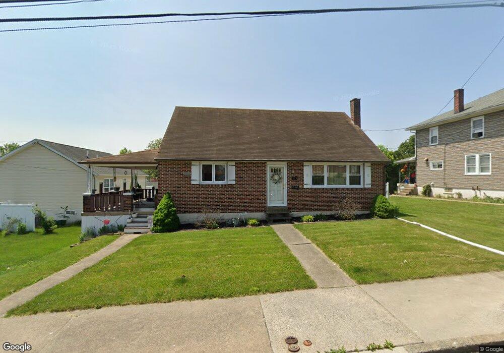
111 Elm St Pottstown, PA 19464
Estimated Value: $240,000 - $337,490
3
Beds
2
Baths
1,512
Sq Ft
$192/Sq Ft
Est. Value
About This Home
This home is located at 111 Elm St, Pottstown, PA 19464 and is currently estimated at $290,123, approximately $191 per square foot. 111 Elm St is a home located in Montgomery County with nearby schools including Lower Pottsgrove Elementary School, Pottsgrove Middle School, and Pottsgrove Senior High School.
Ownership History
Date
Name
Owned For
Owner Type
Purchase Details
Closed on
Jan 2, 2008
Sold by
Conroy Berdina Ann and Oister Mary Louise
Bought by
Vanhorn Daniel and Vanhorn Danielle L
Current Estimated Value
Home Financials for this Owner
Home Financials are based on the most recent Mortgage that was taken out on this home.
Original Mortgage
$49,000
Outstanding Balance
$30,946
Interest Rate
6.17%
Estimated Equity
$259,177
Create a Home Valuation Report for This Property
The Home Valuation Report is an in-depth analysis detailing your home's value as well as a comparison with similar homes in the area
Home Values in the Area
Average Home Value in this Area
Purchase History
| Date | Buyer | Sale Price | Title Company |
|---|---|---|---|
| Vanhorn Daniel | $135,000 | None Available | |
| Conroy Berdina Ann | -- | None Available |
Source: Public Records
Mortgage History
| Date | Status | Borrower | Loan Amount |
|---|---|---|---|
| Open | Conroy Berdina Ann | $49,000 | |
| Closed | Vanhorn Daniel | $49,000 |
Source: Public Records
Tax History
| Year | Tax Paid | Tax Assessment Tax Assessment Total Assessment is a certain percentage of the fair market value that is determined by local assessors to be the total taxable value of land and additions on the property. | Land | Improvement |
|---|---|---|---|---|
| 2025 | $5,399 | $112,400 | $35,060 | $77,340 |
| 2024 | $5,399 | $112,400 | $35,060 | $77,340 |
| 2023 | $5,228 | $112,400 | $35,060 | $77,340 |
| 2022 | $5,147 | $112,400 | $35,060 | $77,340 |
| 2021 | $5,072 | $112,400 | $35,060 | $77,340 |
| 2020 | $4,996 | $112,400 | $35,060 | $77,340 |
| 2019 | $4,969 | $112,400 | $35,060 | $77,340 |
Source: Public Records
Map
Nearby Homes
- 801 Glasgow St
- 511 E Vine St Unit 73
- 225 Potts Dr
- 203 Lemon St
- 601 W High St
- 14 Kristen Cir
- 703 Holly Dr
- 313 W Walnut St
- 227 W King St
- 536 & 538 W Vine St
- 443 Manatawny St
- 81 W 4th St
- 75 W 4th St
- 105 W Harmony Dr Unit 18
- 112 W Harmony Dr
- 510 Upland St
- 50 Middlemarch Rd
- 66 Random Rd
- 462 Clearview St
- 77 Random Rd
Your Personal Tour Guide
Ask me questions while you tour the home.