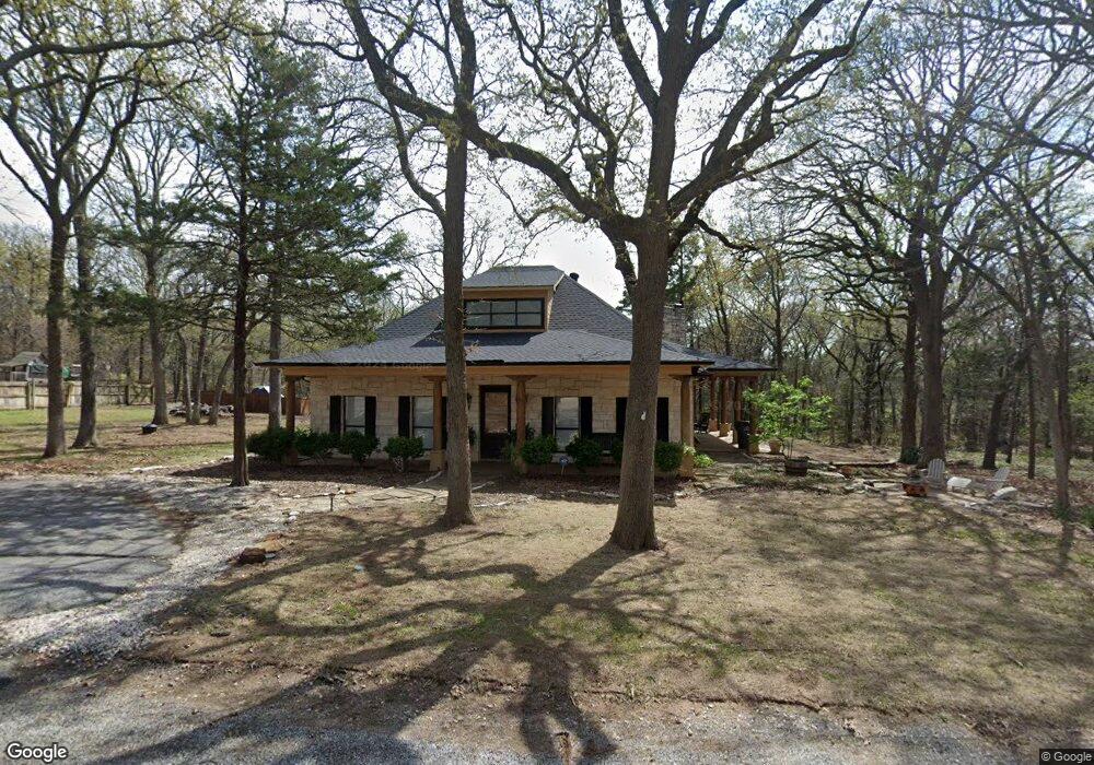
111 Hilltop Ln Pottsboro, TX 75076
Estimated Value: $582,000 - $684,000
3
Beds
3
Baths
2,350
Sq Ft
$263/Sq Ft
Est. Value
About This Home
This home is located at 111 Hilltop Ln, Pottsboro, TX 75076 and is currently estimated at $617,968, approximately $262 per square foot. 111 Hilltop Ln is a home located in Grayson County with nearby schools including Pottsboro Elementary School, Pottsboro Middle School, and Pottsboro High School.
Ownership History
Date
Name
Owned For
Owner Type
Purchase Details
Closed on
Nov 16, 2020
Sold by
Avery Ashli Burbridge and Casper Lynn
Bought by
Kunde Jeffrey Mark and Kunde Judith Anne
Current Estimated Value
Home Financials for this Owner
Home Financials are based on the most recent Mortgage that was taken out on this home.
Original Mortgage
$252,000
Outstanding Balance
$224,244
Interest Rate
2.8%
Mortgage Type
New Conventional
Estimated Equity
$393,724
Purchase Details
Closed on
Oct 13, 2015
Sold by
Covington William C and Covington Sarah T
Bought by
Avery Ashli Burbridge and Casper Lynn
Purchase Details
Closed on
Feb 15, 2005
Sold by
Roberts Cynthia Lynn and Boyd Cynthia Lynn Roberts
Bought by
Covington William C and Covington Sarah T
Home Financials for this Owner
Home Financials are based on the most recent Mortgage that was taken out on this home.
Original Mortgage
$233,700
Interest Rate
5.77%
Mortgage Type
Purchase Money Mortgage
Create a Home Valuation Report for This Property
The Home Valuation Report is an in-depth analysis detailing your home's value as well as a comparison with similar homes in the area
Home Values in the Area
Average Home Value in this Area
Purchase History
| Date | Buyer | Sale Price | Title Company |
|---|---|---|---|
| Kunde Jeffrey Mark | -- | Grayson County Title | |
| Avery Ashli Burbridge | -- | Grayson County Title | |
| Covington William C | -- | -- |
Source: Public Records
Mortgage History
| Date | Status | Borrower | Loan Amount |
|---|---|---|---|
| Open | Kunde Jeffrey Mark | $252,000 | |
| Previous Owner | Covington William C | $233,700 |
Source: Public Records
Tax History Compared to Growth
Tax History
| Year | Tax Paid | Tax Assessment Tax Assessment Total Assessment is a certain percentage of the fair market value that is determined by local assessors to be the total taxable value of land and additions on the property. | Land | Improvement |
|---|---|---|---|---|
| 2025 | $8,666 | $629,123 | $164,833 | $464,290 |
| 2024 | $8,666 | $625,452 | $161,157 | $464,295 |
| 2023 | $9,127 | $657,690 | $189,277 | $468,413 |
| 2022 | $7,700 | $489,217 | $129,847 | $359,370 |
| 2021 | $6,595 | $405,546 | $106,595 | $298,951 |
| 2020 | $6,739 | $399,191 | $113,897 | $285,294 |
| 2019 | $7,112 | $402,025 | $113,897 | $288,128 |
| 2018 | $5,650 | $315,394 | $113,897 | $201,497 |
| 2017 | $6,325 | $348,457 | $138,165 | $210,292 |
| 2016 | $5,854 | $322,515 | $109,502 | $213,013 |
| 2015 | $4,563 | $247,015 | $109,502 | $137,513 |
| 2014 | $4,514 | $242,355 | $109,502 | $132,853 |
Source: Public Records
Map
Nearby Homes
- 105 Eagleview Cir
- 110 Eagleview Cir
- 120 Eagleview Cir
- 210 Walnut Ln
- 219 Ray Rd
- 33 Queens Dr
- 11 Mayfield Ln
- 83 Mayfield Ln
- 344 Castle Dr
- 137 Anderson Ln
- 491 Black Forest Dr
- 545 Black Forest Dr
- 226 Cambridge Dr
- 16 Wales Dr
- 142 Wales Dr
- 34 Cambridge Dr
- 191 Black Forest Dr
- 81 Windsor Dr
- 207 Wales Dr
- 258 Lou-Sand Hill Rd
- 113 Hilltop Ln
- 107 Russwood Dr
- 113 Russwood Dr
- 110 Hilltop Ln
- 112 Hilltop Ln
- 108 Hilltop Ln
- 105 Russwood Dr
- 105 Hilltop Ln
- 115 Hilltop Ln
- 106 Hilltop Ln
- 201 Island View Dr
- 129 Eagleview Cir
- 116 Hilltop Ln
- 131 Eagleview Cir
- 203 Island View Dr
- 104 Eagleview Cir
- 127 Eagleview Cir
- 126 Eagleview Cir
- 747 Russwood Dr
- 118 Hilltop Ln