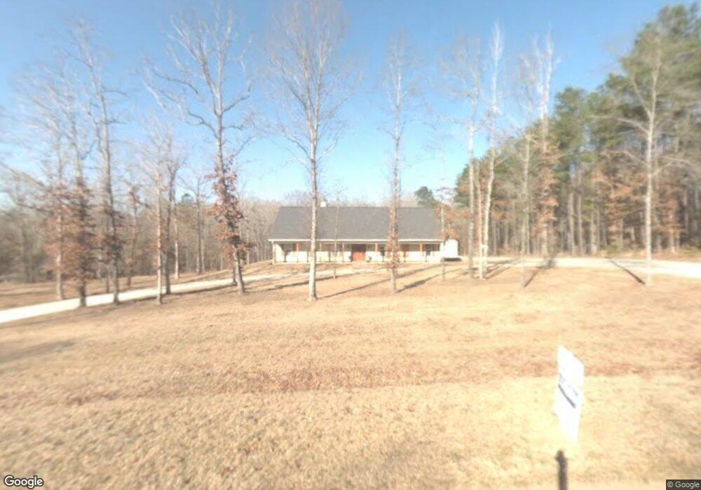
111 Katie Ln Ruston, LA 71270
Estimated Value: $484,000 - $509,949
--
Bed
1
Bath
3,235
Sq Ft
$154/Sq Ft
Est. Value
About This Home
This home is located at 111 Katie Ln, Ruston, LA 71270 and is currently estimated at $497,237, approximately $153 per square foot. 111 Katie Ln is a home located in Lincoln Parish with nearby schools including Glen View Elementary School, Cypress Springs Elementary School, and Ruston Junior High School.
Ownership History
Date
Name
Owned For
Owner Type
Purchase Details
Closed on
Jan 15, 2009
Sold by
Miller Parker Robert Gordon and Miller Parker Stefanie
Bought by
Mcadams Michael Lane and Mcadams Pamela Dugan
Current Estimated Value
Home Financials for this Owner
Home Financials are based on the most recent Mortgage that was taken out on this home.
Original Mortgage
$245,250
Outstanding Balance
$157,485
Interest Rate
5.48%
Mortgage Type
Purchase Money Mortgage
Estimated Equity
$339,752
Purchase Details
Closed on
May 16, 2007
Sold by
Parker Robert G
Bought by
Adair Asset Management Llc/Us Bank
Create a Home Valuation Report for This Property
The Home Valuation Report is an in-depth analysis detailing your home's value as well as a comparison with similar homes in the area
Home Values in the Area
Average Home Value in this Area
Purchase History
| Date | Buyer | Sale Price | Title Company |
|---|---|---|---|
| Mcadams Michael Lane | $272,500 | None Available | |
| Adair Asset Management Llc/Us Bank | $1,686 | None Available |
Source: Public Records
Mortgage History
| Date | Status | Borrower | Loan Amount |
|---|---|---|---|
| Open | Mcadams Michael Lane | $245,250 |
Source: Public Records
Tax History Compared to Growth
Tax History
| Year | Tax Paid | Tax Assessment Tax Assessment Total Assessment is a certain percentage of the fair market value that is determined by local assessors to be the total taxable value of land and additions on the property. | Land | Improvement |
|---|---|---|---|---|
| 2024 | $3,178 | $38,909 | $7,158 | $31,751 |
| 2023 | $2,705 | $31,919 | $5,453 | $26,466 |
| 2022 | $2,719 | $31,919 | $5,453 | $26,466 |
| 2021 | $2,507 | $31,919 | $5,453 | $26,466 |
| 2020 | $2,500 | $31,658 | $5,453 | $26,205 |
| 2019 | $2,553 | $33,197 | $5,453 | $27,744 |
| 2018 | $2,480 | $33,197 | $5,453 | $27,744 |
| 2017 | $2,486 | $33,197 | $5,453 | $27,744 |
| 2016 | $2,476 | $0 | $0 | $0 |
| 2015 | $2,240 | $27,470 | $4,756 | $22,714 |
| 2013 | $2,206 | $26,586 | $4,756 | $21,830 |
Source: Public Records
Map
Nearby Homes
- 106 Gracie Beth Ln
- 122 Gracie Beth Ln
- 126 Gracie Beth Ln
- 102 Lovemore Dr
- 135 Lovemore Dr
- 000 Highway 167
- 180 Vz Top Farm Rd
- 600 Jefferson Ave
- 1205 Wafer Creek Estate
- 297 Jefferson Oaks Dr
- 1203 Wafer Creek Estate
- 1201 Wafer Creek Estate
- 111 New Prospect Rd
- 521 Audubon Dr
- Kavanaugh Rd
- 000 Tarbutton Rd
- 2111 W Kentucky Ave
- 693 Ball Rd
- 1108 Pea Ridge Rd
- 3001 Belcara Dr