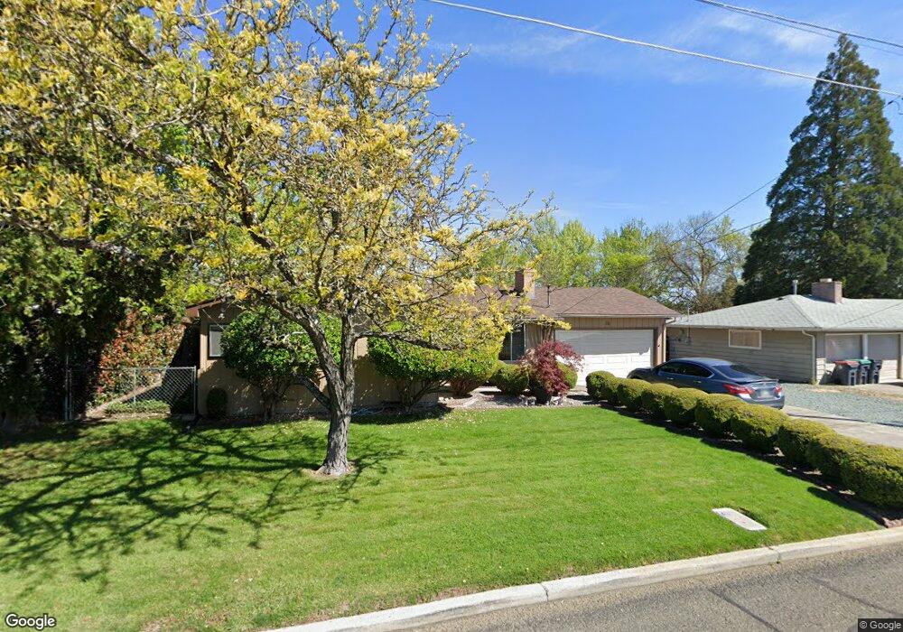
111 Kings Way Central Point, OR 97502
Estimated Value: $309,000 - $361,000
3
Beds
2
Baths
1,190
Sq Ft
$283/Sq Ft
Est. Value
About This Home
This home is located at 111 Kings Way, Central Point, OR 97502 and is currently estimated at $337,079, approximately $283 per square foot. 111 Kings Way is a home located in Jackson County with nearby schools including Jewett Elementary School, Scenic Middle School, and Crater High School.
Ownership History
Date
Name
Owned For
Owner Type
Purchase Details
Closed on
Nov 10, 2025
Sold by
Dorothy C Groth Living Trust and Groth Keri M
Bought by
Groth Keri M
Current Estimated Value
Purchase Details
Closed on
Jun 27, 2025
Sold by
Groth Dorothy C
Bought by
Dorothy C Groth Living Trust and Groth
Purchase Details
Closed on
Jun 10, 2022
Sold by
Groth Dorothy C
Bought by
Groth Dorothy C
Create a Home Valuation Report for This Property
The Home Valuation Report is an in-depth analysis detailing your home's value as well as a comparison with similar homes in the area
Home Values in the Area
Average Home Value in this Area
Purchase History
| Date | Buyer | Sale Price | Title Company |
|---|---|---|---|
| Groth Keri M | -- | None Listed On Document | |
| Dorothy C Groth Living Trust | -- | None Listed On Document | |
| Groth Dorothy C | -- | Ticor Title |
Source: Public Records
Tax History Compared to Growth
Tax History
| Year | Tax Paid | Tax Assessment Tax Assessment Total Assessment is a certain percentage of the fair market value that is determined by local assessors to be the total taxable value of land and additions on the property. | Land | Improvement |
|---|---|---|---|---|
| 2025 | $2,402 | $170,760 | $87,750 | $83,010 |
| 2024 | $2,402 | $165,790 | $85,190 | $80,600 |
| 2023 | $2,325 | $160,970 | $82,720 | $78,250 |
| 2022 | $2,270 | $160,970 | $82,720 | $78,250 |
| 2021 | $2,206 | $156,290 | $80,310 | $75,980 |
| 2020 | $2,141 | $151,740 | $77,980 | $73,760 |
| 2019 | $2,089 | $143,040 | $73,510 | $69,530 |
| 2018 | $2,025 | $138,880 | $71,370 | $67,510 |
| 2017 | $1,974 | $138,880 | $71,370 | $67,510 |
| 2016 | $1,917 | $130,920 | $67,260 | $63,660 |
| 2015 | $1,836 | $130,920 | $67,260 | $63,660 |
| 2014 | $1,790 | $123,410 | $63,400 | $60,010 |
Source: Public Records
Map
Nearby Homes
- 1010 N 3rd St
- 905 Comet Ave
- 55 Crater Ln
- 4626 N Pacific Hwy
- 342 Hazel St
- 920 N 10th St
- 741 Hazel St
- 431 N 5th St
- 833 Hazel St
- 327 Brookhaven Dr
- 356 Marian Ave Unit 40
- 1167 Boulder Ridge St
- 405 N 9th St
- 4035 Rock Way
- 626 Griffin Oaks Dr
- 0 Peninger Rd
- 426 Bridge Creek Dr
- 546 Laurel St
- 144 N 5th St
- 335 Applewood Dr