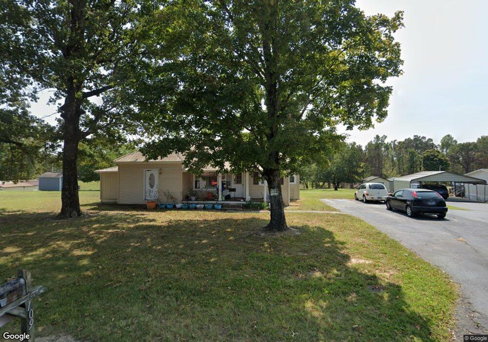
111 Lakeside Dr Unit 109 Rock Island, TN 38581
Estimated Value: $68,000 - $175,000
--
Bed
2
Baths
1,078
Sq Ft
$109/Sq Ft
Est. Value
About This Home
This home is located at 111 Lakeside Dr Unit 109, Rock Island, TN 38581 and is currently estimated at $117,453, approximately $108 per square foot. 111 Lakeside Dr Unit 109 is a home located in Warren County with nearby schools including Eastside Elementary School and Warren County High School.
Ownership History
Date
Name
Owned For
Owner Type
Purchase Details
Closed on
May 8, 2025
Sold by
Gunter Richard and Gunter Vickie
Bought by
Gunter Rachel and Ferrell Matthew
Current Estimated Value
Home Financials for this Owner
Home Financials are based on the most recent Mortgage that was taken out on this home.
Original Mortgage
$62,284
Outstanding Balance
$61,525
Interest Rate
6.65%
Mortgage Type
New Conventional
Estimated Equity
$55,928
Purchase Details
Closed on
May 10, 2024
Sold by
Gunter Richard and Gunter Vickie
Bought by
Harper Gregory and Pack Roxanne
Home Financials for this Owner
Home Financials are based on the most recent Mortgage that was taken out on this home.
Original Mortgage
$41,181
Interest Rate
6.79%
Mortgage Type
New Conventional
Purchase Details
Closed on
Dec 15, 2020
Sold by
Smyth James Robert
Bought by
Gunter Richard and Gunter Vickie
Purchase Details
Closed on
Aug 3, 2016
Sold by
Harness Brenda
Bought by
Smyth James Robert
Purchase Details
Closed on
Feb 24, 2013
Sold by
Hubbard Sara N
Bought by
Smyth James R
Purchase Details
Closed on
Feb 8, 2013
Sold by
Smyth James R
Bought by
Harness Brenda and Harness Johnie F
Purchase Details
Closed on
Apr 13, 2012
Sold by
Smyth James T
Bought by
Hubbard Sara N
Purchase Details
Closed on
Apr 9, 2012
Sold by
Smyth Warren T
Bought by
Smyth James T
Purchase Details
Closed on
Nov 2, 2011
Sold by
Key Lawerance Henry
Bought by
Smyth Warren T
Purchase Details
Closed on
Dec 31, 2008
Sold by
Smyth Warren
Bought by
Key Lawrence Henry
Home Financials for this Owner
Home Financials are based on the most recent Mortgage that was taken out on this home.
Original Mortgage
$70,000
Interest Rate
5.48%
Purchase Details
Closed on
Sep 12, 2007
Sold by
Russell Baum
Bought by
Warren Smyth
Home Financials for this Owner
Home Financials are based on the most recent Mortgage that was taken out on this home.
Original Mortgage
$67,200
Interest Rate
6.57%
Purchase Details
Closed on
Aug 24, 2006
Sold by
Craig Carroll C
Bought by
Russell Baum
Create a Home Valuation Report for This Property
The Home Valuation Report is an in-depth analysis detailing your home's value as well as a comparison with similar homes in the area
Home Values in the Area
Average Home Value in this Area
Purchase History
| Date | Buyer | Sale Price | Title Company |
|---|---|---|---|
| Gunter Rachel | -- | None Listed On Document | |
| Gunter Rachel | -- | None Listed On Document | |
| Harper Gregory | -- | None Listed On Document | |
| Gunter Richard | $25,000 | None Available | |
| Smyth James Robert | $46,800 | -- | |
| Smyth James R | -- | -- | |
| Harness Brenda | -- | -- | |
| Hubbard Sara N | $60,000 | -- | |
| Smyth James T | -- | -- | |
| Smyth Warren T | $39,900 | -- | |
| Key Lawrence Henry | $70,000 | -- | |
| Warren Smyth | $51,900 | -- | |
| Russell Baum | $49,000 | -- |
Source: Public Records
Mortgage History
| Date | Status | Borrower | Loan Amount |
|---|---|---|---|
| Open | Gunter Rachel | $62,284 | |
| Closed | Gunter Rachel | $62,284 | |
| Previous Owner | Harper Gregory | $41,181 | |
| Previous Owner | Russell Baum | $70,000 | |
| Previous Owner | Russell Baum | $67,200 |
Source: Public Records
Tax History Compared to Growth
Tax History
| Year | Tax Paid | Tax Assessment Tax Assessment Total Assessment is a certain percentage of the fair market value that is determined by local assessors to be the total taxable value of land and additions on the property. | Land | Improvement |
|---|---|---|---|---|
| 2025 | $255 | $25,275 | $0 | $0 |
| 2024 | $255 | $12,975 | $2,275 | $10,700 |
| 2023 | $316 | $16,050 | $5,350 | $10,700 |
| 2022 | $316 | $16,050 | $5,350 | $10,700 |
| 2021 | $316 | $16,050 | $5,350 | $10,700 |
| 2020 | $230 | $16,050 | $5,350 | $10,700 |
| 2019 | $263 | $11,700 | $4,975 | $6,725 |
| 2018 | $230 | $11,700 | $4,975 | $6,725 |
| 2017 | $230 | $11,700 | $4,975 | $6,725 |
| 2016 | $368 | $18,720 | $7,960 | $10,760 |
| 2015 | $374 | $18,720 | $7,960 | $10,760 |
| 2014 | -- | $18,720 | $7,960 | $10,760 |
| 2013 | -- | $17,994 | $0 | $0 |
Source: Public Records
Map
Nearby Homes
- 98 Lakeside Dr
- 239 Pine Bluff Rd
- 0 Goodbar Rd Unit RTC2866377
- 0 Goodbar Rd Unit RTC2990114
- 0 Goodbar Rd Unit RTC2866387
- 0 Goodbar Rd Unit RTC2866833
- 0 Goodbar Rd Unit RTC2990108
- 0 Goodbar Rd Unit RTC2990119
- 1.50 AC Rock Island Shores Dr
- 371 Rock Station Rd
- 0 Rock Station Rd
- 3426 Old Rock Island Rd
- 115 Long Point Dr
- 622 Bone Cave Rd
- 0 Bone Cave Rd Unit RTC3048650
- 0 Bone Cave Rd Unit 1518019
- 2 Hidden River Rd
- 676 George Rd
- Lot 8 Hidden River Rd
- 0 Anchor Bend Dr Unit RTC2904354
- 118 Lakeside Dr
- 80 Lakeside Dr
- 131 Lakeside Dr
- 136 Lakeside Dr
- 57 Lakeside Dr
- 64 Lakeside Dr
- 157 Lakeside Dr
- 160 Lakeside Dr
- 175 Pine Bluff Rd
- 178 Lakeside Dr
- 196 Lakeside Dr
- 219 Track Rd
- 119 Pine Bluff Rd
- 101 Pine Bluff Rd
- 218 Lakeside Dr
- 81 Pine Bluff Rd
- 200 Pine Bluff Rd
- 238 Lakeside Dr
- 41 Pine Bluff Rd
- 278 Lakeside Dr