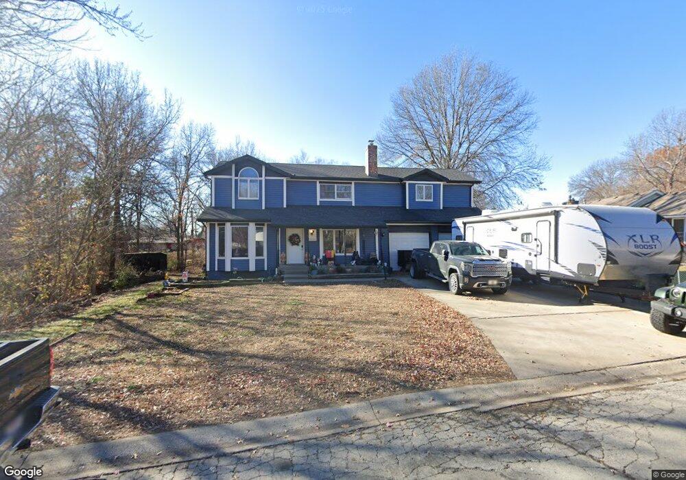
111 Maple Ln Smithville, MO 64089
Estimated Value: $341,000 - $368,000
4
Beds
2
Baths
2,295
Sq Ft
$154/Sq Ft
Est. Value
About This Home
This home is located at 111 Maple Ln, Smithville, MO 64089 and is currently estimated at $352,704, approximately $153 per square foot. 111 Maple Ln is a home located in Clay County with nearby schools including Maple Elementary School, Smithville Middle School, and Smithville High School.
Ownership History
Date
Name
Owned For
Owner Type
Purchase Details
Closed on
Aug 7, 2024
Sold by
Merrilyn W Slack Schinkel Trust and Merrilyn W Slack Revocable Living Trust
Bought by
Merrilyn W Slack Schinkel Trust and Schinkel
Current Estimated Value
Home Financials for this Owner
Home Financials are based on the most recent Mortgage that was taken out on this home.
Original Mortgage
$60,000
Outstanding Balance
$58,424
Interest Rate
6.86%
Mortgage Type
Credit Line Revolving
Estimated Equity
$294,280
Purchase Details
Closed on
May 7, 1998
Sold by
Slack Merrilyn W
Bought by
Liv Slack Merrilyn W and Merrilyn W Slack Revocable Living Trust
Create a Home Valuation Report for This Property
The Home Valuation Report is an in-depth analysis detailing your home's value as well as a comparison with similar homes in the area
Home Values in the Area
Average Home Value in this Area
Purchase History
| Date | Buyer | Sale Price | Title Company |
|---|---|---|---|
| Merrilyn W Slack Schinkel Trust | -- | Continental Title | |
| Liv Slack Merrilyn W | -- | -- |
Source: Public Records
Mortgage History
| Date | Status | Borrower | Loan Amount |
|---|---|---|---|
| Open | Merrilyn W Slack Schinkel Trust | $60,000 |
Source: Public Records
Tax History
| Year | Tax Paid | Tax Assessment Tax Assessment Total Assessment is a certain percentage of the fair market value that is determined by local assessors to be the total taxable value of land and additions on the property. | Land | Improvement |
|---|---|---|---|---|
| 2025 | $3,701 | $56,980 | -- | -- |
| 2024 | $3,701 | $51,260 | -- | -- |
| 2023 | $3,540 | $51,260 | $0 | $0 |
| 2022 | $3,136 | $43,740 | $0 | $0 |
| 2021 | $3,159 | $43,738 | $3,420 | $40,318 |
| 2020 | $2,802 | $38,530 | $0 | $0 |
| 2019 | $2,822 | $38,530 | $0 | $0 |
Source: Public Records
Map
Nearby Homes
- 105 Highland Dr
- 523 Hawthorne St
- 1.77 Acres Highway 169
- 319 E Meadow St
- 106A N Smith St
- 17205 Thomas Lane Rd
- 0 Highway 169
- 423 E Main St
- 000 E Meadow St
- 407 Sixth St
- 300 Winner Ave
- 503 Whitetail Ct
- 508 Whitetail Ct
- 604 Blackhawke Dr
- 700 Blackhawke Dr
- 506 Blackhawke Dr
- 504 Blackhawke Dr
- 502 Blackhawke Dr
- 17409 Sparrowhawke Dr
- 500 Blackhawke Dr
Your Personal Tour Guide
Ask me questions while you tour the home.