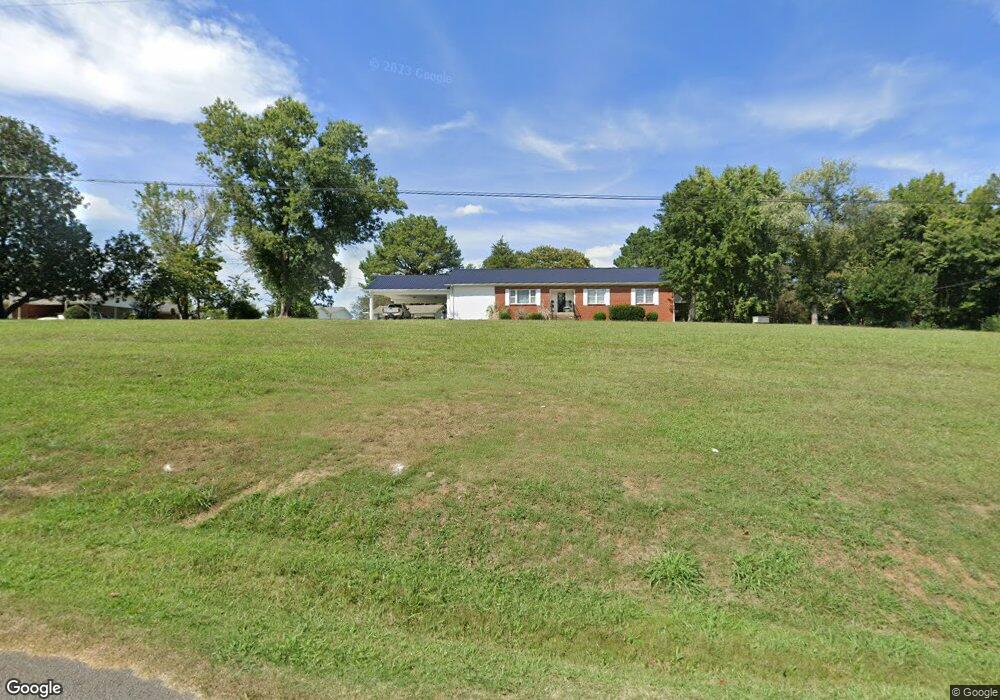
111 Riverside Dr Linden, TN 37096
Estimated Value: $186,000 - $383,000
--
Bed
1
Bath
1,978
Sq Ft
$133/Sq Ft
Est. Value
About This Home
This home is located at 111 Riverside Dr, Linden, TN 37096 and is currently estimated at $263,959, approximately $133 per square foot. 111 Riverside Dr is a home located in Perry County.
Ownership History
Date
Name
Owned For
Owner Type
Purchase Details
Closed on
Mar 13, 2009
Bought by
Lineberry Matthew and Lineberry Tamara
Current Estimated Value
Purchase Details
Closed on
Feb 5, 2009
Bought by
Equicredit Corporation Of America
Purchase Details
Closed on
Feb 11, 1991
Bought by
Brown James and Brown Judy
Purchase Details
Closed on
Jul 26, 1989
Bought by
Hinson Sammy Conger
Purchase Details
Closed on
Jan 14, 1985
Bought by
Hinson Judy Etvir Sammy
Create a Home Valuation Report for This Property
The Home Valuation Report is an in-depth analysis detailing your home's value as well as a comparison with similar homes in the area
Home Values in the Area
Average Home Value in this Area
Purchase History
| Date | Buyer | Sale Price | Title Company |
|---|---|---|---|
| Lineberry Matthew | $69,200 | -- | |
| Equicredit Corporation Of America | $67,200 | -- | |
| Brown James | $50,000 | -- | |
| Hinson Sammy Conger | -- | -- | |
| Hinson Judy Etvir Sammy | -- | -- |
Source: Public Records
Tax History Compared to Growth
Tax History
| Year | Tax Paid | Tax Assessment Tax Assessment Total Assessment is a certain percentage of the fair market value that is determined by local assessors to be the total taxable value of land and additions on the property. | Land | Improvement |
|---|---|---|---|---|
| 2025 | $982 | $35,075 | $0 | $0 |
| 2024 | $982 | $35,075 | $4,500 | $30,575 |
| 2023 | $678 | $35,075 | $4,500 | $30,575 |
| 2022 | $678 | $24,200 | $4,500 | $19,700 |
| 2021 | $678 | $24,200 | $4,500 | $19,700 |
| 2020 | $556 | $24,200 | $4,500 | $19,700 |
| 2019 | $743 | $24,925 | $6,600 | $18,325 |
| 2018 | $743 | $24,925 | $6,600 | $18,325 |
| 2017 | $736 | $24,925 | $6,600 | $18,325 |
| 2016 | $736 | $24,925 | $6,600 | $18,325 |
| 2015 | $724 | $24,925 | $6,600 | $18,325 |
| 2014 | $724 | $24,925 | $6,600 | $18,325 |
| 2013 | $698 | $24,062 | $0 | $0 |
Source: Public Records
Map
Nearby Homes
- 218 Cedar Ave
- 122 Shelton St
- 130 Elm Ln
- 107 Possum Trot Ln
- 8072 Old Hohenwald Rd
- 5681 Old Hohenwald Rd
- 4439 Old Hohenwald Rd
- 7696 Old Hohenwald Rd
- 6004 Old Hohenwald Rd
- 5608 Old Hohenwald Rd
- 245 S Mill St
- 141 Maple St
- 0 Church St
- 0 Treadwell Prong Unit RTC2707562
- 628 Starlight Dr
- 8884 U S Highway 412
- Lot 4 Campers Ln
- Lot 8 Campers Ln
- Lot 5 Campers Ln
- Lot 6 Campers Ln
- 113 Riverside Dr
- 103 Hadley Cir
- 96 River Edge Ln
- 108 Riverside Dr
- 977 Squirrel Hollow Dr
- 1015 Squirrel Hollow Dr
- 114 Riverside Dr
- 121 Riverside Dr
- 106 Hadley Cir
- 0 Hadley Cir Unit 1776009
- 122 Riverside Dr
- 110 Hadley Cir
- 135 Riverside Dr
- 905 Squirrel Hollow Dr
- 114 Hadley Cir
- 132 Riverside Dr
- 134 Hadley Cir
- 141 Riverside Dr
- 136 Riverside Dr
- 130 Hadley Cir