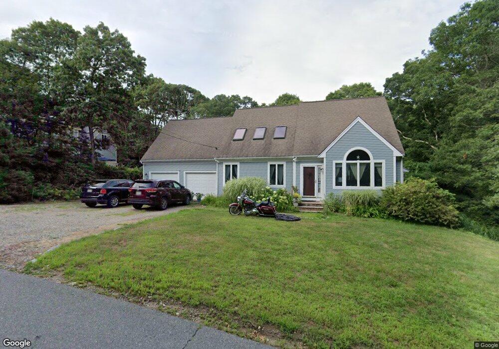
111 Sand Point Shores Dr East Falmouth, MA 02536
Hatchville NeighborhoodEstimated Value: $788,000 - $856,551
3
Beds
3
Baths
2,176
Sq Ft
$381/Sq Ft
Est. Value
About This Home
This home is located at 111 Sand Point Shores Dr, East Falmouth, MA 02536 and is currently estimated at $828,388, approximately $380 per square foot. 111 Sand Point Shores Dr is a home located in Barnstable County with nearby schools including Mullen-Hall School, Morse Pond School, and Lawrence School.
Ownership History
Date
Name
Owned For
Owner Type
Purchase Details
Closed on
Oct 15, 2009
Sold by
Kelly William B
Bought by
Baumann Kurt W and Baumann Leslie E
Current Estimated Value
Home Financials for this Owner
Home Financials are based on the most recent Mortgage that was taken out on this home.
Original Mortgage
$252,000
Outstanding Balance
$163,718
Interest Rate
5.14%
Mortgage Type
Purchase Money Mortgage
Estimated Equity
$664,670
Purchase Details
Closed on
Feb 3, 2004
Sold by
Weber Kenneth E and Weber Cheri A
Bought by
Kelly William B
Purchase Details
Closed on
Oct 16, 2003
Sold by
Gourley Lenore E
Bought by
Weber Kenneth L and Weber Mary
Home Financials for this Owner
Home Financials are based on the most recent Mortgage that was taken out on this home.
Original Mortgage
$223,250
Interest Rate
6.43%
Mortgage Type
Purchase Money Mortgage
Create a Home Valuation Report for This Property
The Home Valuation Report is an in-depth analysis detailing your home's value as well as a comparison with similar homes in the area
Home Values in the Area
Average Home Value in this Area
Purchase History
| Date | Buyer | Sale Price | Title Company |
|---|---|---|---|
| Baumann Kurt W | $315,000 | -- | |
| Baumann Kurt W | $315,000 | -- | |
| Kelly William B | $172,000 | -- | |
| Weber Kenneth E | $172,000 | -- | |
| Kelly William B | $172,000 | -- | |
| Weber Kenneth L | $125,000 | -- | |
| Weber Kenneth L | $125,000 | -- |
Source: Public Records
Mortgage History
| Date | Status | Borrower | Loan Amount |
|---|---|---|---|
| Open | Baumann Kurt W | $252,000 | |
| Closed | Weber Kenneth L | $252,000 | |
| Previous Owner | Weber Kenneth L | $223,250 |
Source: Public Records
Tax History Compared to Growth
Tax History
| Year | Tax Paid | Tax Assessment Tax Assessment Total Assessment is a certain percentage of the fair market value that is determined by local assessors to be the total taxable value of land and additions on the property. | Land | Improvement |
|---|---|---|---|---|
| 2025 | $4,413 | $751,800 | $173,300 | $578,500 |
| 2024 | $4,291 | $683,300 | $156,800 | $526,500 |
| 2023 | $4,236 | $612,200 | $156,800 | $455,400 |
| 2022 | $3,556 | $441,700 | $98,700 | $343,000 |
| 2021 | $3,372 | $396,700 | $94,400 | $302,300 |
| 2020 | $3,334 | $388,100 | $85,800 | $302,300 |
| 2019 | $3,261 | $380,900 | $85,800 | $295,100 |
| 2018 | $3,179 | $369,700 | $85,800 | $283,900 |
| 2017 | $3,050 | $357,600 | $85,800 | $271,800 |
| 2016 | $2,993 | $357,600 | $85,800 | $271,800 |
| 2015 | $2,929 | $357,600 | $85,800 | $271,800 |
| 2014 | $2,932 | $359,800 | $90,200 | $269,600 |
Source: Public Records
Map
Nearby Homes
- 12 Rock Hollow Dr
- 59 Whitecaps Dr
- 47 Shallow Pond Ln
- 68 Deepwood Dr
- 11 Shallow Pond Ln
- 12 Beach Plum Path
- 34 Mckenna Ridge Rd
- 61 Mckenna Ridge Dr
- 17 Pinewood Dr
- 4 Josiah Path
- 7 Josiah Path
- 18 Josiah Path
- 20 Josiah Path
- 21 Josiah Path
- 30 Josiah Path
- 590 Sandwich Rd
- 25 Harris Hill Rd
- 23 Little John Rd
- 273 Sandwich Rd
- 111 Sand Point Shores Dr
- 107 Sand Point Shores Dr
- 117 Sand Point Shores Dr
- 117 Sand Point Shores Dr
- 23 Shagbark Ln
- 101 Sand Point Shores Dr
- 0 Crooked Meadow Rd
- 0 Shagbark Ln
- 00 Shagbark Cir
- 110 Sand Point Shores Dr
- 5 Shagbark Ln
- 100 Sand Point Shores Dr
- 14 Shagbark Ln
- 10 Shagbark Ln
- 24 Shagbark Ln
- 4 Shagbark Ln
- 9 Crooked Meadow Rd
- 10 Crooked Meadow Rd
- 81 Sand Point Shores Dr
- 7 Spur Ln