Estimated Value: $197,000 - $209,000
3
Beds
1
Bath
1,032
Sq Ft
$196/Sq Ft
Est. Value
About This Home
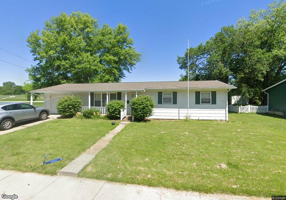
This home is located at 111 Trail Ave, Troy, MO 63379 and is currently estimated at $202,090, approximately $195 per square foot. 111 Trail Ave is a home located in Lincoln County with nearby schools including Main Street Elementary School, Troy Middle School, and Troy Buchanan High School.
Ownership History
Date
Name
Owned For
Owner Type
Purchase Details
Closed on
Apr 18, 2012
Sold by
Cannon Bulders Inc
Bought by
Cannon Properties Inc
Current Estimated Value
Purchase Details
Closed on
Apr 16, 2012
Sold by
Darnell Steve and Darnell Carrie
Bought by
Cannon Builders Inc
Purchase Details
Closed on
Mar 21, 2012
Sold by
Peasel Ryan M and Peasel Jamie
Bought by
Darnell Steve
Purchase Details
Closed on
Sep 30, 2008
Sold by
Thornhill Loretta E and Thornhill Gerald D
Bought by
Peasel Ryan M
Home Financials for this Owner
Home Financials are based on the most recent Mortgage that was taken out on this home.
Original Mortgage
$90,000
Interest Rate
6.52%
Mortgage Type
FHA
Create a Home Valuation Report for This Property
The Home Valuation Report is an in-depth analysis detailing your home's value as well as a comparison with similar homes in the area
Home Values in the Area
Average Home Value in this Area
Purchase History
| Date | Buyer | Sale Price | Title Company |
|---|---|---|---|
| Cannon Properties Inc | -- | None Available | |
| Cannon Builders Inc | -- | None Available | |
| Darnell Steve | -- | None Available | |
| Peasel Ryan M | -- | Meyer Title Company |
Source: Public Records
Mortgage History
| Date | Status | Borrower | Loan Amount |
|---|---|---|---|
| Previous Owner | Peasel Ryan M | $90,000 |
Source: Public Records
Tax History
| Year | Tax Paid | Tax Assessment Tax Assessment Total Assessment is a certain percentage of the fair market value that is determined by local assessors to be the total taxable value of land and additions on the property. | Land | Improvement |
|---|---|---|---|---|
| 2025 | $1,148 | $18,276 | $2,010 | $16,266 |
| 2024 | $1,071 | $16,722 | $1,340 | $15,382 |
| 2023 | $1,064 | $16,722 | $1,340 | $15,382 |
| 2022 | $1,015 | $15,869 | $1,340 | $14,529 |
| 2021 | $1,020 | $83,520 | $0 | $0 |
| 2020 | $893 | $73,000 | $0 | $0 |
| 2019 | $894 | $73,000 | $0 | $0 |
| 2018 | $925 | $14,184 | $0 | $0 |
| 2017 | $928 | $14,184 | $0 | $0 |
| 2016 | $844 | $12,560 | $0 | $0 |
| 2015 | $846 | $12,560 | $0 | $0 |
| 2014 | $857 | $12,698 | $0 | $0 |
| 2013 | -- | $12,698 | $0 | $0 |
Source: Public Records
Map
Nearby Homes
- 218 John St
- 971 Boone St
- 1091 Boone St
- 340 Kemper St
- 904 2nd St
- 151 Colonial Ln
- 701 Cap Au Gris St
- N Lincoln Dr ( 52+ - Acres)
- 0 Penn Unit 16017625
- 0 Merlin Dr Unit xx 21006708
- 896 E Cherry St
- 0 Turnbull Trail (1-3+ - Acres)
- 2489 Oak Forest Dr
- 105 Hickory Dr
- 0 Mac Unit MIS26002263
- 0 Turnbull Trail (4-7+ - Acres)
- 996 Huntington Dr
- 158 Hickory Dr
- 473 N Lincoln Dr
- 101 Kensington Palace Dr