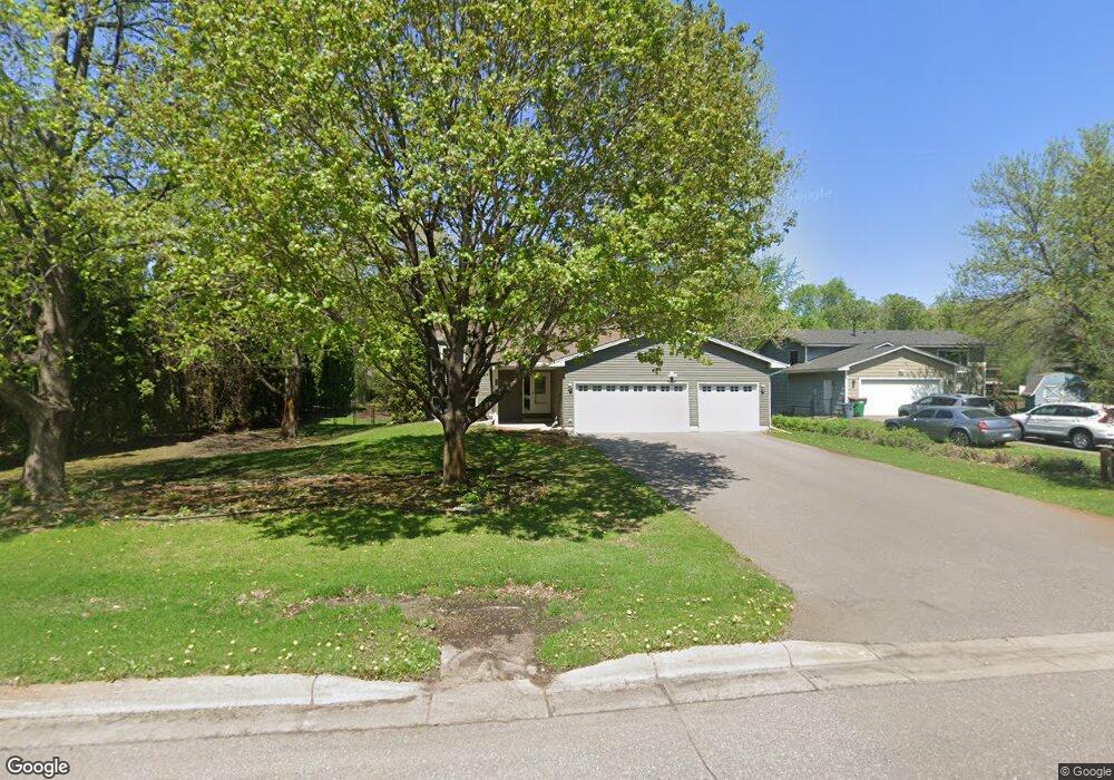
111 van Tassle Cir Big Lake, MN 55309
Estimated Value: $308,000 - $340,000
4
Beds
2
Baths
987
Sq Ft
$327/Sq Ft
Est. Value
About This Home
This home is located at 111 van Tassle Cir, Big Lake, MN 55309 and is currently estimated at $322,264, approximately $326 per square foot. 111 van Tassle Cir is a home located in Sherburne County with nearby schools including Liberty Elementary School, Independence Elementary School, and Big Lake Middle School.
Ownership History
Date
Name
Owned For
Owner Type
Purchase Details
Closed on
Jun 22, 2016
Sold by
Welker Brock N and Welker Carrie M
Bought by
Holthues William R and Holthues Dawn
Current Estimated Value
Home Financials for this Owner
Home Financials are based on the most recent Mortgage that was taken out on this home.
Original Mortgage
$105,000
Outstanding Balance
$85,034
Interest Rate
4.12%
Mortgage Type
FHA
Estimated Equity
$237,230
Purchase Details
Closed on
May 13, 2005
Sold by
Iverson Mark C and Iverson Kari L
Bought by
Welker Brock and Welker Carrie
Create a Home Valuation Report for This Property
The Home Valuation Report is an in-depth analysis detailing your home's value as well as a comparison with similar homes in the area
Home Values in the Area
Average Home Value in this Area
Purchase History
| Date | Buyer | Sale Price | Title Company |
|---|---|---|---|
| Holthues William R | $199,500 | Edina Realty Title Inc | |
| Welker Brock | $200,500 | -- |
Source: Public Records
Mortgage History
| Date | Status | Borrower | Loan Amount |
|---|---|---|---|
| Open | Holthues William R | $105,000 |
Source: Public Records
Tax History Compared to Growth
Tax History
| Year | Tax Paid | Tax Assessment Tax Assessment Total Assessment is a certain percentage of the fair market value that is determined by local assessors to be the total taxable value of land and additions on the property. | Land | Improvement |
|---|---|---|---|---|
| 2025 | $4,572 | $310,500 | $94,100 | $216,400 |
| 2024 | $4,614 | $307,600 | $94,100 | $213,500 |
| 2023 | $4,552 | $310,200 | $94,100 | $216,100 |
| 2022 | $4,252 | $295,000 | $79,500 | $215,500 |
| 2020 | $4,092 | $225,800 | $47,100 | $178,700 |
| 2019 | $3,930 | $215,100 | $41,500 | $173,600 |
| 2018 | $2,794 | $199,400 | $38,100 | $161,300 |
| 2017 | $2,490 | $184,000 | $34,600 | $149,400 |
| 2016 | $2,370 | $162,100 | $31,300 | $130,800 |
| 2015 | $2,062 | $133,300 | $25,500 | $107,800 |
| 2014 | $1,956 | $122,400 | $24,000 | $98,400 |
| 2013 | -- | $110,300 | $23,200 | $87,100 |
Source: Public Records
Map
Nearby Homes
- 637 Norwood Ln
- 705 Independence Dr NW
- 631 Norwood Ln
- 722 Independence Dr NW
- 19101 Gunter Way
- 824 Independence Dr NW
- 19128 Eagle Lake Rd S
- 541 William St
- 874 Independence Dr NW
- 19400 Karen Ln
- 199 Henry Rd
- 19024 Engle Wood Dr
- TBD Highway 10 NW
- 393 Phyllis St
- 23xxx 182nd St NW
- 241 Leighton Dr
- 491 Highland Ave
- 679 Lakeshore Dr
- 585 Glenwood Ave
- 591 Glenwood Ave
- 121 van Tassle Cir
- 191 Tarrytown Rd
- 201 Tarrytown Rd
- 181 Tarrytown Rd
- 100 van Tassle Cir
- 131 van Tassle Cir
- 211 Tarrytown Rd
- 171 Tarrytown Rd
- 180 Tarrytown Rd
- 511 Ormsbee St
- 160 Tarrytown Rd
- 501 Ormsbee St
- 471 Ormsbee St
- 161 Tarrytown Rd
- 210 Tarrytown Rd
- 451 Ormsbee St
- 490 Sullivan Way
- 220 Tarrytown Rd
- 220 Tarrytown Rd
- 150 Tarrytown Rd