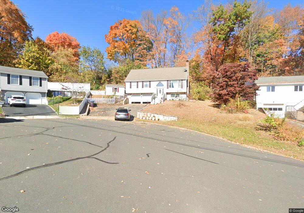
111 Varmor Dr New Britain, CT 06053
Estimated Value: $256,000 - $363,000
2
Beds
2
Baths
1,424
Sq Ft
$233/Sq Ft
Est. Value
About This Home
This home is located at 111 Varmor Dr, New Britain, CT 06053 and is currently estimated at $331,557, approximately $232 per square foot. 111 Varmor Dr is a home located in Hartford County with nearby schools including Holmes School, Pulaski Middle School, and St. Francis of Assisi Middle School.
Ownership History
Date
Name
Owned For
Owner Type
Purchase Details
Closed on
Nov 6, 2018
Sold by
Grabek Ryszard and Sulewski Krystyna
Bought by
Sulewski Krystyna
Current Estimated Value
Purchase Details
Closed on
Oct 24, 2018
Sold by
Sulewski Adam
Bought by
Sulewski Ryszard and Sulewski Krystyna
Purchase Details
Closed on
Aug 6, 2015
Sold by
Sulewski Henry K
Bought by
Sulewski Adam
Home Financials for this Owner
Home Financials are based on the most recent Mortgage that was taken out on this home.
Original Mortgage
$120,000
Interest Rate
4.03%
Create a Home Valuation Report for This Property
The Home Valuation Report is an in-depth analysis detailing your home's value as well as a comparison with similar homes in the area
Home Values in the Area
Average Home Value in this Area
Purchase History
| Date | Buyer | Sale Price | Title Company |
|---|---|---|---|
| Sulewski Krystyna | -- | -- | |
| Sulewski Ryszard | -- | -- | |
| Sulewski Adam | $120,000 | -- |
Source: Public Records
Mortgage History
| Date | Status | Borrower | Loan Amount |
|---|---|---|---|
| Previous Owner | Sulewski Adam | $120,000 |
Source: Public Records
Tax History Compared to Growth
Tax History
| Year | Tax Paid | Tax Assessment Tax Assessment Total Assessment is a certain percentage of the fair market value that is determined by local assessors to be the total taxable value of land and additions on the property. | Land | Improvement |
|---|---|---|---|---|
| 2025 | $6,988 | $178,360 | $58,030 | $120,330 |
| 2024 | $7,061 | $178,360 | $58,030 | $120,330 |
| 2023 | $6,828 | $178,360 | $58,030 | $120,330 |
| 2022 | $6,580 | $132,930 | $40,600 | $92,330 |
| 2021 | $6,580 | $132,930 | $40,600 | $92,330 |
| 2020 | $6,713 | $132,930 | $40,600 | $92,330 |
| 2019 | $6,713 | $132,930 | $40,600 | $92,330 |
| 2018 | $6,713 | $132,930 | $40,600 | $92,330 |
| 2017 | $5,660 | $112,070 | $27,020 | $85,050 |
| 2016 | $5,660 | $112,070 | $27,020 | $85,050 |
| 2015 | $5,491 | $112,070 | $27,020 | $85,050 |
| 2014 | $5,491 | $112,070 | $27,020 | $85,050 |
Source: Public Records
Map
Nearby Homes
- 200 Belridge Rd
- 122 Batterson Dr
- 2337 Stanley St
- 180 Brittany Farms Rd Unit D
- 32 Leona Ln
- 198 Brittany Farms Rd Unit D
- 123 Brittany Farms Rd Unit B
- 123 Brittany Farms Rd Unit C
- 4 Ingelside Dr
- 180 Batterson Park Rd
- 182 Batterson Park Rd
- 187 Miriam Rd
- 46 Robin Rd
- 140 Lewis Rd
- 135 Village Square Dr Unit 8
- 801 Farmington Ave
- 10 Garden Gate
- 34 Hutchinson St
- 122 Hazelmere Rd
- 28 SyMcO Dr