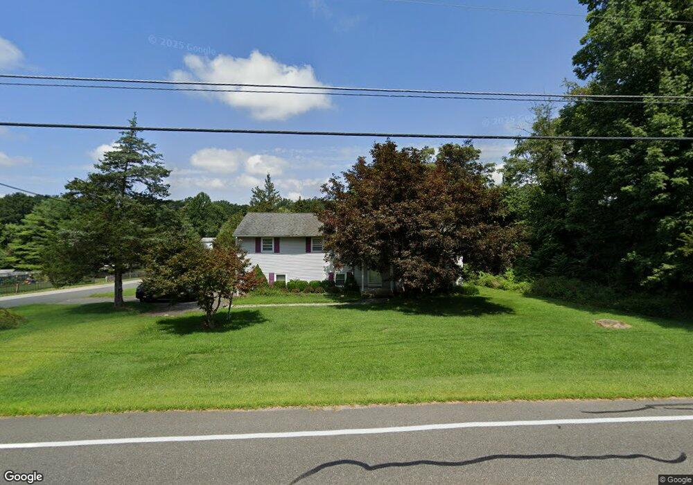
111 Wolfs Corner Rd Newton, NJ 07860
Estimated Value: $526,000 - $611,000
Studio
--
Bath
2,344
Sq Ft
$237/Sq Ft
Est. Value
About This Home
This home is located at 111 Wolfs Corner Rd, Newton, NJ 07860 and is currently estimated at $556,404, approximately $237 per square foot. 111 Wolfs Corner Rd is a home located in Sussex County with nearby schools including Green Hills School and Tranquility Adventist School.
Ownership History
Date
Name
Owned For
Owner Type
Purchase Details
Closed on
Dec 31, 2008
Sold by
Fisher Timothy H and Fisher Robin D
Bought by
Bannister Carl and Bannister Juliette
Current Estimated Value
Home Financials for this Owner
Home Financials are based on the most recent Mortgage that was taken out on this home.
Original Mortgage
$305,962
Outstanding Balance
$202,493
Interest Rate
6.08%
Mortgage Type
FHA
Estimated Equity
$353,911
Create a Home Valuation Report for This Property
The Home Valuation Report is an in-depth analysis detailing your home's value as well as a comparison with similar homes in the area
Home Values in the Area
Average Home Value in this Area
Purchase History
| Date | Buyer | Sale Price | Title Company |
|---|---|---|---|
| Bannister Carl | $310,000 | Central Jersey Title Co Inc |
Source: Public Records
Mortgage History
| Date | Status | Borrower | Loan Amount |
|---|---|---|---|
| Open | Bannister Carl | $305,962 |
Source: Public Records
Tax History
| Year | Tax Paid | Tax Assessment Tax Assessment Total Assessment is a certain percentage of the fair market value that is determined by local assessors to be the total taxable value of land and additions on the property. | Land | Improvement |
|---|---|---|---|---|
| 2025 | $9,138 | $402,100 | $117,300 | $284,800 |
| 2024 | $9,073 | $234,800 | $80,500 | $154,300 |
| 2023 | $9,073 | $234,800 | $80,500 | $154,300 |
| 2022 | $8,631 | $234,800 | $80,500 | $154,300 |
| 2021 | $8,519 | $234,800 | $80,500 | $154,300 |
| 2020 | $8,312 | $234,800 | $80,500 | $154,300 |
| 2019 | $8,136 | $234,800 | $80,500 | $154,300 |
| 2018 | $8,563 | $234,800 | $80,500 | $154,300 |
| 2017 | $8,392 | $234,800 | $80,500 | $154,300 |
| 2016 | $8,145 | $234,800 | $80,500 | $154,300 |
| 2015 | $7,854 | $234,800 | $80,500 | $154,300 |
| 2014 | $7,640 | $234,800 | $80,500 | $154,300 |
Source: Public Records
Map
Nearby Homes
- 37 Pequest Rd
- 30 MacKerley Rd
- 33 Hibler Rd
- 112 Kennedy Rd
- 88 Kennedy Rd
- 488 Ridge Rd
- 52 Whitehall Rd
- 96 Brighton Rd
- 10 Sunny Ln
- 0 Decker Pond Airport Rd Unit 3945534
- 30 Scenic Dr
- 21 Greendale Rd
- 735 New Jersey 94
- 500 New Jersey 94
- 203 Johnsonburg Rd
- 116 W Sunset Blvd
- 103 W Sunset Blvd
- 17 High St
- 386 Ridge Rd
- 208 Willows Rd
- 107 Wolfs Corner Rd
- 2 Michael Ct
- 115 Wolfs Corner Rd
- 106 Wolfs Corner Rd
- 105 Wolfs Corner Rd
- 3 Michael Ct
- 102 Wolfs Corner Rd
- 4 Michael Ct
- 9 Michael Ct
- 119 Wolfs Corner Rd
- 0 Wolfs Corner Rd
- 114 Wolfs Corner Rd
- 101 Wolfs Corner Rd
- 100 Wolfs Corner Rd
- 5 Michael Ct
- 14 Michael Ct
- 9 Shotwell Rd
- 15 Shotwell Rd
- 6 Michael Ct
- 116 Wolfs Corner Rd
Your Personal Tour Guide
Ask me questions while you tour the home.