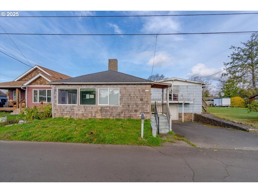
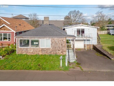
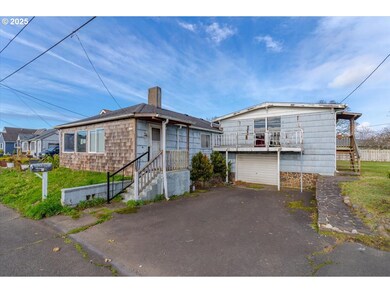
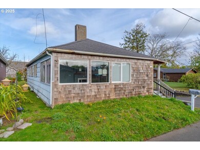
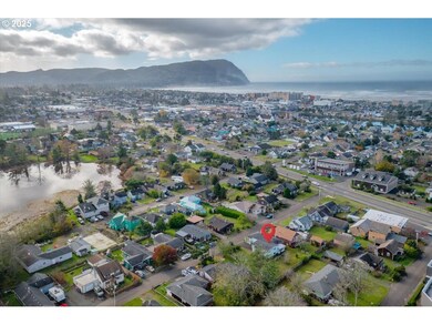
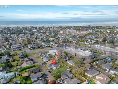
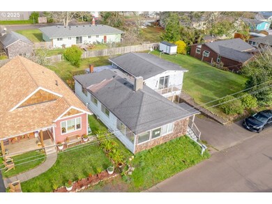
1110 6th Ave Seaside, OR 97138
Estimated payment $1,898/month
Highlights
- Deck
- 1 Car Attached Garage
- Tile Flooring
- No HOA
- Living Room
- Forced Air Heating and Cooling System
About This Home
Walk about 6 blocks to the promenade and beach! Floor plan has potential to create two units for short term or long-term rental, buyer to do all due diligence. Ready for your vision multiple possibilities. Beach house, residence, rental, vacation rental, or a combo? Possible investor rehab project. See Instructions.
Listing Agent
White Star Realty, Inc Brokerage Email: derricke@whitestarrealty.com License #200103075 Listed on: 11/24/2025
Home Details
Home Type
- Single Family
Est. Annual Taxes
- $2,184
Year Built
- Built in 1953
Lot Details
- 4,791 Sq Ft Lot
- Property is zoned R2
Parking
- 1 Car Attached Garage
- Driveway
Home Design
- Fixer Upper
- Composition Roof
- Wood Siding
- Lap Siding
- Concrete Perimeter Foundation
Interior Spaces
- 1,678 Sq Ft Home
- 1-Story Property
- Wood Burning Fireplace
- Family Room
- Living Room
- Dining Room
- Unfinished Basement
Kitchen
- Built-In Oven
- Built-In Range
- Range Hood
Flooring
- Wall to Wall Carpet
- Tile
Bedrooms and Bathrooms
- 4 Bedrooms
- 2 Full Bathrooms
Outdoor Features
- Deck
Schools
- Pacific Ridge Elementary School
- Seaside Middle School
- Seaside High School
Utilities
- Forced Air Heating and Cooling System
- Heating System Uses Gas
- Gas Water Heater
Community Details
- No Home Owners Association
Listing and Financial Details
- Assessor Parcel Number 55698
Map
Home Values in the Area
Average Home Value in this Area
Tax History
| Year | Tax Paid | Tax Assessment Tax Assessment Total Assessment is a certain percentage of the fair market value that is determined by local assessors to be the total taxable value of land and additions on the property. | Land | Improvement |
|---|---|---|---|---|
| 2025 | $2,184 | $178,305 | -- | -- |
| 2024 | $2,120 | $173,112 | -- | -- |
| 2023 | $2,057 | $168,071 | $0 | $0 |
| 2022 | $2,001 | $163,177 | $0 | $0 |
| 2021 | $1,959 | $158,425 | $0 | $0 |
| 2020 | $1,913 | $153,812 | $0 | $0 |
| 2019 | $1,861 | $149,333 | $0 | $0 |
| 2018 | $1,787 | $144,984 | $0 | $0 |
| 2017 | $1,705 | $140,762 | $0 | $0 |
| 2016 | $1,500 | $136,663 | $25,557 | $111,106 |
| 2015 | $1,461 | $132,683 | $24,813 | $107,870 |
| 2014 | $1,457 | $128,820 | $0 | $0 |
| 2013 | -- | $125,069 | $0 | $0 |
Property History
| Date | Event | Price | List to Sale | Price per Sq Ft |
|---|---|---|---|---|
| 11/24/2025 11/24/25 | For Sale | $324,900 | -- | $194 / Sq Ft |
Purchase History
| Date | Type | Sale Price | Title Company |
|---|---|---|---|
| Deed In Lieu Of Foreclosure | -- | Ticor Title | |
| Interfamily Deed Transfer | -- | None Available |
Mortgage History
| Date | Status | Loan Amount | Loan Type |
|---|---|---|---|
| Previous Owner | $468,000 | Reverse Mortgage Home Equity Conversion Mortgage |
Source: Regional Multiple Listing Service (RMLS)
MLS Number: 456834762
APN: 55698
Disclaimer: Certain information contained herein is derived from information provided by parties other than Homes.com. All information provided is deemed reliable, but is not guaranteed to be accurate and should be independently verified.
![]() The content relating to real estate for sale on this web site comes in part from the IDX program of the RMLS™ of Portland, Oregon. Real estate listings held by brokerage firms other than Ten-X are marked with the RMLS™ logo, and detailed information about these properties includes the names of the listing brokers. Listing content is copyright © 2025 RMLS™, Portland, Oregon. Some properties which appear for sale on this web site may subsequently have sold or may no longer be available. All information provided is deemed reliable but is not guaranteed and should be independently verified.
The content relating to real estate for sale on this web site comes in part from the IDX program of the RMLS™ of Portland, Oregon. Real estate listings held by brokerage firms other than Ten-X are marked with the RMLS™ logo, and detailed information about these properties includes the names of the listing brokers. Listing content is copyright © 2025 RMLS™, Portland, Oregon. Some properties which appear for sale on this web site may subsequently have sold or may no longer be available. All information provided is deemed reliable but is not guaranteed and should be independently verified.
- 1299 6th Ave
- 845 9th Ave
- 815 N King St
- 835 N Holladay Dr
- 739 11th Ave
- 717 12th Ave
- 821 13th Ave
- 0 Vacant Land Unit 159249124
- 646 Necanicum Dr
- 0 N Wahanna Rd
- 830 Oceanway St
- 460 12th Ave
- 218 Necanicum Dr
- 423 N Downing St
- 814 17th Ave
- 790 17th Ave
- 1269 Avenue D
- 1022 N Unit 208
- 1265 Avenue D
- 1022 N Promenade Unit 208
