Estimated Value: $144,899 - $201,000
--
Bed
--
Bath
1,235
Sq Ft
$142/Sq Ft
Est. Value
About This Home
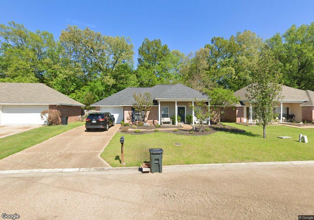
This home is located at 1110 Bullrun Dr, Byram, MS 39272 and is currently estimated at $175,725, approximately $142 per square foot. 1110 Bullrun Dr is a home located in Hinds County with nearby schools including Gary Road Elementary School, Gary Road Intermediate School, and Byram Middle School.
Ownership History
Date
Name
Owned For
Owner Type
Purchase Details
Closed on
May 28, 2021
Sold by
Mayo Lawrence P and Mayo Molly Shorter
Bought by
Mayo Lawrence P and Mayo Molly Shorter
Current Estimated Value
Home Financials for this Owner
Home Financials are based on the most recent Mortgage that was taken out on this home.
Original Mortgage
$110,400
Outstanding Balance
$99,735
Interest Rate
2.9%
Mortgage Type
Purchase Money Mortgage
Estimated Equity
$75,990
Create a Home Valuation Report for This Property
The Home Valuation Report is an in-depth analysis detailing your home's value as well as a comparison with similar homes in the area
Home Values in the Area
Average Home Value in this Area
Purchase History
| Date | Buyer | Sale Price | Title Company |
|---|---|---|---|
| Mayo Lawrence P | -- | None Available |
Source: Public Records
Mortgage History
| Date | Status | Borrower | Loan Amount |
|---|---|---|---|
| Open | Mayo Lawrence P | $110,400 |
Source: Public Records
Tax History Compared to Growth
Tax History
| Year | Tax Paid | Tax Assessment Tax Assessment Total Assessment is a certain percentage of the fair market value that is determined by local assessors to be the total taxable value of land and additions on the property. | Land | Improvement |
|---|---|---|---|---|
| 2025 | $2,088 | $13,344 | $3,750 | $9,594 |
| 2024 | $2,088 | $13,344 | $3,750 | $9,594 |
| 2023 | $2,088 | $8,896 | $2,500 | $6,396 |
| 2022 | $1,368 | $8,896 | $2,500 | $6,396 |
| 2021 | $1,051 | $8,896 | $2,500 | $6,396 |
| 2020 | $1,016 | $8,781 | $2,500 | $6,281 |
| 2019 | $1,009 | $8,781 | $2,500 | $6,281 |
| 2018 | $1,009 | $8,781 | $2,500 | $6,281 |
| 2017 | $985 | $8,781 | $2,500 | $6,281 |
| 2016 | $985 | $8,781 | $2,500 | $6,281 |
| 2015 | $966 | $8,653 | $2,500 | $6,153 |
| 2014 | $949 | $8,653 | $2,500 | $6,153 |
Source: Public Records
Map
Nearby Homes
- 880 Redwood Cove
- 125 Churchill Place
- 4417 Blake Cir
- 909 Eagles Nest Dr
- 85 Susan Cove
- 310 Byram Place Lot: Unit A
- 38 Stacy Cove
- 0 Byram Place
- 5306 Gardens Way
- 2120 Meagan Dr
- 640 Statesman Dr
- 8834 Gary Rd
- 1060 Lake Dockery Rd
- 0 Byram Pkwy
- 0 Henderson Rd Unit 4126215
- 00 S Siwell Rd
- 0 S Siwell Rd Unit 4088750
- 0 S Siwell Rd Unit 24872982
- 6760 S Siwell Rd
- 737 Forest Woods Dr Unit 48
- 1108 Bullrun Dr
- 1112 Bullrun Dr
- 1114 Bullrun Dr
- 1106 Bullrun Dr
- 1107 Bullrun Dr
- 1105 Bullrun Dr
- 1109 Bullrun Dr
- 1104 Bullrun Dr
- 1103 Bullrun Dr
- 1111 Bullrun Dr
- 1116 Bullrun Dr
- 1113 Bullrun Dr
- 1102 Bullrun Dr
- 1118 Bullrun Dr
- 1062 Bullrun Dr
- 707 Olive Branch Cove
- 1060 Bullrun Dr
- 1115 Bullrun Dr
- 705 Olive Branch Cove
- 1120 Bullrun Dr