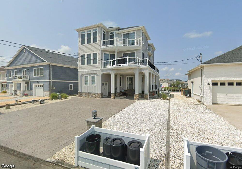
1110 Capstan Dr Forked River, NJ 08731
Estimated Value: $885,619 - $1,160,000
4
Beds
4
Baths
3,182
Sq Ft
$325/Sq Ft
Est. Value
About This Home
This home is located at 1110 Capstan Dr, Forked River, NJ 08731 and is currently estimated at $1,035,405, approximately $325 per square foot. 1110 Capstan Dr is a home located in Ocean County with nearby schools including Lacey Township High School.
Ownership History
Date
Name
Owned For
Owner Type
Purchase Details
Closed on
Jun 8, 2017
Sold by
Angeline Steven
Bought by
Angeline Steven and Angeline Christine Joyce
Current Estimated Value
Purchase Details
Closed on
Aug 22, 2016
Sold by
Angeline Steven and Angeline Karen
Bought by
Amngeline Stevem
Purchase Details
Closed on
Sep 22, 1999
Sold by
Taub Arnold and Taub Agnes
Bought by
Angeline Steven and Angeline Karen
Create a Home Valuation Report for This Property
The Home Valuation Report is an in-depth analysis detailing your home's value as well as a comparison with similar homes in the area
Home Values in the Area
Average Home Value in this Area
Purchase History
| Date | Buyer | Sale Price | Title Company |
|---|---|---|---|
| Angeline Steven | -- | -- | |
| Amngeline Stevem | -- | -- | |
| Angeline Steven | $77,500 | -- |
Source: Public Records
Tax History
| Year | Tax Paid | Tax Assessment Tax Assessment Total Assessment is a certain percentage of the fair market value that is determined by local assessors to be the total taxable value of land and additions on the property. | Land | Improvement |
|---|---|---|---|---|
| 2025 | $12,830 | $506,300 | $159,800 | $346,500 |
| 2024 | $11,994 | $506,300 | $159,800 | $346,500 |
Source: Public Records
Map
Nearby Homes
- 1025 Capstan Dr
- 814 Ensign Dr
- 986 Capstan Dr
- 0 Windward Dr Unit NJOC2039288
- 0 Windward Dr Unit 22601526
- 915 Shenandoah Dr
- 715 Richmond Dr
- 709 Richmond Dr
- 510 Conifer Dr
- 1029 Bowsprit Point
- 0 Union Ct Unit 22605987
- 802 E Hickory Dr
- 606 Bowsprit Point
- 826 Hazelton Ave
- 1001 Painter Point
- 710 Hazelton Ave
- 821 Bunnell St
- 330 Riviera Dr
- 905 Clairmore Ave
- 416 Chestnut Dr
- 1106 Capstan Dr
- 1114 Capstan Dr
- 1116 Capstan Dr
- 1038 Capstan Dr
- 1210 Ariel Dr
- 1034 Capstan Dr
- 1118 Capstan Dr
- 1103 Capstan Dr
- 1101 Capstan Dr
- 1207 Ariel Dr
- 1195 Capstan Dr
- 1206 Ariel Dr
- 1120 Capstan Dr
- 1023 Capstan Dr
- 1032 Capstan Dr
- 1205 Ariel Dr
- 1197 Capstan Dr
- 1030 Capstan Dr
- 1215 Ariel Dr
- 1021 Capstan Dr
Your Personal Tour Guide
Ask me questions while you tour the home.