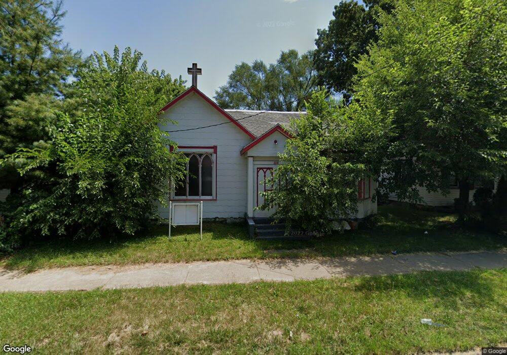
1110 N Sheridan Rd Peoria, IL 61606
West Bluff NeighborhoodEstimated Value: $68,500
1
Bed
2
Baths
1,708
Sq Ft
$40/Sq Ft
Est. Value
About This Home
This home is located at 1110 N Sheridan Rd, Peoria, IL 61606 and is currently priced at $68,500, approximately $40 per square foot. 1110 N Sheridan Rd is a home located in Peoria County with nearby schools including Franklin Primary School, Harold B. Dawson Jr. Middle School, and Peoria High School.
Ownership History
Date
Name
Owned For
Owner Type
Purchase Details
Closed on
Nov 20, 2023
Sold by
Trust No 18-04-302-003
Bought by
Hernandez Cecilia
Current Estimated Value
Purchase Details
Closed on
Jul 28, 2023
Sold by
County Clerk Of The County Of Peoria
Bought by
Trust No 18-04-302-003
Purchase Details
Closed on
Jul 27, 2023
Sold by
County Clerk/The County/Peoria
Bought by
Trust No 18-04-302-003 and Peoria County
Purchase Details
Closed on
Sep 30, 1999
Bought by
Good News Missionary Church
Create a Home Valuation Report for This Property
The Home Valuation Report is an in-depth analysis detailing your home's value as well as a comparison with similar homes in the area
Home Values in the Area
Average Home Value in this Area
Purchase History
| Date | Buyer | Sale Price | Title Company |
|---|---|---|---|
| Hernandez Cecilia | -- | None Listed On Document | |
| Trust No 18-04-302-003 | -- | None Listed On Document | |
| Trust No 18-04-302-003 | -- | None Listed On Document | |
| Good News Missionary Church | $188,600 | -- |
Source: Public Records
Tax History Compared to Growth
Tax History
| Year | Tax Paid | Tax Assessment Tax Assessment Total Assessment is a certain percentage of the fair market value that is determined by local assessors to be the total taxable value of land and additions on the property. | Land | Improvement |
|---|---|---|---|---|
| 2024 | $394 | $4,360 | $3,460 | $900 |
| 2023 | $228 | $2,420 | $1,610 | $810 |
| 2022 | $0 | $0 | $0 | $0 |
| 2021 | $335 | $0 | $0 | $0 |
| 2020 | $335 | $0 | $0 | $0 |
| 2019 | $335 | $0 | $0 | $0 |
| 2018 | $0 | $0 | $0 | $0 |
| 2017 | $0 | $0 | $0 | $0 |
| 2016 | -- | $0 | $0 | $0 |
| 2015 | -- | $0 | $0 | $0 |
| 2014 | -- | $0 | $0 | $0 |
| 2013 | -- | $0 | $0 | $0 |
Source: Public Records
Map
Nearby Homes
- 1224 N Douglas St
- 1313 N Ellis St
- 816 W Columbia Terrace
- 1312 N Ellis St
- 609 W Armstrong Ave
- 429 W High St
- 1410 N Douglas St
- 710 W Armstrong Ave
- 1216 N North St
- 911 W Russell St
- 319 W Columbia Terrace
- 1402 N Broadway St
- 401 W Armstrong Ave
- 919 W Windom St
- 1009 W Armstrong Ave
- 1112 W Columbia Terrace
- 1119 N Underhill St
- 919 W Moss Ave
- 1220 N University St
- 1504 N Linn St
- 1106 N Sheridan Rd
- 1114 N Sheridan Rd
- 1102 N Sheridan Rd
- 1119 N Sheridan Rd
- 1100 N Sheridan Rd
- 1120 N Sheridan Rd
- 1101 N Ellis St
- 1113 N Ellis St
- 1109 N Ellis St
- 1111 N Sheridan Rd
- 1115 N Ellis St
- 1119 N Ellis St
- 1105 N Ellis St
- 1107 N Sheridan Rd
- 1107 N Sheridan Rd Unit 1107 N Sheridan
- 1105 N Sheridan Rd
- 1113 N Sheridan Rd
- 1115 N Sheridan Rd
- 1123 N Ellis St
- 1117 N Sheridan Rd