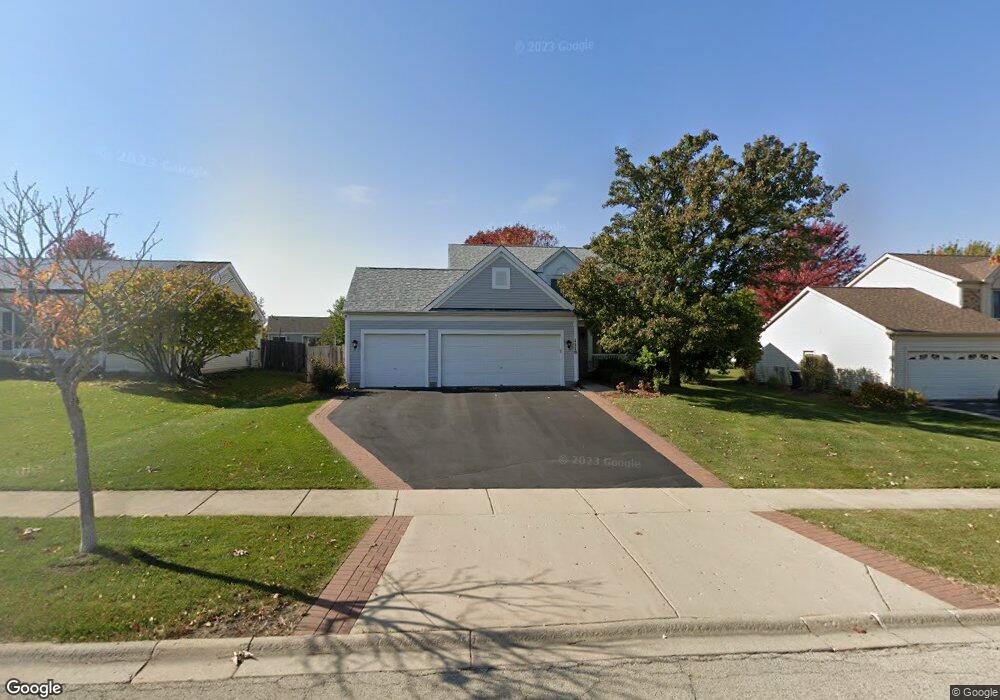
1110 Stonegate Rd Algonquin, IL 60102
Estimated Value: $379,000 - $434,152
4
Beds
3
Baths
1,876
Sq Ft
$219/Sq Ft
Est. Value
About This Home
This home is located at 1110 Stonegate Rd, Algonquin, IL 60102 and is currently estimated at $411,038, approximately $219 per square foot. 1110 Stonegate Rd is a home located in McHenry County with nearby schools including Westfield Community School, Kenneth E Neubert Elementary School, and Harry D Jacobs High School.
Ownership History
Date
Name
Owned For
Owner Type
Purchase Details
Closed on
Jun 26, 2017
Sold by
Skalla Theresa L
Bought by
Ngo Thuy and Nguyen Hung
Current Estimated Value
Purchase Details
Closed on
Feb 26, 2010
Sold by
Shover Theresa L
Bought by
Shover Theresa L and The Theresa L Shover Revocable Trust
Purchase Details
Closed on
Nov 8, 1996
Sold by
Pulte Home Corp
Bought by
Shover John D and Shover Theresa L
Home Financials for this Owner
Home Financials are based on the most recent Mortgage that was taken out on this home.
Original Mortgage
$55,000
Interest Rate
8.26%
Create a Home Valuation Report for This Property
The Home Valuation Report is an in-depth analysis detailing your home's value as well as a comparison with similar homes in the area
Purchase History
| Date | Buyer | Sale Price | Title Company |
|---|---|---|---|
| Ngo Thuy | $242,000 | Heritage Title Co | |
| Shover Theresa L | -- | None Available | |
| Shover John D | $188,500 | 1St American Title |
Source: Public Records
Mortgage History
| Date | Status | Borrower | Loan Amount |
|---|---|---|---|
| Previous Owner | Shover John D | $55,000 |
Source: Public Records
Tax History
| Year | Tax Paid | Tax Assessment Tax Assessment Total Assessment is a certain percentage of the fair market value that is determined by local assessors to be the total taxable value of land and additions on the property. | Land | Improvement |
|---|---|---|---|---|
| 2024 | $8,898 | $113,748 | $27,506 | $86,242 |
| 2023 | $8,516 | $101,734 | $24,601 | $77,133 |
| 2022 | $8,795 | $102,553 | $22,899 | $79,654 |
| 2021 | $8,478 | $95,540 | $21,333 | $74,207 |
| 2020 | $8,275 | $92,158 | $20,578 | $71,580 |
| 2019 | $8,100 | $88,207 | $19,696 | $68,511 |
| 2018 | $7,767 | $81,485 | $18,195 | $63,290 |
| 2017 | $7,047 | $76,764 | $17,141 | $59,623 |
| 2016 | $6,940 | $71,998 | $16,077 | $55,921 |
| 2013 | -- | $70,888 | $14,998 | $55,890 |
Source: Public Records
Map
Nearby Homes
- 681 Majestic Dr
- 2380 Dawson Ln Unit 165
- 760 Regal Ln
- 1157 Sawmill Ln
- 1820 Crofton Dr
- 1920 Jester Ln
- 700 Fairfield Ln
- 2051 Carlisle St
- 1002 Interloch Ct Unit 152
- 145 S Oakleaf Rd
- 20 Peach Tree Ct Unit 4153
- 18 Peach Tree Ct Unit 4154
- 2069 Peach Tree Ln Unit 4116
- 7 Falcon Ridge Ct
- 135 Arquilla Dr
- 1 N Hubbard St
- SWC Talaga and Algonquin Rd
- 1431 Essex St
- 601 Woods Creek Ln
- 14 Wander Way
- 1120 Stonegate Rd
- 1100 Stonegate Rd
- 1111 Millcreek Ln
- 1130 Stonegate Rd
- 1101 Millcreek Ln
- 1121 Millcreek Ln
- 1111 Stonegate Rd
- 1121 Stonegate Rd
- 1140 Stonegate Rd
- 1101 Stonegate Rd
- 1131 Stonegate Rd
- 1131 Millcreek Ln
- 2241 Dawson Ln Unit 316
- 2231 Dawson Ln Unit 311
- 1150 Stonegate Rd
- 2239 Dawson Ln
- 1141 Stonegate Rd
- 2237 Dawson Ln
- 2237 Dawson Ln Unit 2237
- 1102 Sawmill Ln
Your Personal Tour Guide
Ask me questions while you tour the home.