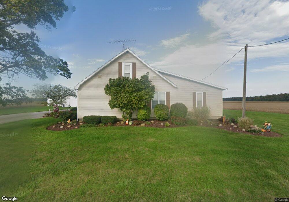
1111 Mcbride Rd Delphos, OH 45833
Estimated Value: $186,682 - $263,000
3
Beds
2
Baths
1,988
Sq Ft
$109/Sq Ft
Est. Value
About This Home
This home is located at 1111 Mcbride Rd, Delphos, OH 45833 and is currently estimated at $216,671, approximately $108 per square foot. 1111 Mcbride Rd is a home located in Allen County with nearby schools including Elida Elementary School, Elida Middle School, and Elida High School.
Ownership History
Date
Name
Owned For
Owner Type
Purchase Details
Closed on
Jul 29, 2009
Sold by
Barnt Diana L
Bought by
Barnt Robert C
Current Estimated Value
Purchase Details
Closed on
Oct 2, 1997
Sold by
Barnt Sonja
Bought by
Barnt Robert and Barnt Diana
Purchase Details
Closed on
Oct 1, 1979
Bought by
Barnt Sonja L
Create a Home Valuation Report for This Property
The Home Valuation Report is an in-depth analysis detailing your home's value as well as a comparison with similar homes in the area
Purchase History
| Date | Buyer | Sale Price | Title Company |
|---|---|---|---|
| Barnt Robert C | -- | Attorney | |
| Barnt Robert | $58,000 | -- | |
| Barnt Sonja L | -- | -- |
Source: Public Records
Tax History
| Year | Tax Paid | Tax Assessment Tax Assessment Total Assessment is a certain percentage of the fair market value that is determined by local assessors to be the total taxable value of land and additions on the property. | Land | Improvement |
|---|---|---|---|---|
| 2024 | $1,880 | $47,430 | $9,350 | $38,080 |
| 2023 | $1,658 | $36,480 | $7,180 | $29,300 |
| 2022 | $1,682 | $36,480 | $7,180 | $29,300 |
| 2021 | $1,621 | $36,480 | $7,180 | $29,300 |
| 2020 | $1,474 | $31,470 | $6,550 | $24,920 |
| 2019 | $1,474 | $31,470 | $6,550 | $24,920 |
| 2018 | $1,523 | $31,470 | $6,550 | $24,920 |
| 2017 | $1,299 | $29,200 | $6,550 | $22,650 |
| 2016 | $1,330 | $29,200 | $6,550 | $22,650 |
| 2015 | $1,355 | $29,200 | $6,550 | $22,650 |
| 2014 | $1,355 | $29,260 | $6,300 | $22,960 |
| 2013 | $1,312 | $29,260 | $6,300 | $22,960 |
Source: Public Records
Map
Nearby Homes
- 0 N Conant Rd
- 0 Agerter Rd
- 3755 Grubb Rd N
- 8240 Spencerville Rd
- 7630 Spencerville Rd
- 17683 Ohio 117
- 2105 Dutch Hollow Rd
- 1955 Dutch Hollow Rd
- 5126 Pheasant St
- 4864 Pheasant St
- 2877 Whippoorwill Ave
- 845 Atalan Trail
- 616 Wildbrook Ln
- 4906 Shoshone Trail
- 4875 Wenatchi Trail
- 2848 Hummingbird St
- 000 Hummingbird St
- 5643 Clover Ridge Dr
- 3000 Sunderland Rd
- 3000 S Sunderland Rd
Your Personal Tour Guide
Ask me questions while you tour the home.