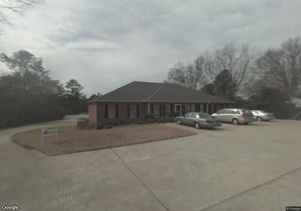
1111 Mooty Bridge Rd Unit A La Grange, GA 30240
--
Bed
1
Bath
4,237
Sq Ft
--
Built
About This Home
This home is located at 1111 Mooty Bridge Rd Unit A, La Grange, GA 30240. 1111 Mooty Bridge Rd Unit A is a home located in Troup County with nearby schools including Franklin Forest Elementary School, Hollis Hand Elementary School, and Ethel W. Kight Elementary School.
Ownership History
Date
Name
Owned For
Owner Type
Purchase Details
Closed on
Feb 18, 2000
Sold by
Durand Dan
Bought by
Greenwood Street Llc
Purchase Details
Closed on
Mar 6, 1991
Sold by
Harry D Durand
Bought by
Durand Dan
Purchase Details
Closed on
Mar 5, 1991
Sold by
Dan Ric Inc
Bought by
Harry D Durand
Purchase Details
Closed on
Aug 7, 1987
Sold by
Kerry Y Abernathy
Bought by
Dan Ric Inc
Purchase Details
Closed on
Aug 2, 1979
Sold by
Henry F Abernathy
Bought by
Kerry Y Abernathy
Create a Home Valuation Report for This Property
The Home Valuation Report is an in-depth analysis detailing your home's value as well as a comparison with similar homes in the area
Home Values in the Area
Average Home Value in this Area
Purchase History
| Date | Buyer | Sale Price | Title Company |
|---|---|---|---|
| Greenwood Street Llc | $525,000 | -- | |
| Durand Dan | -- | -- | |
| Harry D Durand | -- | -- | |
| Dan Ric Inc | $104,500 | -- | |
| Kerry Y Abernathy | -- | -- |
Source: Public Records
Tax History Compared to Growth
Tax History
| Year | Tax Paid | Tax Assessment Tax Assessment Total Assessment is a certain percentage of the fair market value that is determined by local assessors to be the total taxable value of land and additions on the property. | Land | Improvement |
|---|---|---|---|---|
| 2024 | $5,575 | $204,400 | $18,360 | $186,040 |
| 2023 | $4,975 | $182,400 | $18,360 | $164,040 |
| 2022 | $5,091 | $182,400 | $18,360 | $164,040 |
| 2021 | $5,150 | $170,760 | $18,360 | $152,400 |
| 2020 | $5,149 | $170,720 | $18,360 | $152,360 |
| 2019 | $4,940 | $163,800 | $18,360 | $145,440 |
| 2018 | $4,940 | $163,800 | $18,360 | $145,440 |
| 2017 | $4,940 | $163,800 | $18,360 | $145,440 |
| 2016 | $5,178 | $171,681 | $18,360 | $153,321 |
| 2015 | $4,791 | $171,681 | $18,360 | $153,321 |
| 2014 | $5,645 | $186,561 | $18,360 | $168,201 |
| 2013 | -- | $186,561 | $18,360 | $168,201 |
Source: Public Records
Map
Nearby Homes
- 106 Ewing St
- 102 Ewing St
- 724 Camellia Dr
- 106 S Chilton Crescent
- 204 Colonial St
- 145 Turner St
- 110 Russell St
- 900 North St
- 806 New Franklin Rd
- 201 S Chilton Crescent
- 203 S Chilton Crescent
- 107 Dixie Creek Dr
- 114 Briarcliff Rd
- 100 Creekside Dr Unit LOT 60A
- 748 Lakewood Dr
- 109 Thomas St
- 219 Banks St
- 109 Dogwood Dr
- 134 S Page St
- 0 Ridley Ave Unit 10550104
- 1107 Mooty Bridge Rd
- 921 Malibu Dr
- 0 Spring St
- 923 Malibu Dr
- 119 Spring St
- 923 Norwood Dr
- 1038 Mooty Bridge Rd
- 1015 Mooty Bridge Rd
- 104 Vista Way
- 925 Norwood Dr
- 1600 Meadow Terrace
- 1600 Meadow Terrace
- 925 Malibu Dr
- 0 Norwood Dr Unit 8694309
- 0 Norwood Dr Unit 8125906
- 927 Norwood Dr
- 927 Malibu Dr
- 107 Vista Way
- 928 Norwood Dr
- 929 Malibu Dr