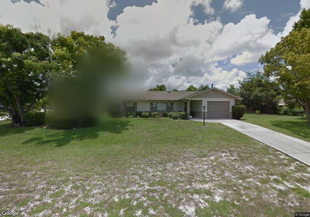
1111 Sherbrook Dr Deltona, FL 32725
Estimated Value: $262,000 - $325,000
3
Beds
2
Baths
1,802
Sq Ft
$167/Sq Ft
Est. Value
About This Home
This home is located at 1111 Sherbrook Dr, Deltona, FL 32725 and is currently estimated at $301,431, approximately $167 per square foot. 1111 Sherbrook Dr is a home located in Volusia County with nearby schools including Spirit Elementary School, Deltona Middle School, and Deltona High School.
Ownership History
Date
Name
Owned For
Owner Type
Purchase Details
Closed on
Aug 26, 2021
Sold by
Gable Irvin P
Bought by
Sweeney Judith
Current Estimated Value
Home Financials for this Owner
Home Financials are based on the most recent Mortgage that was taken out on this home.
Original Mortgage
$200,000
Outstanding Balance
$180,391
Interest Rate
2.8%
Mortgage Type
New Conventional
Estimated Equity
$121,040
Create a Home Valuation Report for This Property
The Home Valuation Report is an in-depth analysis detailing your home's value as well as a comparison with similar homes in the area
Home Values in the Area
Average Home Value in this Area
Purchase History
| Date | Buyer | Sale Price | Title Company |
|---|---|---|---|
| Sweeney Judith | $250,000 | First American Title Ins Co | |
| Sweeney Judith | $250,000 | First American Title |
Source: Public Records
Mortgage History
| Date | Status | Borrower | Loan Amount |
|---|---|---|---|
| Open | Sweeney Judith | $200,000 | |
| Closed | Sweeney Judith | $200,000 |
Source: Public Records
Tax History
| Year | Tax Paid | Tax Assessment Tax Assessment Total Assessment is a certain percentage of the fair market value that is determined by local assessors to be the total taxable value of land and additions on the property. | Land | Improvement |
|---|---|---|---|---|
| 2026 | $5,708 | $280,506 | $65,018 | $215,488 |
| 2025 | $5,708 | $280,506 | $65,018 | $215,488 |
| 2024 | $5,330 | $272,285 | $57,692 | $214,593 |
| 2023 | $5,330 | $272,177 | $66,392 | $205,785 |
| 2022 | $4,880 | $225,670 | $46,703 | $178,967 |
| 2021 | $3,833 | $189,081 | $30,220 | $158,861 |
| 2020 | $3,479 | $163,666 | $24,267 | $139,399 |
| 2019 | $3,360 | $155,303 | $20,147 | $135,156 |
| 2018 | $3,104 | $135,922 | $15,110 | $120,812 |
| 2017 | $2,868 | $116,449 | $10,959 | $105,490 |
| 2016 | $2,576 | $101,604 | $0 | $0 |
| 2015 | $2,422 | $91,314 | $0 | $0 |
| 2014 | $2,233 | $83,616 | $0 | $0 |
Source: Public Records
Map
Nearby Homes
- 2062 Dearing Ave
- 2061 Greenview Dr
- 2046 Dalton Ave
- 1170 Elkcam Blvd Unit 6
- 2034 Claremont Dr
- 1007 Sullivan St
- 919 Sylvia Dr
- 925 Elkcam Blvd
- 2078 Kelso Ave
- 1991 Tilburg Ave
- 869 Sylvia Dr
- 2102 Nedra Ave
- 2266 Fillmore Ave
- 2091 Oldham Ave
- 857 S Atmore Cir
- 2273 Banbury Ave
- 2297 E Fairbanks Dr
- 2123 Shadow Ridge Dr
- 1250 Indian Rock Ct
- 1878 Viking Ave
- 2090 Greenview Dr
- 2082 Greenview Dr
- 1101 Sherbrook Dr
- 2079 Dearing Ave
- 1114 Sherbrook Dr
- 2073 Dearing Ave
- 1120 Sherbrook Dr
- 1102 Sherbrook Dr
- 1121 Sherbrook Dr
- 2074 Greenview Dr Unit 8
- 2067 Dearing Ave
- 2081 Greenview Dr
- 1126 Sherbrook Dr
- 2061 Dearing Ave
- 2066 Greenview Dr
- 1125 Feather Dr
- 1121 Feather Dr
- 1029 Top Ct
- 1129 Feather Dr
- 1117 Feather Dr
Your Personal Tour Guide
Ask me questions while you tour the home.