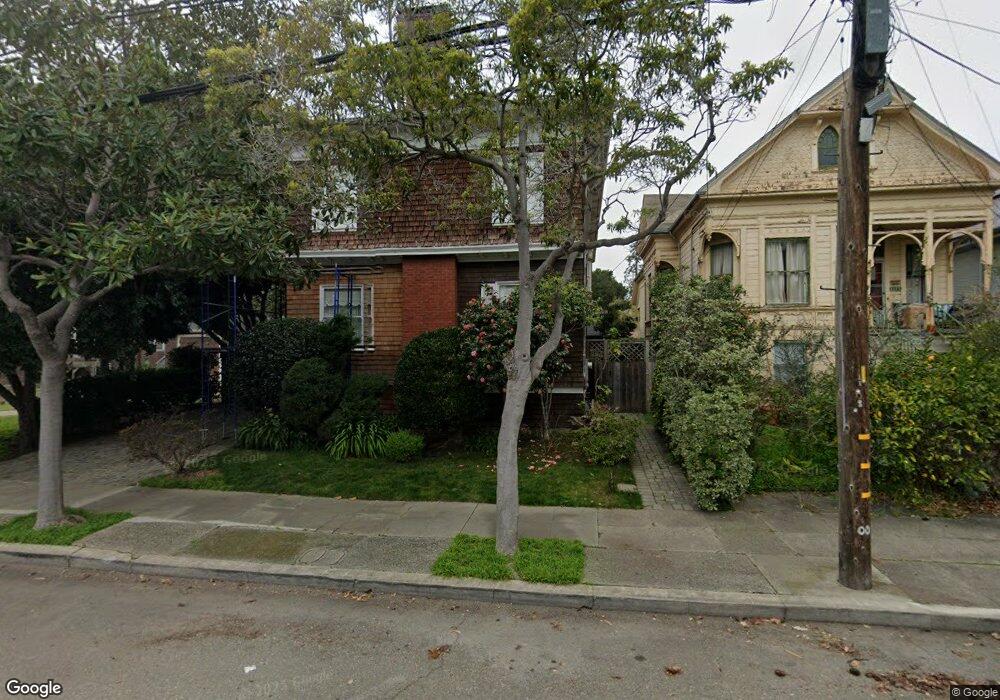
1111 Union St Alameda, CA 94501
South Shore NeighborhoodEstimated Value: $1,416,000 - $1,843,737
5
Beds
2
Baths
3,008
Sq Ft
$542/Sq Ft
Est. Value
About This Home
This home is located at 1111 Union St, Alameda, CA 94501 and is currently estimated at $1,631,184, approximately $542 per square foot. 1111 Union St is a home located in Alameda County with nearby schools including Franklin Elementary, Will C. Wood Middle School, and Encinal Junior/Senior High.
Ownership History
Date
Name
Owned For
Owner Type
Purchase Details
Closed on
Oct 25, 2018
Sold by
Karry Kelley
Bought by
Cahill Sean
Current Estimated Value
Purchase Details
Closed on
Sep 17, 2007
Sold by
Kelley Karry Paul and Cahill Sean P
Bought by
Kelley Karry and Cahill Sean
Purchase Details
Closed on
Jul 20, 1999
Sold by
Kramer Michael and Kramer Elizabeth S
Bought by
Kelley Karry Paul and Cahill Sean P
Home Financials for this Owner
Home Financials are based on the most recent Mortgage that was taken out on this home.
Original Mortgage
$448,000
Interest Rate
3.95%
Purchase Details
Closed on
Feb 26, 1997
Sold by
Cookson Arnold L and Cookson Joan C
Bought by
Shibata Kramer Michael and Shibata Kramer Elizabeth
Create a Home Valuation Report for This Property
The Home Valuation Report is an in-depth analysis detailing your home's value as well as a comparison with similar homes in the area
Home Values in the Area
Average Home Value in this Area
Purchase History
| Date | Buyer | Sale Price | Title Company |
|---|---|---|---|
| Cahill Sean | -- | None Listed On Document | |
| Kelley Karry | -- | None Listed On Document | |
| Kelley Karry | -- | None Available | |
| Kelley Karry Paul | $560,000 | Old Republic Title Company | |
| Shibata Kramer Michael | $335,000 | North American Title Co |
Source: Public Records
Mortgage History
| Date | Status | Borrower | Loan Amount |
|---|---|---|---|
| Previous Owner | Kelley Karry Paul | $448,000 |
Source: Public Records
Tax History
| Year | Tax Paid | Tax Assessment Tax Assessment Total Assessment is a certain percentage of the fair market value that is determined by local assessors to be the total taxable value of land and additions on the property. | Land | Improvement |
|---|---|---|---|---|
| 2025 | $13,083 | $853,657 | $258,197 | $602,460 |
| 2024 | $13,083 | $836,784 | $253,135 | $590,649 |
| 2023 | $12,611 | $827,242 | $248,172 | $579,070 |
| 2022 | $12,346 | $804,024 | $243,307 | $567,717 |
| 2021 | $12,060 | $788,127 | $238,538 | $556,589 |
| 2020 | $11,923 | $786,978 | $236,093 | $550,885 |
| 2019 | $11,009 | $771,550 | $231,465 | $540,085 |
| 2018 | $10,742 | $756,424 | $226,927 | $529,497 |
| 2017 | $10,262 | $741,596 | $222,479 | $519,117 |
| 2016 | $10,279 | $727,058 | $218,117 | $508,941 |
| 2015 | $10,249 | $716,138 | $214,841 | $501,297 |
| 2014 | $9,793 | $702,110 | $210,633 | $491,477 |
Source: Public Records
Map
Nearby Homes
- 610 Grand St
- 1822 Clinton Ave
- 1211 Paru St
- 2000 Clinton Ave
- 1500 Alameda Ave Unit G
- 1401 Cottage St Unit D
- 1203 Benton St
- 2050 Central Ave
- 1707 Lincoln Ave
- 2118 Alameda Ave
- 2031 Otis Dr Unit H
- 1246 Otis Dr
- 2106 Otis Dr Unit A
- 1211 Santa Clara Ave
- 2137 Otis Dr Unit 111
- 1821 Grand St
- 1606 Morton St
- 325 Kitty Hawk Rd Unit 207
- 2136 Pacific Ave
- 1665 Ellen Craig Ave
- 1117 Union St
- 1103 Union St
- 1119 Union St
- 1729 San Antonio Ave
- 1123 Union St
- 1730 Encinal Ave
- 1725 San Antonio Ave
- 1726 Encinal Ave
- 1127 Union St
- 1112 Union St
- 1721 San Antonio Ave
- 1722 Encinal Ave
- 1118 Union St
- 1803 San Antonio Ave
- 1122 Union St
- 1719 San Antonio Ave
- 1126 Union St
- 1718 Encinal Ave
- 1734 San Antonio Ave
- 1738 San Antonio Ave
Your Personal Tour Guide
Ask me questions while you tour the home.