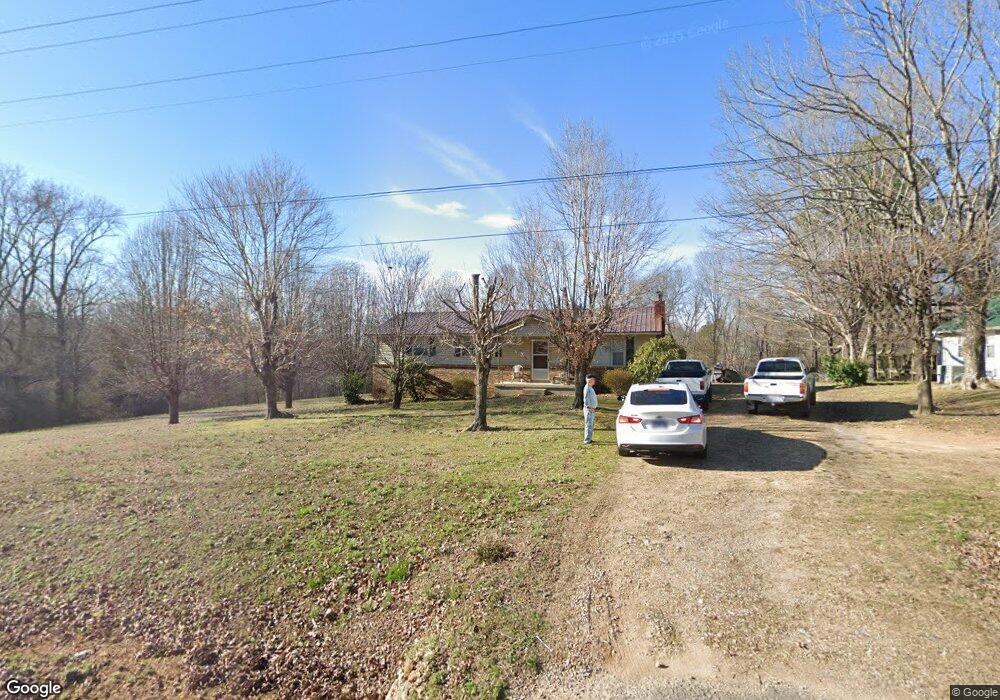
1111 W Point Rd Lawrenceburg, TN 38464
Estimated Value: $180,403 - $229,000
--
Bed
1
Bath
1,400
Sq Ft
$148/Sq Ft
Est. Value
About This Home
This home is located at 1111 W Point Rd, Lawrenceburg, TN 38464 and is currently estimated at $207,601, approximately $148 per square foot. 1111 W Point Rd is a home located in Lawrence County with nearby schools including David Crockett Elementary School, Ingram Sowell Elementary School, and Lawrenceburg Public Elementary School.
Ownership History
Date
Name
Owned For
Owner Type
Purchase Details
Closed on
Jul 26, 2011
Sold by
Perry Judy Faye
Bought by
Perry Thomas Ray and C/O Billy Perry
Current Estimated Value
Purchase Details
Closed on
May 28, 2008
Bought by
Perry Billy Joe
Purchase Details
Closed on
Jun 25, 1997
Sold by
Lester Perry
Bought by
Perry Joey D
Purchase Details
Closed on
Feb 8, 1960
Bought by
Perry Lester and Perry Louise
Create a Home Valuation Report for This Property
The Home Valuation Report is an in-depth analysis detailing your home's value as well as a comparison with similar homes in the area
Home Values in the Area
Average Home Value in this Area
Purchase History
| Date | Buyer | Sale Price | Title Company |
|---|---|---|---|
| Perry Thomas Ray | -- | -- | |
| Perry Billy Joe | $60,000 | -- | |
| Perry Joey D | $20,000 | -- | |
| Perry Lester | -- | -- |
Source: Public Records
Tax History Compared to Growth
Tax History
| Year | Tax Paid | Tax Assessment Tax Assessment Total Assessment is a certain percentage of the fair market value that is determined by local assessors to be the total taxable value of land and additions on the property. | Land | Improvement |
|---|---|---|---|---|
| 2024 | $676 | $33,600 | $7,575 | $26,025 |
| 2023 | $676 | $33,600 | $7,575 | $26,025 |
| 2022 | $676 | $33,600 | $7,575 | $26,025 |
| 2021 | $491 | $16,600 | $4,400 | $12,200 |
| 2020 | $491 | $16,600 | $4,400 | $12,200 |
| 2019 | $491 | $16,600 | $4,400 | $12,200 |
| 2018 | $491 | $16,600 | $4,400 | $12,200 |
| 2017 | $491 | $16,600 | $4,400 | $12,200 |
| 2016 | $491 | $16,600 | $4,400 | $12,200 |
| 2015 | $455 | $16,600 | $4,400 | $12,200 |
| 2014 | $453 | $16,525 | $4,400 | $12,125 |
Source: Public Records
Map
Nearby Homes
- 112 Oakdale Dr
- 0 Hoyt Dr
- 47 Long Branch Rd
- 43 Long Branch Rd
- 0 Long Branch Rd
- 15 Clifton Rd
- 347 Waterloo Rd
- 420 Long Branch Rd
- 12 Grace Ln
- 0 Hughes Hollow Rd
- 0 U S Highway 64
- 528 W Point Rd
- 1610 Hilltop Dr
- 1814 Grandaddy Rd
- 303 Shady Ln
- 1800 Grandaddy Rd
- 307 Stribling Rd
- 1710 Deer Hollow Dr
- 1708 Deer Hollow Dr
- 0 Devin St
- 1115 W Point Rd
- 1114 W Point Rd
- 1109 W Point Rd
- 1125 W Point Rd
- 1106 W Point Rd
- 1103 W Point Rd
- 1851 Walnut Grove Cir
- 1126 W Point Rd
- 6 Greenbriar Rd
- 1097 W Point Rd
- 1133 W Point Rd
- 12 Greenbriar Rd
- 1095 W Point Rd
- 1077 W Point Rd
- 1865 Walnut Grove Cir
- 1866 Walnut Grove Cir
- 1850 Walnut Grove Cir
- 18 Greenbriar Rd
- 0 Greenbriar Rd
- 1085 W Point Rd